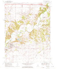
1970 Map of Mackinaw
USGS Topo · Published 1972About this map
The Mackinaw River winds through this Central Illinois landscape, carving a valley defined by numerous gravel pits and complex hydrology. The village of Mackinaw sits as the primary hub, where the Penn Central tracks intersect the local road network. Notably, the map records the Oak Knoll Sanatorium situated just north of the village, a specialized medical facility that once served the region. Nearby, the smaller settlement of Lilly and the rail stop at Sargent reflect the rural development patterns of the mid-20th century.
Find a feature on this map
43 named features on this map. Tap any name to fly to it.
Don’t see what you’re looking for? This feature index may not catch every label — zoom into the map to look around manually.
Map Details
Editions of this 1970 Mackinaw Map
2 editions found
Other maps of this area

1927 · Danvers
USGS Topo · 1:62,500

1928 · Mackinaw
USGS Topo · 1:62,500

1930 · Danvers
USGS Topo · 1:62,500

1932 · Mackinaw
USGS Topo · 1:62,500

1949 · Mc Lean
USGS Topo · 1:62,500

1951 · McLean
USGS Topo · 1:62,500

1951 · Minier
USGS Topo · 1:62,500

1958 · Peoria
USGS Topo · 1:250,000

1961 · Peoria
USGS Topo · 1:250,000

1963 · Peoria
USGS Topo · 1:250,000