1950s Maps of Dubois County, Indiana
Explore 13 historic maps of Dubois County from the 1950s. These maps offer a rare glimpse into what life looked like during the 1950s — showing old roads, neighborhoods, homes, and landmarks that have changed or disappeared over time.
Whether you're researching your family's past, planning a metal detecting trip, or studying how Dubois County's landscape evolved across the 1950s, these high-resolution maps are a powerful tool for exploring the history of this region.
- Focus on a specific era: All maps on this page are from the 1950s, giving you a focused view of this time period.
- See what’s changed: Compare century-old streets, trails, and buildings to today's modern landscape using overlays and satellite layers.
- Research with precision: Use these maps for genealogy, historical research, land use analysis, or educational projects.
- View, download, or print: Maps are fully viewable online in high resolution, and can be downloaded or printed for your own records.
Start exploring Dubois County's history through authentic maps from the 1950s. This is your window into the past.
Dubois County, IN maps
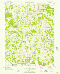
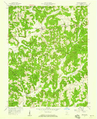
(13)- 1951 Map of Hillham
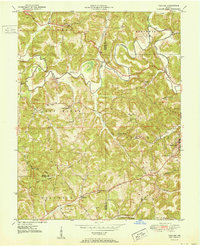 1951 Hillham1951 Print · USGSSouthern Indiana hills and the winding course of the Lost River define this rural landscape during the early fifties. Genealogists and local historians can locate remote family plots like Wininger Cem and Hawkins Cem alongside the tracks of the Southern railroad.
 - 1954 Map of Dubois, 1955 Print
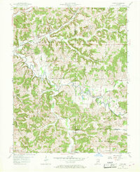
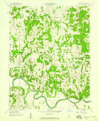
 1954 Dubois1955 Print · USGSIn the mid-1950s, the Patoka River valley was defined by the Southern Railway Line and scattered farm towns. Genealogists can trace family names at Harbison Cem and locate rural landmarks like St Raphaels Ch and Kellerville.
 - 1954 Map of Huntingburg, 1956 Print
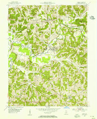
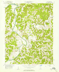
 1954 Huntingburg1956 Print · USGSMid-century Dubois County comes to life as Huntingburg expands around its rail crossing and oil fields in the early 1950s. Genealogists can locate family landmarks like Fairmount Cem, Hagen Cem, and the vanished settlement at Rose Bank.2 unique versions available
 - 1955 Map of Saint Anthony, 1956 Print
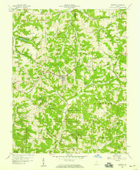
 1955 Saint Anthony1956 Print · USGSDubois County is captured in the mid-1950s as a landscape of small railroad hamlets and state timberlands. Genealogists and local historians can trace the Southern rail line between Bretzville and Kyana or locate family plots at Schnellville Cem and Dugan Cem.2 unique versions available
 - 1956 Map of Alfordsville, 1957 Print
 1956 Alfordsville1957 Print · USGSDaviess and Dubois counties come alive in the mid-1950s as a landscape of surface mines and river-bottom settlements. Genealogists and historians can trace family locations near Alfordsville, Truelove Ch, and the old river crossing at Portersville.2 unique versions available
 - 1956 Map of Rusk, 1958 Print
 1956 Rusk1958 Print · USGSSouthern Indiana's hill country is captured here in the mid-1950s, documenting the rural landscape within the Hoosier National Forest. Trace family roots and local landmarks through the records of South Martin Church, Hindustan Falls, and old cemeteries like Holtsclaw Cemetery.
 - 1956 Map of Vincennes, 1967 Print
 1956 Vincennes1967 Print · USGSSouthern Indiana and the Illinois borderlands are captured here in the mid-fifties, showing the region's dense network of river towns and rail lines. Researchers can trace historic river crossings along the Wabash River or locate landmarks like Wyandotte Cave and Lincoln State Park.4 unique versions available
 - 1957 Map of Vincennes
 1957 Vincennes1957 Print · USGSSouthwest Indiana and the Illinois borderlands come alive in the late 1950s, a period of heavy rail traffic and expanding state forests. Genealogists and historians can trace the riverfronts and rail lines of Vincennes, New Harmony, and the vast Crane Naval Ammunition Depot.
 - 1957 Map of Cuzco, 1958 Print
 1957 Cuzco1958 Print · USGSThe rural landscapes of Orange and Dubois counties are frozen in time during the late fifties, centered on the Patoka River valley. Genealogists and researchers can locate family landmarks like Cane Creek Ch, Bender Sch, and the small settlement of Newton Stewart.2 unique versions available
 - 1957 Map of Birdseye, 1959 Print
 1957 Birdseye1959 Print · USGSSouthern Indiana was a landscape of deep forests and rail-linked towns in the late fifties, where the Southern Railway connected communities across Dubois and Crawford counties. Genealogists and local historians can trace family roots through several remote burial sites and churches, including Waddle Cem, Adkins Cem, and Anderson Valley Ch.2 unique versions available
 - 1957 Map of Bristow, 1959 Print
 1957 Bristow1959 Print · USGSPerry County's rural landscape is captured here in the late fifties as small communities like Bristow and Siberia thrived alongside sprawling forest reserves. Genealogists can locate family landmarks like Lasher Cem and historic country parishes including St Johns Ch.4 unique versions available
 - 1958 Map of Vincennes
 1958 Vincennes1958 Print · USGSSouthern Indiana and the Illinois borderlands are captured during a mid-century period of heavy rail traffic and military activity. Researchers can trace the sprawling bounds of the Crane Naval Ammunition Depot or locate historic settlements like New Harmony and French Lick.2 unique versions available
 - 1958 Map of Glendale, 1959 Print
 1958 Glendale1959 Print · USGSDaviess County's southern townships are captured in the late fifties, showing a landscape defined by the winding East Fork White River. Genealogists and local historians can locate rural landmarks like St Patricks Ch, Glencoe Cem, and the community of Glendale.
End of results
Showing maps 1-13 of 13
Top cities of Dubois County
Frequently asked questions
- What are the different types of historical maps available for Dubois County?
- What is the oldest map of Dubois County?
- Where can I purchase historical maps of Dubois County for my home or office?
- Where can I download high-res historical maps of Dubois County?
- Are there historical topographic maps available for Dubois County?
- Is there historical aerial imagery available for Dubois County?
- Where are historical maps of Dubois County sourced from?