
1955 Map of Saint Anthony
USGS Topo · Published 1956About this map
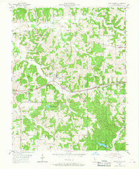
The Southern railroad corridor cuts a distinct horizontal line through the heart of Dubois County, connecting the small agrarian settlements of Bretzville, Saint Anthony, and Kyana. This mid-1950s landscape is defined by its drainage patterns, with Hall Creek and Grassy Fork carving through the northern sections while Hurricane Creek winds through the southern timberlands. The southern portion of the map is dominated by the Ferdinand State Forest, featuring the Lookout Tower Ferd and the nearby Saint Anthony Conservation Lake. For genealogists, several burial grounds are documented, including the Schnellville Cem on the eastern edge and the Cox Cem further south. The map illustrates a rural Indiana community where local life was organized around small church-centered hamlets like Saint Marks and the township intersections of Jackson and Ferdinand.
Find a feature on this map
25 named features on this map. Tap any name to fly to it.
Don’t see what you’re looking for? This feature index may not catch every label — zoom into the map to look around manually.
Map Details
Editions of this 1955 Saint Anthony Map
2 editions found
Other maps of this area

1900 · St Meinrad
USGS Topo · 1:62,500

1903 · St. Meinrad
USGS Topo · 1:62,500

1946 · Jasper
USGS Topo · 1:24,000

1954 · Dubois
USGS Topo · 1:24,000

1954 · Huntingburg
USGS Topo · 1:24,000

1956 · Vincennes
USGS Topo · 1:250,000

1957 · Vincennes
USGS Topo · 1:250,000

1957 · Cuzco
USGS Topo · 1:24,000

1957 · Birdseye
USGS Topo · 1:24,000
1957 · Bristow
USGS Topo · 1:24,000