Old Maps of Morgan County, Indiana for Metal Detecting
Plan your next treasure hunt with 148 historic maps of Morgan County. Find old homesites, ghost towns, trails, and gathering spots that may be lost to time — perfect for identifying promising metal detecting locations.
- Locate forgotten sites: Uncover places like long-lost settlements, abandoned rail lines, or gathering spots.
- Plan better hunts: Use map overlays combined with LiDAR or satellite views to narrow in on historically rich areas.
- Made for detectorists: Thousands of hobbyists use these maps to discover relics, coins, and hidden history.
Use these historic maps to boost your research and find new opportunities beneath the surface of Morgan County.
Morgan County, IN maps
(148)- 1942 Map of Franklin
 1942 Franklin1942 Print · USGSCentral Indiana during the early years of the war shows a landscape of established rail towns and growing military installations. Genealogists can trace family names across small settlements like Nineveh, Bean Blossom, and Helmsburg, or locate the Indiana University Observatory.
 - 1947 Map of Gosport, 1958 Print
 1947 Gosport1958 Print · USGSMid-century Owen and Monroe counties are seen here through their winding river valleys and small railroad towns. Researchers can trace the heritage of rural congregations and family lands near Stinesville, Shiloh Ch, and the Chambersville Cem.
 - 1947 Map of Franklin, 1964 Print
 1947 Franklin1964 Print · USGSMid-century Johnson County is captured here during a period of significant military activity and established civic life. Genealogists and local historians can locate Franklin College, the Prisoner of War Camp at Camp Atterbury, and numerous rural sites like Lick Spring Church and Hopewell Cem.
 - 1948 Map of Maywood
 1948 Maywood1948 Print · USGSThe southern suburbs of Indianapolis are captured here in the post-war era as industrial centers and new neighborhoods expand toward the county line. Genealogists and historians can trace the foundations of Mars Hill, explore the campus of Indiana Central College, or locate family sites at Holy Cross Cem.2 unique versions available
 - 1948 Map of Trafalgar
 1948 Trafalgar1948 Print · USGSTrafalgar and the surrounding Johnson County townships appear here during the late 1940s as rail-connected farming communities. Researchers can locate historic rural schoolhouses like Union Township Sch, small settlements at Bud and Anita, and old burial grounds including Harris Cem.2 unique versions available
 - 1948 Map of Hindustan
 1948 Hindustan1948 Print · USGSThe Morgan and Monroe county borders were a landscape of deep hollows and high ridges during the late nineteen-forties. Genealogists and hikers can trace old forest homesteads and landmarks like Stepp Cem, Honey Creek Sch, and the Hindustan settlement.3 unique versions available
 - 1948 Map of Fruitdale
 1948 Fruitdale1948 Print · USGSNear the border of Johnson and Brown counties in the late 1940s, this area shows a landscape of ridge-top roads and tucked-away hollows. Genealogists can trace family names through landmarks like Duncan Cem, Spearsville Sch, and the Illinois Central rail line.3 unique versions available
 - 1948 Map of Morgantown, 1956 Print
 1948 Morgantown1956 Print · USGSThe Morgan and Brown County borderlands come to life in the late 1940s, showing the ridge-and-hollow terrain south of Morgantown. Researchers can trace the Illinois Central railroad through Helmsburg or locate rural landmarks like Mt Zion Ch and Bear Creek Cem.
 - 1949 Map of Quincy
 1949 Quincy1949 Print · USGSOwen County’s rural townships are captured in the late 1940s, centered on the railroad hub at Quincy. Genealogists can trace family landmarks like Little Mount Cem, Montgomery Chapel, and the vanished School No. 2 near the Morgan County line.2 unique versions available
 - 1950 Map of Gosport
 1950 Gosport1950 Print · USGSMid-century Owen and Monroe Counties center on the winding river valley as the regional rail network and park system flourished. Researchers can trace rural lineages through sites like Old Dutch Ch, Stinesville, and the Chambersville Cem.
 - 1950 Map of Morgantown
 1950 Morgantown1950 Print · USGSMid-century Morgan and Brown Counties are shown here at a time when the Illinois Central railroad still linked small rural timber and farming hamlets. Trace family roots and vanished landmarks near Helmsburg, Needmore, and the Bear Creek Cem.2 unique versions available
 - 1950 Map of Franklin
 1950 Franklin1950 Print · USGSMid-century Johnson County and Brown County come into focus here, showing the expansion of settlements and military infrastructure during the post-war years. Researchers can trace the layout of the Camp Atterbury Military Reservation, locate family names at Greenlawn Cemetery, or find vanished landmarks like the Prisoner of War Camp.2 unique versions available
 - 1952 Map of Bargersville, 1953 Print
 1952 Bargersville1953 Print · USGSBargersville and the White River valley of Johnson County are shown here in the early fifties during a period of steady rural growth. Local researchers can trace family roots through numerous burial grounds like Old Bargersville Cem and Boles Cem, or locate landmarks such as Stones Crossing and Salem Ch.
 - 1953 Map of Bridgeport, 1954 Print
 1953 Bridgeport1954 Print · USGSWestern Marion County in the early fifties is captured here at the cusp of suburban expansion along the historic National Road. Genealogists and researchers can trace family landmarks and early schools like St Joseph High Sch, Center Cem, and the community of West Newton.
 - 1953 Map of Plainfield, 1955 Print
 1953 Plainfield1955 Print · USGSMid-century Hendricks County is captured here as the post-war era transformed the landscape around the National Road. Genealogists and local historians can trace the foundations of Plainfield or find rural landmarks like Sugar Grove Ch and the Indiana Boys School.
 - 1953 Map of Indianapolis, 1965 Print
 1953 Indianapolis1965 Print · USGSCentral Indiana and the Illinois borderlands are captured in the mid-sixties, showing the growth of Indianapolis and its industrial rail corridors. Genealogists and historians can trace the development of outlying towns like Zionsville or Beech Grove and find landmarks such as Atterbury AAF and Turkey Run State Park.4 unique versions available
 - 1955 Map of Hall, 1956 Print
 1955 Hall1956 Print · USGSThe rural landscapes of Morgan and Hendricks counties are captured here in the mid-fifties, showing a network of small agricultural settlements. Genealogists can locate family burial sites at Mt Zion Cem and trace old farmsteads near Hazelwood and Mt Zion Corner.
 - 1955 Map of Cope, 1957 Print
 1955 Cope1957 Print · USGSMid-century Morgan County is captured here at a time when small communities like Cope and Exchange were central to rural life. Researchers can locate family landmarks such as Williams Cem, trace the Illinois Central rail line into Morgantown, or find the old Fish Hatchery.
 - 1955 Map of Mooresville West, 1957 Print
 1955 Mooresville West1957 Print · USGSMorgan County in the mid-1950s showcases a landscape of rural crossroads and river-valley industry. Genealogists and local historians can locate early landmarks like West Union Ch, the Goethe Link Observatory, and the Brick Kilns near Centerton.
 - 1955 Map of Martinsville, 1957 Print
 1955 Martinsville1957 Print · USGSMartinsville and the White River valley are seen here in the mid-fifties, capturing a time when the railroad still connected the town to rural sidings. Genealogists can trace family landmarks like Hill Dale Cem, Maple Grove Ch, and the local High School.
 - 1955 Map of Mooresville East, 1957 Print
 1955 Mooresville East1957 Print · USGSMorgan County in the mid-fifties is captured here during a time of rural stability and industrial transition. Researchers can trace family history through the IOOF Cem, locate the Walnut Grove Sch, or find the mid-century Drive-in Theater near Mooresville.
 - 1956 Map of Indianapolis
 1956 Indianapolis1956 Print · USGSCentral Indiana in the mid-fifties is captured during a period of industrial growth and military presence. Genealogists and historians can trace the rail networks of the New York Central or locate regional landmarks like Fort Benjamin Harrison and Camp Atterbury.
 - 1956 Map of Eminence, 1957 Print
 1956 Eminence1957 Print · USGSCentral Indiana's rural townships are captured in the mid-1950s at the junction of Putnam and Morgan counties. Researchers can trace family sites like the Broadstreet Cem, visit Belle Union, or locate the Walnut Chapel along Mill Creek.
 - 1957 Map of Indianapolis
 1957 Indianapolis1957 Print · USGSCentral Indiana in the mid-fifties is captured here as a crossroads of major rail lines and nascent federal highways. Genealogists and historians can trace family-named ridges like Poplar Ridge or locate strategic sites like Camp Atterbury and Speedway.2 unique versions available
 - 1957 Map of Paragon, 1958 Print
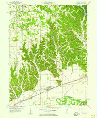 1957 Paragon1958 Print · USGSMid-century Morgan County is centered on the river-and-rail corridor of Paragon during the late fifties. Genealogists can trace family landmarks and rural burials from Rattsville to Plano, including Lingle Cem and Corinth Ch.
Showing maps 1-25 of 148
Top cities of Morgan County
- Martinsville historical maps
- Mooresville historical maps
- Brooklyn historical maps
- Adams historical maps
- Morgantown historical maps
- Paragon historical maps
See more
Frequently asked questions
- What are the different types of historical maps available for Morgan County?
- What is the oldest map of Morgan County?
- Where can I purchase historical maps of Morgan County for my home or office?
- Where can I download high-res historical maps of Morgan County?
- Are there historical topographic maps available for Morgan County?
- Is there historical aerial imagery available for Morgan County?
- Where are historical maps of Morgan County sourced from?