1900-1909 Maps of Troy, Indiana
Explore 3 historic maps of Troy from 1900-1909. These maps offer a rare glimpse into what life looked like during the 1900s — showing old roads, neighborhoods, homes, and landmarks that have changed or disappeared over time.
Whether you're researching your family's past, planning a metal detecting trip, or studying how Troy's landscape evolved across the 1900s, these high-resolution maps are a powerful tool for exploring the history of this region.
- Focus on a specific era: All maps on this page are from the 1900s, giving you a focused view of this time period.
- See what’s changed: Compare century-old streets, trails, and buildings to today's modern landscape using overlays and satellite layers.
- Research with precision: Use these maps for genealogy, historical research, land use analysis, or educational projects.
- View, download, or print: Maps are fully viewable online in high resolution, and can be downloaded or printed for your own records.
Start exploring Troy's history through authentic maps from the 1900s. This is your window into the past.
Troy, IN maps
(3)- 1900 Map of St Meinrad, 1961 Print
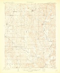
 1900 St Meinrad1961 Print · USGSSouthern Indiana at the turn of the century shows a landscape of growing rail towns and river crossings. Genealogists can trace family roots through early settlements like Santa Claus, St. Meinrad, and Mariah Hill, or locate landmarks such as Old Mill Fd.
 - 1903 Map of St. Meinrad
 1903 St. Meinrad1903 Print · USGSSouthern Indiana at the start of the twentieth century shows a landscape of rail-connected villages and the winding Anderson River. Trace the early routes of the Southern railway through Lincoln City or locate the original sites of Santa Claus and St.Meinrad.2 unique versions available
 - 1903 Map of Tell City
 1903 Tell City1903 Print · USGSThe Ohio River valley at the turn of the century is captured here as a vital corridor for both river and rail trade. Researchers can trace the early layouts of Tell City and Hawesville or locate smaller settlements like Knottsville and Waitman.7 unique versions available
End of results
Showing maps 1-3 of 3
Top cities near Troy
- Tell City historical maps
- Ferdinand historical maps
- Lewisport historical maps
- Dale historical maps
- Cannelton historical maps
- Cloverport historical maps
See more
Frequently asked questions
- What are the different types of historical maps available for Troy?
- What is the oldest map of Troy?
- Where can I purchase historical maps of Troy for my home or office?
- Where can I download high-res historical maps of Troy?
- Are there historical topographic maps available for Troy?
- Is there historical aerial imagery available for Troy?
- Where are historical maps of Troy sourced from?