1960s Maps of Finney County, Kansas
Explore 11 historic maps of Finney County from the 1960s. These maps offer a rare glimpse into what life looked like during the 1960s — showing old roads, neighborhoods, homes, and landmarks that have changed or disappeared over time.
Whether you're researching your family's past, planning a metal detecting trip, or studying how Finney County's landscape evolved across the 1960s, these high-resolution maps are a powerful tool for exploring the history of this region.
- Focus on a specific era: All maps on this page are from the 1960s, giving you a focused view of this time period.
- See what’s changed: Compare century-old streets, trails, and buildings to today's modern landscape using overlays and satellite layers.
- Research with precision: Use these maps for genealogy, historical research, land use analysis, or educational projects.
- View, download, or print: Maps are fully viewable online in high resolution, and can be downloaded or printed for your own records.
Start exploring Finney County's history through authentic maps from the 1960s. This is your window into the past.
Finney County, KS maps
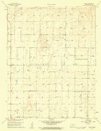
(11)- 1960 Map of Garden City East, 1961 Print
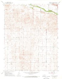
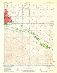 1960 Garden City East1961 Print · USGSGarden City and the Arkansas River valley are shown in detail during the early sixties as the city expanded eastward. Genealogists can trace neighborhood growth through several local schools like Garfield Sch and find burials at Valley View Cemetery.3 unique versions available
 - 1960 Map of Garden City SW, 1961 Print
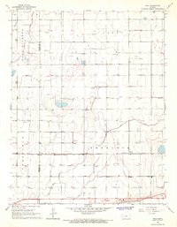
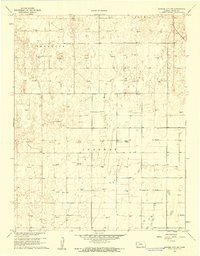 1960 Garden City SW1961 Print · USGSFinney County in the early sixties was a landscape defined by township grids and a burgeoning energy sector. Researchers can trace land ownership patterns and find landmarks like Goldamer Cem or the numerous Gas Wells throughout Ivanhoe.2 unique versions available
 - 1960 Map of Deerfield SE, 1961 Print
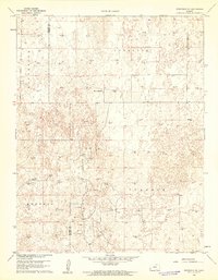 1960 Deerfield SE1961 Print · USGSFinney and Kearny Counties were entering a new era of petroleum production at the dawn of the sixties. Genealogists and historians can trace the intersection of ranching and industry through landmarks like Reeve Ranch and the many Gas Well sites across Ivanhoe.2 unique versions available
 - 1960 Map of Garden City West, 1961 Print
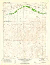
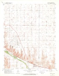
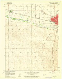 1960 Garden City West1961 Print · USGSFinney County was evolving rapidly in the early sixties as industrial development and conservation efforts reshaped the plains. Trace the mid-century street grid of Garden City and the wild dunes of the Finney County State Game Refuge.3 unique versions available
 - 1960 Map of Plymell, 1961 Print
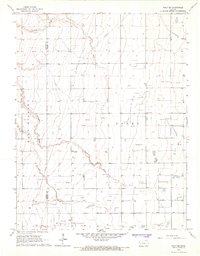
 1960 Plymell1961 Print · USGSFinney County agricultural and energy landscapes are captured here during a period of significant mid-century development. Researchers can trace dozens of individual Gas Well sites across Ivanhoe and identify landmarks like the Tower (KGLD-TV).2 unique versions available
 - 1960 Map of Deerfield NE, 1961 Print
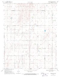
 1960 Deerfield NE1961 Print · USGSThe Kansas High Plains meet the industrial age in the 1960s as irrigation and energy extraction transform the landscape. Trace the irrigation network of Great Eastern Ditch and the dozens of Gas Wells that dot the hills of Sherlock.2 unique versions available
 - 1965 Map of Wolf, 1967 Print
 1965 Wolf1967 Print · USGSFinney County irrigation and rail networks are laid bare in the mid-sixties, showing the high-plains landscape before modern pivots. Genealogists can trace family connections to Wolf, Petersen, or Ritchal along the Garden City Western railroad line.
 - 1965 Map of Wolf NE, 1967 Print
 1965 Wolf NE1967 Print · USGSWestern Kansas energy development is on full display in the mid-1960s as industrial exploration reaches across the High Plains. Researchers can trace the network of the East Hubbard Field and infrastructure like the Amazon Ditch.
 - 1967 Map of Pierceville SW, 1969 Print
 1967 Pierceville SW1969 Print · USGSThe Kansas high plains meet the winding Arkansas River in the late 1960s, capturing a moment of agricultural and industrial expansion. Researchers can trace the path of the Atchison Topeka and Santa Fe railroad or locate numerous Gas Wells across the prairie.
 - 1967 Map of Pierceville, 1969 Print
 1967 Pierceville1969 Print · USGSThe Arkansas River valley in the mid-1960s serves as a hub for transport and energy between Finney and Gray counties. Researchers can trace the rail corridor of the Atchison Topeka and Santa Fe through Pierceville and locate the Pierceville Cem.
 - 1969 Map of Copeland NW, 1971 Print
 1969 Copeland NW1971 Print · USGSHaskell and Gray counties come together in the Kansas high plains during the late sixties, showing a landscape defined by industrial agriculture and mineral wells. Genealogists and historians can locate Colusa Cem, the Salem Ch, and the Radio Tower (KUPK-TV).
End of results
Showing maps 1-11 of 11
Top cities of Finney County
Frequently asked questions
- What are the different types of historical maps available for Finney County?
- What is the oldest map of Finney County?
- Where can I purchase historical maps of Finney County for my home or office?
- Where can I download high-res historical maps of Finney County?
- Are there historical topographic maps available for Finney County?
- Is there historical aerial imagery available for Finney County?
- Where are historical maps of Finney County sourced from?