Old Maps of Finney County, Kansas for Hiking & Exploration
Hike through history with 235 historic maps of Finney County. Explore old trails, ghost towns, and forgotten backroads — perfect for outdoor adventurers and local explorers.
- Rediscover forgotten places: Map out old mining camps, roads, and footpaths that no longer exist on modern maps.
- Layer with modern tools: Combine with LiDAR or satellite views to plan hikes through historical terrain.
- Made for exploration: Popular among hikers, overlanders, and local history lovers.
Use these maps to find adventure and explore the hidden past of Finney County.
Finney County, KS maps
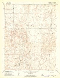
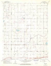
(235)- 1891 Map of Larned, 1921 Print
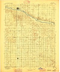
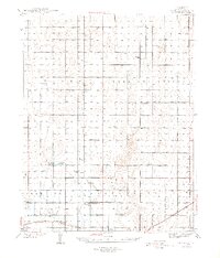
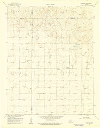
 1891 Larned1921 Print · USGSThe Arkansas River valley at the close of the nineteenth century shows a landscape being rapidly transformed by rail and irrigation. Genealogists and historians can trace early prairie life through rail stops like Rush Centre, Garfield, and the hub at Larned.
 - 1896 Map of Garden
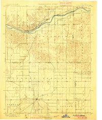
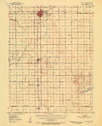
 1896 Garden1896 Print · USGSFinney and Haskell counties come into focus during the late nineteenth century as the railroad transformed the High Plains. Genealogists and researchers can trace the early footprints of Garden and Santa Fe or locate prairie outposts like Ivanhoe and Pierceville.4 unique versions available
 - 1900 Map of Lakin
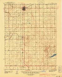
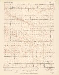
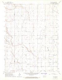
 1900 Lakin1900 Print · USGSSouthwestern Kansas at the close of the nineteenth century is defined by the rail corridor along the Arkansas River and the early grid of prairie townships. Genealogists can trace pioneer-era locations like Ulysses and Shockey, or the remote station at Conductor.5 unique versions available
 - 1940 Map of Scott City
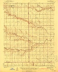
 1940 Scott City1940 Print · USGSWestern Kansas agriculture and early energy development intersect in the late 1930s. Genealogists can trace rural school districts like Buffalo Sch and Lone Valley Sch or locate ancestors in the Scott City Cem.
 - 1941 Map of Modoc
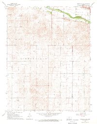
 1941 Modoc1941 Print · USGSWichita and Scott counties are shown just before the war, when the rural school system and the Missouri Pacific railroad anchored the High Plains economy. Researchers can locate numerous local landmarks including St Marys Cem, Lydia Ch, and schools like Prairie Bell Sch.
 - 1944 Map of Tennis
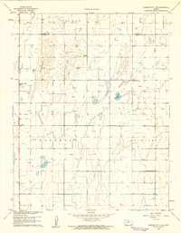
 1944 Tennis1944 Print · USGSFinney County irrigation and rail networks are shown here just after the start of the decade. Genealogists can trace family footprints near Tennis, Alfalfa, and numerous rural schoolhouses like Skyline Sch and Silverdale Sch.2 unique versions available
 - 1951 Map of Scott City, 1952 Print
 1951 Scott City1952 Print · USGSScott County at mid-century was a landscape of rail-driven commerce and emerging energy production. Genealogists can trace rural family roots through landmarks like Kingdom Hall Ch, the Scott City Cem, and several country schools including Hines Sch and Mt Hope Sch.
 - 1951 Map of Modoc, 1952 Print
 1951 Modoc1952 Print · USGSWestern Kansas farming communities are captured in the early fifties as the rural school system and steam-era rail lines still defined the landscape. Genealogists can locate family landmarks like St Marys Cem, Lydia Ch, and several country schools including Grandview Sch.
 - 1955 Map of Dodge City, 1968 Print
 1955 Dodge City1968 Print · USGSSouthwest Kansas in the mid-fifties reveals an expansive landscape of cattle towns, early gas fields, and prairie outposts. Researchers can trace rural school districts like Moundview and Good Luck or locate the Kansas State Game Farm near Lakin.3 unique versions available
 - 1955 Map of Scott City, 1969 Print
 1955 Scott City1969 Print · USGSWestern Kansas in the mid-fifties is captured here as a landscape of rural schoolhouses and significant rail corridors. Family historians can trace the locations of Skyline and Beaver Creek Schools or follow the Union Pacific line through Oakley and Sharon Springs.4 unique versions available
 - 1958 Map of Dodge City
 1958 Dodge City1958 Print · USGSSouthwest Kansas in the late fifties shows a landscape of river-valley agriculture and burgeoning energy infrastructure. Genealogists can trace rural life through numerous landmarks like Fairview Cemetery, the Goodwell School, and Concord Church.
 - 1958 Map of Scott City
 1958 Scott City1958 Print · USGSWestern Kansas at the peak of the post-war era reveals a landscape of high-plains agriculture and vital rail junctions. Genealogists and historians can trace old country school sites like Prairie Bell School, the landmark Chalk Pyramids, and small stops along the Union Pacific and Missouri Pacific.
 - 1959 Map of Dodge City
 1959 Dodge City1959 Print · USGSSouthwest Kansas in the mid-fifties is captured at its agricultural height, centered on the vital rail and river hubs of Dodge City and Garden City. Genealogists and local historians can trace rural school districts like Shockey School and Hickok School or locate the Fairview Cemetery.
 - 1959 Map of Garden City 3 NW, 1961 Print
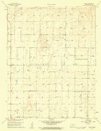
 1959 Garden City 3 NW1961 Print · USGSHaskell County and Finney County are captured during a period of significant energy development in the late fifties. Genealogists and historians can trace rural infrastructure through locations like Valley Sch and a vast network of Gas Well sites.3 unique versions available
 - 1959 Map of Hickok NE, 1961 Print
 1959 Hickok NE1961 Print · USGSHaskell County and its neighbors are seen here in the late fifties, during a period of significant growth for the regional energy industry. Genealogists and researchers can locate rural landmarks such as Pleasant Prairie Ch, Pleasant Prairie Sch, and scores of Gas Wells.2 unique versions available
 - 1959 Map of Garden City 3 NE, 1961 Print
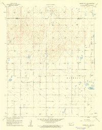
 1959 Garden City 3 NE1961 Print · USGSHaskell County prairie life in the late fifties is captured here through its network of one-room schools and emerging gas fields. Genealogists and local historians can locate the Ivanhoe Cem and trace the rural districts around Lake View Sch and Independence Sch.3 unique versions available
 - 1960 Map of Garden City East, 1961 Print
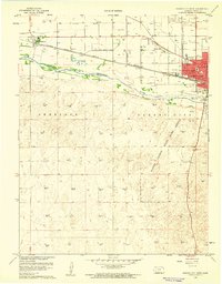
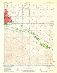 1960 Garden City East1961 Print · USGSGarden City and the Arkansas River valley are shown in detail during the early sixties as the city expanded eastward. Genealogists can trace neighborhood growth through several local schools like Garfield Sch and find burials at Valley View Cemetery.3 unique versions available
 - 1960 Map of Garden City SW, 1961 Print
 1960 Garden City SW1961 Print · USGSFinney County in the early sixties was a landscape defined by township grids and a burgeoning energy sector. Researchers can trace land ownership patterns and find landmarks like Goldamer Cem or the numerous Gas Wells throughout Ivanhoe.2 unique versions available
 - 1960 Map of Deerfield SE, 1961 Print
 1960 Deerfield SE1961 Print · USGSFinney and Kearny Counties were entering a new era of petroleum production at the dawn of the sixties. Genealogists and historians can trace the intersection of ranching and industry through landmarks like Reeve Ranch and the many Gas Well sites across Ivanhoe.2 unique versions available
 - 1960 Map of Garden City West, 1961 Print
 1960 Garden City West1961 Print · USGSFinney County was evolving rapidly in the early sixties as industrial development and conservation efforts reshaped the plains. Trace the mid-century street grid of Garden City and the wild dunes of the Finney County State Game Refuge.3 unique versions available
 - 1960 Map of Plymell, 1961 Print
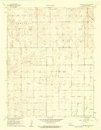
 1960 Plymell1961 Print · USGSFinney County agricultural and energy landscapes are captured here during a period of significant mid-century development. Researchers can trace dozens of individual Gas Well sites across Ivanhoe and identify landmarks like the Tower (KGLD-TV).2 unique versions available
 - 1960 Map of Deerfield NE, 1961 Print
 1960 Deerfield NE1961 Print · USGSThe Kansas High Plains meet the industrial age in the 1960s as irrigation and energy extraction transform the landscape. Trace the irrigation network of Great Eastern Ditch and the dozens of Gas Wells that dot the hills of Sherlock.2 unique versions available
 - 1965 Map of Wolf, 1967 Print
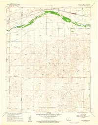
 1965 Wolf1967 Print · USGSFinney County irrigation and rail networks are laid bare in the mid-sixties, showing the high-plains landscape before modern pivots. Genealogists can trace family connections to Wolf, Petersen, or Ritchal along the Garden City Western railroad line.
 - 1965 Map of Wolf NE, 1967 Print
 1965 Wolf NE1967 Print · USGSWestern Kansas energy development is on full display in the mid-1960s as industrial exploration reaches across the High Plains. Researchers can trace the network of the East Hubbard Field and infrastructure like the Amazon Ditch.
 - 1967 Map of Pierceville SW, 1969 Print
 1967 Pierceville SW1969 Print · USGSThe Kansas high plains meet the winding Arkansas River in the late 1960s, capturing a moment of agricultural and industrial expansion. Researchers can trace the path of the Atchison Topeka and Santa Fe railroad or locate numerous Gas Wells across the prairie.
Showing maps 1-25 of 235
Top cities of Finney County
Frequently asked questions
- What are the different types of historical maps available for Finney County?
- What is the oldest map of Finney County?
- Where can I purchase historical maps of Finney County for my home or office?
- Where can I download high-res historical maps of Finney County?
- Are there historical topographic maps available for Finney County?
- Is there historical aerial imagery available for Finney County?
- Where are historical maps of Finney County sourced from?