Old Maps of Rooks County, Kansas for Metal Detecting
Plan your next treasure hunt with 128 historic maps of Rooks County. Find old homesites, ghost towns, trails, and gathering spots that may be lost to time — perfect for identifying promising metal detecting locations.
- Locate forgotten sites: Uncover places like long-lost settlements, abandoned rail lines, or gathering spots.
- Plan better hunts: Use map overlays combined with LiDAR or satellite views to narrow in on historically rich areas.
- Made for detectorists: Thousands of hobbyists use these maps to discover relics, coins, and hidden history.
Use these historic maps to boost your research and find new opportunities beneath the surface of Rooks County.
Rooks County, KS maps
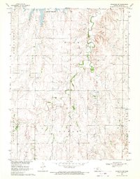
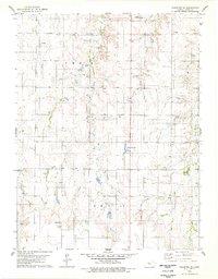
(128)- 1893 Map of Norton
 1893 Norton1893 Print · USGSNorthwest Kansas during the mid-1890s shows a region defined by the growth of railroad towns and water-carved valleys. Genealogists and historians can trace early town sites and rail lines including Norton, Almena, and the Pacific Railroad route through Logan.4 unique versions available
 - 1893 Map of Phillipsburg
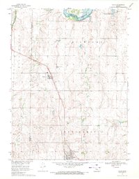
 1893 Phillipsburg1893 Print · USGSPhillips County was a burgeoning rail and river corridor in the 1890s, with three major railroads carving paths through the prairie townships. Genealogists and researchers can trace the early layouts of Phillipsburg, Kirwin, and Agra as they appeared before the turn of the century.4 unique versions available
 - 1893 Map of Hill
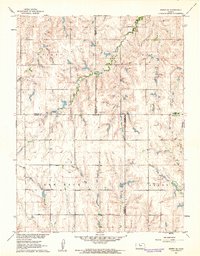
 1893 Hill1893 Print · USGSNorthwestern Kansas in the early 1890s shows a landscape of developing prairie townships and the vital Union Pacific Railway corridor. Researchers can trace the early footprint of the historic colony at Nicodemus and find old stations like Millbrook and Paleo.4 unique versions available
 - 1896 Map of Plainville
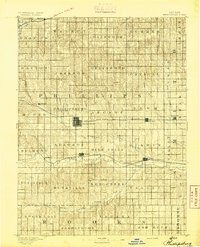
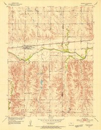
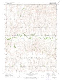
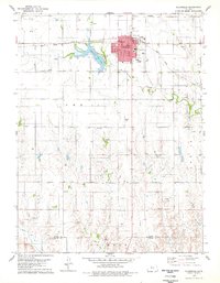
 1896 Plainville1896 Print · USGSThe Rooks County high plains are seen here in the 1890s as the rail networks expanded across the Solomon and Saline river valleys. Genealogists can trace family roots in early settlements like Plainville, Stockton, and the vanished site of Turkville.3 unique versions available
 - 1952 Map of Webster Dam, 1955 Print
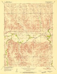
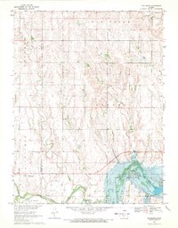
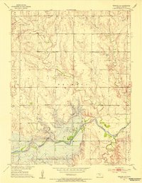 1952 Webster Dam1955 Print · USGSRooks County was on the brink of a major transformation in the early 1950s as the Missouri River Basin project began reshaping the Solomon valley. Researchers can trace the original townsite of Webster and nearby landmarks like Mt Vernon Cem before they were impacted by the Webster Dam.2 unique versions available
 - 1953 Map of Woodston NW, 1954 Print
 1953 Woodston NW1954 Print · USGSRooks County agriculture and transport are centered along the river valley in the early fifties. Genealogists and local historians can trace the foundations of the community through the Woodston Cem, New Hope Sch, and the Missouri Pacific rail line.2 unique versions available
 - 1953 Map of Stockton, 1954 Print
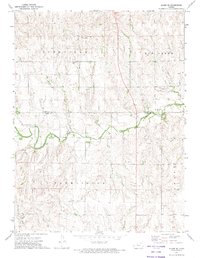
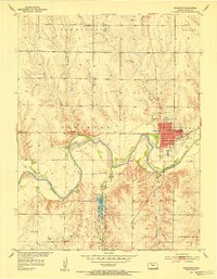 1953 Stockton1954 Print · USGSStockton and the Rooks County plains are captured here in the early fifties, following the course of the South Fork Solomon River. Genealogists can locate rural landmarks like Mt Nebo Sch, the Old Stockton Cem, and the Community Hall.3 unique versions available
 - 1953 Map of Woodston, 1954 Print
 1953 Woodston1954 Print · USGSThe town of Woodston and its surrounding townships are shown here in the early fifties, caught between the river and the rail line. Researchers can trace the mid-century footprint of local education and community at High Sch, Pleasant Valley Sch, and the Pleasant Valley Cem.2 unique versions available
 - 1955 Map of Beloit, 1971 Print
 1955 Beloit1971 Print · USGSNorth Central Kansas in the mid-fifties shows a landscape of river-valley agriculture and expanding water infrastructure. Genealogists can trace the rail lines of the Union Pacific through towns like Nicodemus, Cawker City, and the State Sanatorium.3 unique versions available
 - 1959 Map of Beloit
 1959 Beloit1959 Print · USGSNorth Central Kansas at mid-century reveals a landscape shaped by river valleys and the expansion of massive water reservoirs. Genealogists and historians can trace the rail-town connections of Beloit and Norton or locate the site of the new Webster Dam.3 unique versions available
 - 1961 Map of Kirwin SE, 1962 Print
 1961 Kirwin SE1962 Print · USGSThe rural crossroads of Rooks, Phillips, Smith, and Osborne counties are captured here in the early sixties. Genealogists can locate family sites and rural landmarks like Bohemian Cem, Spring Branch Cem, and Ash Rock Sch 2.
 - 1961 Map of Kirwin SW, 1963 Print
 1961 Kirwin SW1963 Print · USGSPhillips and Rooks County lands are captured here in the early sixties as the reservoir system reshaped the valley. Genealogists can locate family landmarks like the Greenwood Cem, Delmar Community Hall, and the West Hope Sch.
 - 1969 Map of Nicodemus, 1971 Print
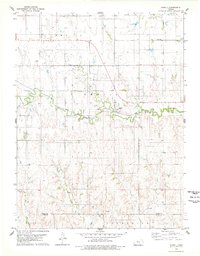
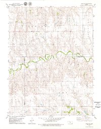
 1969 Nicodemus1971 Print · USGSThe historic settlement of Nicodemus and the surrounding Solomon Valley are captured here in the late sixties. Genealogists and researchers can trace family landmarks like Nicodemus Cem or the La Sage Oil Field along the South Fork Solomon River.
 - 1969 Map of Palco, 1971 Print
 1969 Palco1971 Print · USGSRooks County agricultural and oil-producing lands are captured here in the late sixties, centered on the Union Pacific rail line. Genealogists and local historians can locate St Joseph Cem and Palco Cem, or trace the development of the Gra-Rook North Oil Field.
 - 1969 Map of Stockton SW, 1971 Print
 1969 Stockton SW1971 Print · USGSRooks County was undergoing significant industrial development in the late sixties as oil extraction moved into the prairie. Genealogists and historians can trace family land across Richland and Hobart, locating the Eureka Cem and the Hayden Oil Field.
 - 1972 Map of Glade SW, 1974 Print
 1972 Glade SW1974 Print · USGSThe Kansas borderlands of Phillips and Rooks counties come alive in the early seventies, centered on the winding Bow Creek. Researchers can trace local heritage through the Plainview Cem, Mt Pleasant Ch, and various township Townhall sites.
 - 1972 Map of Glade SE, 1974 Print
 1972 Glade SE1974 Print · USGSThe borderlands of Phillips and Rooks counties come into focus in the early 1970s, showcasing a landscape of section-line roads and prairie creek beds. Genealogists and local historians can pinpoint the Lockwood Cem, the local Townhall, and the winding course of Bow Creek.
 - 1978 Map of Natoma, 1979 Print
 1978 Natoma1979 Print · USGSThe Kansas plains of the late seventies come alive on this sheet centered on the rail-side community of Natoma. Researchers can trace the legacy of local industry and genealogy through the Oil Field and landmarks like Conger Cem.
 - 1978 Map of Plainville, 1979 Print
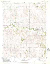
 1978 Plainville1979 Print · USGSIn the late seventies, this Rooks County landscape centered on the intersection of prairie agriculture and the booming energy industry. Trace the town's layout through landmarks like the Drive-in Theater, the Union Pacific rail line, and Plainville Twp Lake.
 - 1978 Map of Codell, 1979 Print
 1978 Codell1979 Print · USGSRooks and Ellis counties in the late 1970s reveal a landscape shaped by petroleum and rail. Researchers can trace the Union Pacific corridor through Codell and locate family burial sites at Shiloh Cem and Center Cem.
 - 1978 Map of Twin Mound, 1979 Print
 1978 Twin Mound1979 Print · USGSRooks County in the late seventies reveals a landscape where ranching roots meet the machinery of the energy industry. Researchers can find old burial sites like Twin Mound Cem and Johnson Cem alongside an extensive Oil Field.
 - 1978 Map of Zurich, 1979 Print
 1978 Zurich1979 Print · USGSZurich thrived as a hub for both rail transit and petroleum extraction in the late seventies. Family historians and researchers can trace the Union Pacific line, locate the community Cem, and map the extensive Oil Field and numerous Oil Wells across the county line.
 - 1978 Map of Laton, 1979 Print
 1978 Laton1979 Print · USGSRooks and Osborne Counties appear here in the late 1970s, showcasing the rural character of the Kansas prairie. Genealogists and historians can trace family roots through several landmarks, including Laton, the Pleasant Plain Church, and Chalk Mound Cemetery.
 - 1978 Map of Stockton SE, 1979 Print
 1978 Stockton SE1979 Print · USGSRooks County in the late seventies is captured here at a height of rural energy production and local development. Genealogists and historians can trace the expansive Oil Field network, locate the Stockton Municipal Airport, or find early landmarks like the County Country Club.
 - 1979 Map of Logan SE
 1979 Logan SE1979 Print · USGSPhillips and Rooks Counties at the close of the 1970s show a structured agricultural landscape shaped by local watercourses and early industry. Family historians can trace rural roots near Prairie Dale Cem or the settlement of Towanda, while following Bow Creek across the county lines.
Showing maps 1-25 of 128
Top cities of Rooks County
- Plainville historical maps
- Stockton historical maps
- Palco historical maps
- Damar historical maps
- Zurich historical maps
- Woodston historical maps
Frequently asked questions
- What are the different types of historical maps available for Rooks County?
- What is the oldest map of Rooks County?
- Where can I purchase historical maps of Rooks County for my home or office?
- Where can I download high-res historical maps of Rooks County?
- Are there historical topographic maps available for Rooks County?
- Is there historical aerial imagery available for Rooks County?
- Where are historical maps of Rooks County sourced from?