1970s Maps of Sherman County, Kansas
Explore 7 historic maps of Sherman County from the 1970s. These maps offer a rare glimpse into what life looked like during the 1970s — showing old roads, neighborhoods, homes, and landmarks that have changed or disappeared over time.
Whether you're researching your family's past, planning a metal detecting trip, or studying how Sherman County's landscape evolved across the 1970s, these high-resolution maps are a powerful tool for exploring the history of this region.
- Focus on a specific era: All maps on this page are from the 1970s, giving you a focused view of this time period.
- See what’s changed: Compare century-old streets, trails, and buildings to today's modern landscape using overlays and satellite layers.
- Research with precision: Use these maps for genealogy, historical research, land use analysis, or educational projects.
- View, download, or print: Maps are fully viewable online in high resolution, and can be downloaded or printed for your own records.
Start exploring Sherman County's history through authentic maps from the 1970s. This is your window into the past.
Sherman County, KS maps
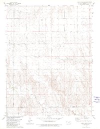
(7)- 1971 Map of Bonny Reservoir SE, 1973 Print
 1971 Bonny Reservoir SE1973 Print · USGSThe Colorado-Kansas borderlands are captured here in the early seventies, showing a remote landscape of high plains ranching and intricate drainage systems. Genealogists and land historians can trace property boundaries and water rights along Beaver Creek, Battle Creek, and Jaqua Creek.2 unique versions available
 - 1978 Map of St. Francis 3 SE
 1978 St. Francis 3 SE1978 Print · USGSNorthwest Kansas in the late 1970s shows a landscape of expansive townships and high-plains water management. Genealogists and researchers can trace land divisions across Benkelman and Voltaire or locate features like Little Beaver Creek.2 unique versions available
 - 1978 Map of St. Francis 3 SW
 1978 St. Francis 3 SW1978 Print · USGSHigh plains ranching and agriculture define this western Kansas borderland in the late seventies. Genealogists and local historians can trace the rural landscape across Benkelman and Jaqua, locating landmarks like Neville Ch and the headwaters of Battle Creek.3 unique versions available
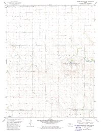
 - 1979 Map of Horsethief Draw NW, 1980 Print
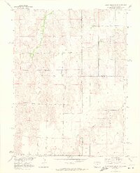
 1979 Horsethief Draw NW1980 Print · USGSSherman and Wallace counties are captured in the late seventies, showing a landscape defined by the High Plains river system. Genealogists and land researchers can locate specific sites like Turtle Creek Lake, Sappa Creek, and various Gravel Pits along the county line.
 - 1979 Map of Harris Draw NE, 1980 Print
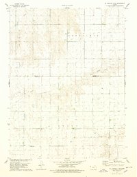
 1979 Harris Draw NE1980 Print · USGSThe High Plains of Western Kansas are documented here in the late seventies as the terrain transitions between Sherman and Wallace counties. Genealogists and local historians can locate the Mennonite Cem and trace the winding course of the North Fork Smoky Hill River and Sand Creek.
 - 1979 Map of Horsethief Draw NE, 1980 Print
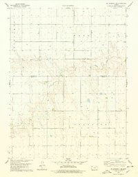
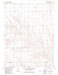
 1979 Horsethief Draw NE1980 Print · USGSSherman County at the close of the 1970s reveals a landscape defined by the confluence of the North Fork Smoky Hill River and Smoky Hill River. Researchers can trace the layout of the Sherman State Fishing Lake and Wildlife Area or locate the Fairview Cem and Soldiers Memorial County Park.
 - 1979 Map of Wild Horse Draw, 1980 Print
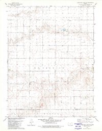
 1979 Wild Horse Draw1980 Print · USGSSherman and Wallace counties are shown in the late 1970s, focused on the high plains drainage systems. Researchers can trace the winding North Fork Smoky Hill River and locate historic land-use sites like the local Gravel Pits and Wild Horse Draw.
End of results
Showing maps 1-7 of 7
Top cities of Sherman County
Frequently asked questions
- What are the different types of historical maps available for Sherman County?
- What is the oldest map of Sherman County?
- Where can I purchase historical maps of Sherman County for my home or office?
- Where can I download high-res historical maps of Sherman County?
- Are there historical topographic maps available for Sherman County?
- Is there historical aerial imagery available for Sherman County?
- Where are historical maps of Sherman County sourced from?