1960s Maps of Sherman County, Kansas
Explore 14 historic maps of Sherman County from the 1960s. These maps offer a rare glimpse into what life looked like during the 1960s — showing old roads, neighborhoods, homes, and landmarks that have changed or disappeared over time.
Whether you're researching your family's past, planning a metal detecting trip, or studying how Sherman County's landscape evolved across the 1960s, these high-resolution maps are a powerful tool for exploring the history of this region.
- Focus on a specific era: All maps on this page are from the 1960s, giving you a focused view of this time period.
- See what’s changed: Compare century-old streets, trails, and buildings to today's modern landscape using overlays and satellite layers.
- Research with precision: Use these maps for genealogy, historical research, land use analysis, or educational projects.
- View, download, or print: Maps are fully viewable online in high resolution, and can be downloaded or printed for your own records.
Start exploring Sherman County's history through authentic maps from the 1960s. This is your window into the past.
Sherman County, KS maps
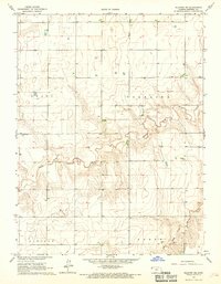
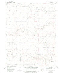
(14)- 1966 Map of Goodland NW, 1967 Print
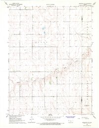
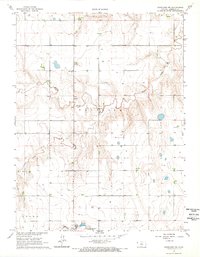 1966 Goodland NW1967 Print · USGSSherman County during the mid-sixties shows a classic Kansas high plains landscape shaped by the Middle Fork Sappa Cr. Researchers can trace old rural infrastructure like the Prairie Star Sch and the Goodland Municipal Airport (Renner Field).2 unique versions available
 - 1966 Map of Goodland, 1967 Print
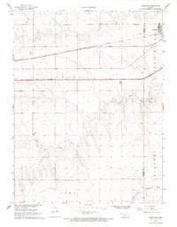
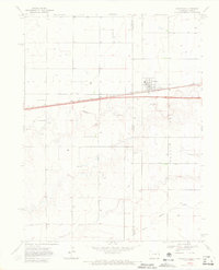
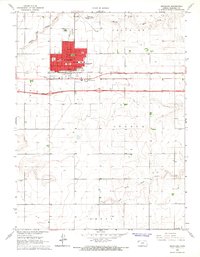 1966 Goodland1967 Print · USGSGoodland and the surrounding Sherman County plains appear here in the mid-1960s, a period of transition for High Plains travel. Researchers can trace the development of the city grid, from the Courthouse and Post Office to the interstate then UNDER CONSTRUCTION and the C R I & P railroad line.3 unique versions available
 - 1966 Map of Ruleton NW, 1967 Print
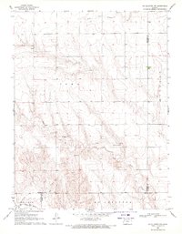
 1966 Ruleton NW1967 Print · USGSHigh Plains ranching and water management define this Sherman County landscape in the mid-sixties. Researchers can trace the path of Middle Fork Beaver Creek across Grant township or locate early industrial sites like the Sandpit.2 unique versions available
 - 1966 Map of Edson, 1967 Print
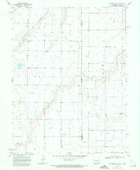
 1966 Edson1967 Print · USGSSherman County life in the mid-1960s centered on the small siding of Edson as the new interstate began to reshape the plains. Genealogists and local historians can trace the Chicago Rock Island and Pacific rail line, the Edson Cem, and the headwaters of South Fork Sappa Creek.2 unique versions available
 - 1966 Map of Ruleton NE, 1967 Print
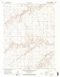
 1966 Ruleton NE1967 Print · USGSSherman County agriculture and high plains drainage are well-documented in this mid-sixties survey of the western Kansas landscape. Researchers can trace the path of Middle Fork Beaver Creek or locate the New Liberty Cem near the border of Grant township.
 - 1966 Map of Goodland NE, 1967 Print
 1966 Goodland NE1967 Print · USGSSherman County in the mid-1960s was a landscape of established townships and quiet prairie drainages. Genealogists and researchers can trace the section lines and watercourses of Shermanville and Voltaire or follow the path of Middle Fork Sappa Creek.
 - 1966 Map of Ruleton, 1967 Print
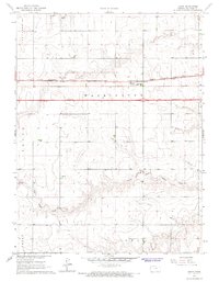
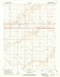 1966 Ruleton1967 Print · USGSSherman County, Kansas, is captured during a period of infrastructure growth in the mid-1960s. Genealogists and historians can trace the development of Ruleton along the Chicago Rock Island and Pacific railroad and a highway marked Under Construction.2 unique versions available
 - 1966 Map of Ruleton SE, 1967 Print
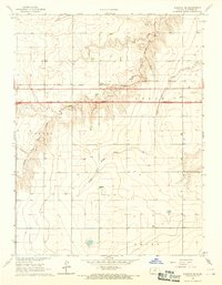 1966 Ruleton SE1967 Print · USGSSherman County is captured during a major transition in the mid-sixties as the interstate highway system arrives. Genealogists and historians can trace the rail-side community of Caruso and follow the route of Interstate 70 while it was still UNDER CONSTRUCTION.2 unique versions available
 - 1966 Map of Brewster NW, 1968 Print
 1966 Brewster NW1968 Print · USGSThe High Plains of Sherman County are captured here in the mid-1960s, showing a landscape defined by section-line roads and the Middle Fork Sappa Creek. Genealogists and historians can locate the Pleasant Home Ch and Freeland Cem or trace the path of the Old Railroad Grade.
 - 1966 Map of Brewster, 1968 Print
 1966 Brewster1968 Print · USGSBrewster sits at the junction of rail and road during a period of high-plains modernization in the mid-sixties. Genealogists can locate Fairview Cem and trace the original path of the Chicago Rock Island and Pacific railroad.2 unique versions available
 - 1969 Map of Mc Allaster NW, 1971 Print
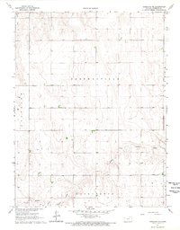
 1969 Mc Allaster NW1971 Print · USGSThe High Plains of western Kansas are captured here in the late sixties at the convergence of four counties. Genealogists and local researchers can trace the drainages of the South Fork Solomon River and Sand Creek near features like the spillway.
 - 1969 Map of Kanorado NE, 1972 Print
 1969 Kanorado NE1972 Print · USGSThe high plains along the Colorado and Kansas border are captured here in the late sixties, showcasing a landscape of section-line roads and prairie creek beds. Researchers can find local landmarks like the Bear Valley Cem, Bear Valley Sch, and the isolated Witzel settlement.
 - 1969 Map of Mount Sunflower NE, 1972 Print
 1969 Mount Sunflower NE1972 Print · USGSThe Colorado-Kansas state line at the edge of Kit Carson and Sherman Counties comes into focus in the late 1960s. Genealogists and local historians can trace rural development near the Green Valley Sch or follow the waters of the North Fork Smoky Hill River and Sappa Creek.
 - 1969 Map of Kanorado, 1972 Print
 1969 Kanorado1972 Print · USGSThe High Plains border town of Kanorado is captured in the late sixties as it straddled the State Line between Kansas and Colorado. Genealogists and researchers can trace the path of the Chicago Rock Island and Pacific railroad and find local markers like Grain Bins and early Gravel Pits.3 unique versions available
End of results
Showing maps 1-14 of 14
Top cities of Sherman County
Frequently asked questions
- What are the different types of historical maps available for Sherman County?
- What is the oldest map of Sherman County?
- Where can I purchase historical maps of Sherman County for my home or office?
- Where can I download high-res historical maps of Sherman County?
- Are there historical topographic maps available for Sherman County?
- Is there historical aerial imagery available for Sherman County?
- Where are historical maps of Sherman County sourced from?