2020s Maps of Shreveport, Louisiana
Explore 16 historic maps of Shreveport from the 2020s. These maps offer a rare glimpse into what life looked like during the 2020s — showing old roads, neighborhoods, homes, and landmarks that have changed or disappeared over time.
Whether you're researching your family's past, planning a metal detecting trip, or studying how Shreveport's landscape evolved across the 2020s, these high-resolution maps are a powerful tool for exploring the history of this region.
- Focus on a specific era: All maps on this page are from the 2020s, giving you a focused view of this time period.
- See what’s changed: Compare century-old streets, trails, and buildings to today's modern landscape using overlays and satellite layers.
- Research with precision: Use these maps for genealogy, historical research, land use analysis, or educational projects.
- View, download, or print: Maps are fully viewable online in high resolution, and can be downloaded or printed for your own records.
Start exploring Shreveport's history through authentic maps from the 2020s. This is your window into the past.
Shreveport, LA maps
(16)- 2020 Map of Shreveport East, 2020 Print
 2020 Shreveport East2020 Print · USGSCovers Shreveport, including Bossier City, Lucas, and other nearby areas
 - 2020 Map of Stonewall, 2020 Print
 2020 Stonewall2020 Print · USGSCovers Shreveport, including Stonewall, Keithville, and other nearby areas
 - 2020 Map of Shreveport West, 2020 Print
 2020 Shreveport West2020 Print · USGSCovers Shreveport, including Pineland Place, Broadview, and other nearby areas
 - 2020 Map of North Highlands, 2020 Print
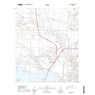 2020 North Highlands2020 Print · USGSCovers Shreveport, including Blanchard, Northwoods, and other nearby areas
 - 2020 Map of Bossier City, 2020 Print
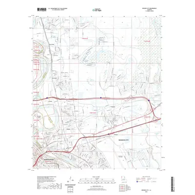 2020 Bossier City2020 Print · USGSCovers Shreveport, including Bossier City, Honore, and other nearby areas
 - 2020 Map of Blanchard, 2020 Print
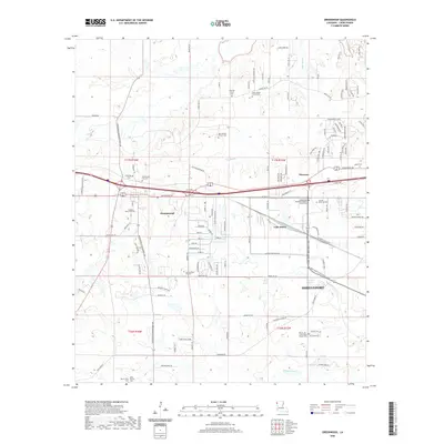
 2020 Blanchard2020 Print · USGSCovers Shreveport, including Blanchard, North Park Estates, and other nearby areas
 - 2020 Map of Greenwood, 2020 Print
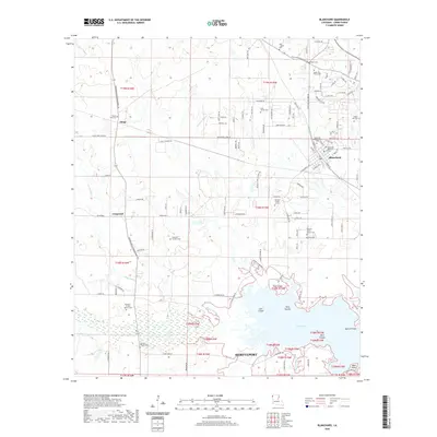
 2020 Greenwood2020 Print · USGSCovers Shreveport, including Greenwood, Lake Hayes, and other nearby areas
 - 2020 Map of Wallace Lake, 2020 Print
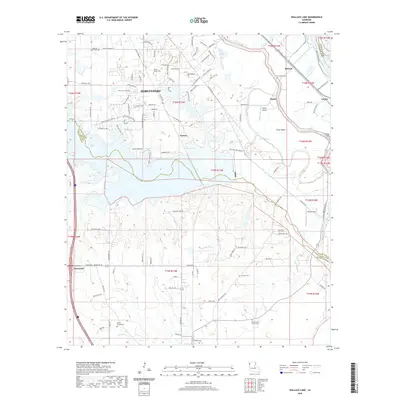 2020 Wallace Lake2020 Print · USGSCovers Shreveport, including Stonewall, Naylor, and other nearby areas
 - 2024 Map of Shreveport East, 2024 Print
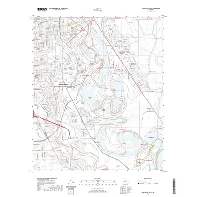
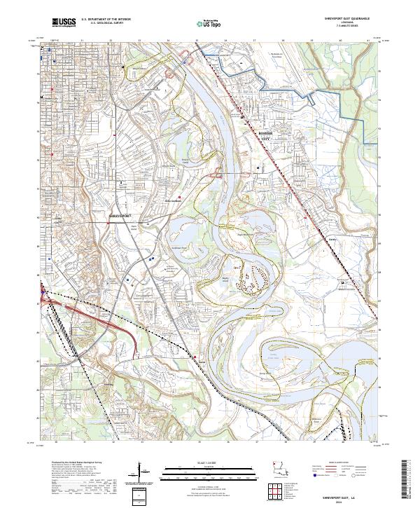 2024 Shreveport East2024 Print · USGSShreveport and Bossier City are captured here along the shifting banks of the Red River in 2024. Genealogists and historians can trace suburban growth and river landmarks like Red River Cem, Anderson Island, and the historic Centenary College of Louisiana.
 - 2024 Map of Wallace Lake, 2024 Print
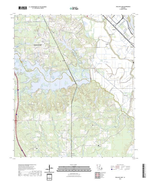 2024 Wallace Lake2024 Print · USGSThe southern outskirts of Shreveport and the Wallace Lake basin are captured here in the early twenty-first century. Genealogists and local historians can trace rural burial grounds like Forbing Union Cem and family landmarks near the Kansas City Southern line.
 - 2024 Map of Greenwood, 2024 Print
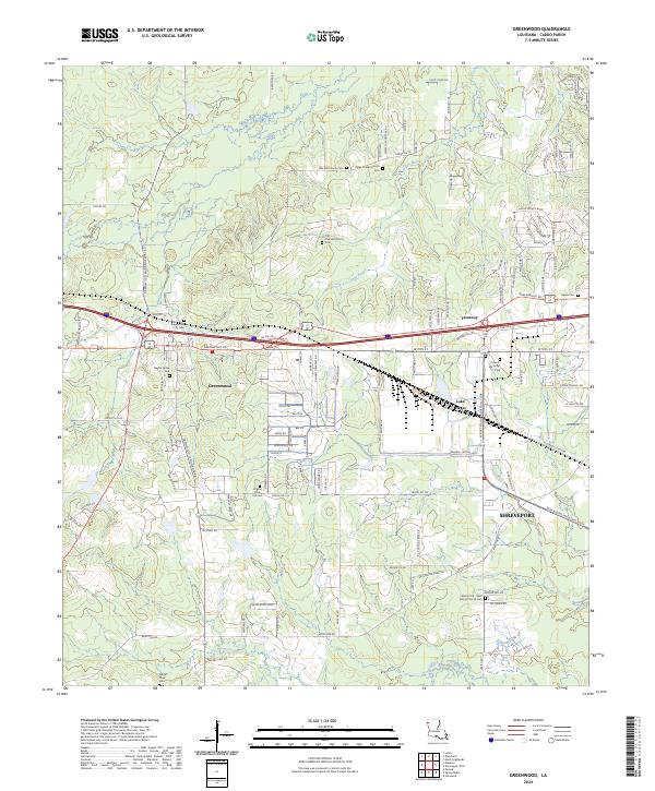 2024 Greenwood2024 Print · USGSWest of Shreveport in the 2020s, the landscape around Greenwood preserves a high density of early community sites and family landmarks. Genealogists and historians can trace numerous burial sites like Bayliss Grave Yard and Jackson Pine Hill Cem or locate Paige Chapel Church.
 - 2024 Map of Blanchard, 2024 Print
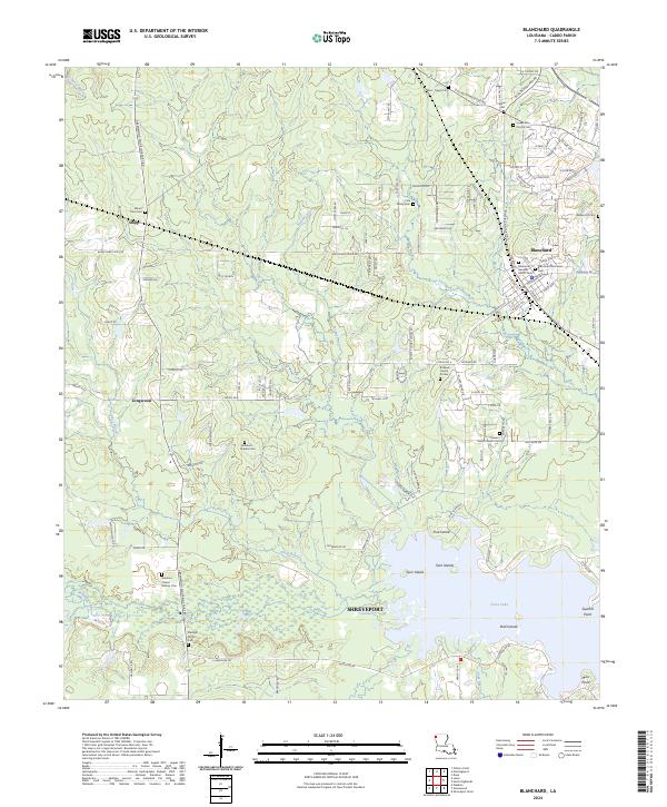 2024 Blanchard2024 Print · USGSNorthern Shreveport and the town of Blanchard are captured here as residential growth expands near the shores of Cross Lake. Genealogists can trace family burial sites like Bickham - Charles Cem and the Cole Family Cem.
 - 2024 Map of Stonewall, 2024 Print
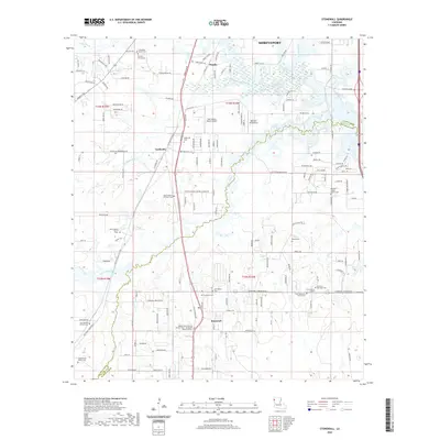
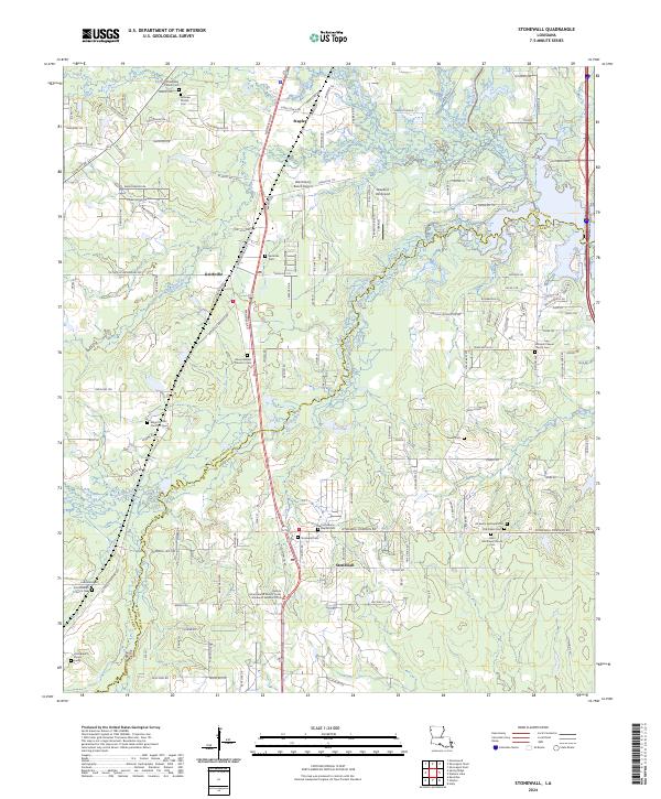 2024 Stonewall2024 Print · USGSThe Caddo and De Soto parish line comes alive in this 2020s study of the north Louisiana bayou country. Researchers can pinpoint several family and church burial grounds, including Old Salem Cem and the Hollinsworth Family Cem near the banks of Johnson Branch.
 - 2024 Map of Bossier City, 2024 Print
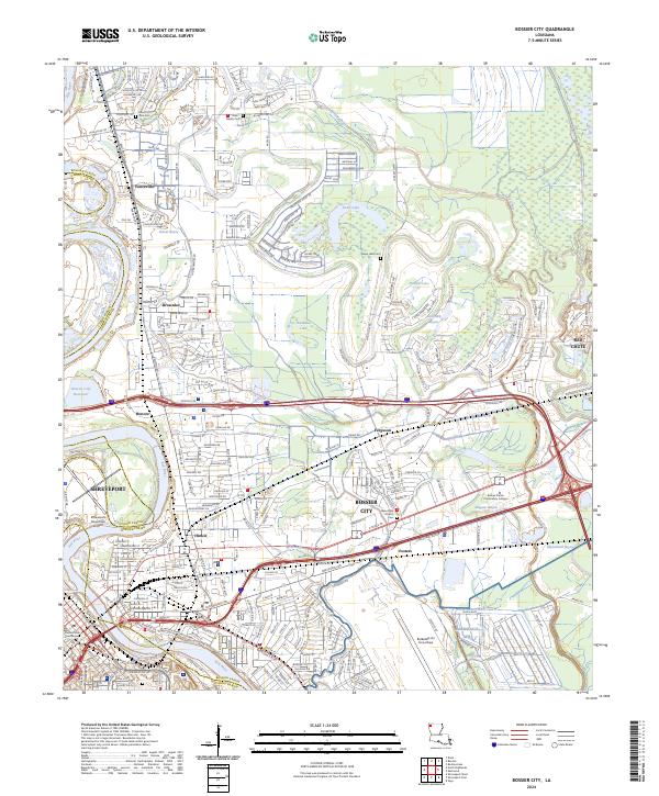 2024 Bossier City2024 Print · USGSBossier City and Shreveport are shown in their modern industrial and suburban complexity just east of the Red River. Researchers can trace family history at Mount Zion Cem, locate Bossier Parish Community College, or study the footprint of Barksdale AFB.
 - 2024 Map of North Highlands, 2024 Print
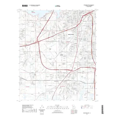
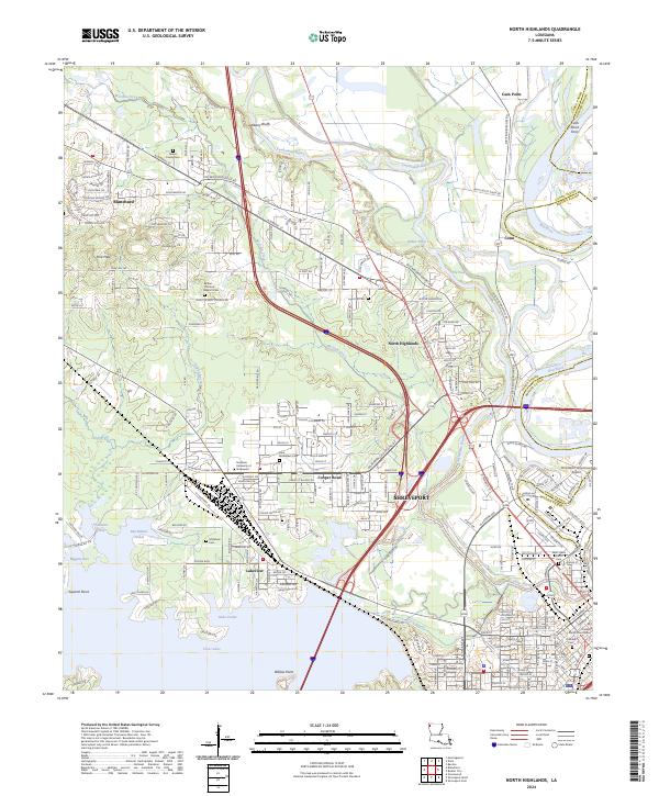 2024 North Highlands2024 Print · USGSCaddo Parish comes into focus in this recent survey of the transition from SHREVEPORT to the surrounding bayou country. Researchers can locate numerous local landmarks like the Shows Family Cem, Southern University at Shreveport, and the Cash Point Ferry.
 - 2024 Map of Shreveport West, 2024 Print
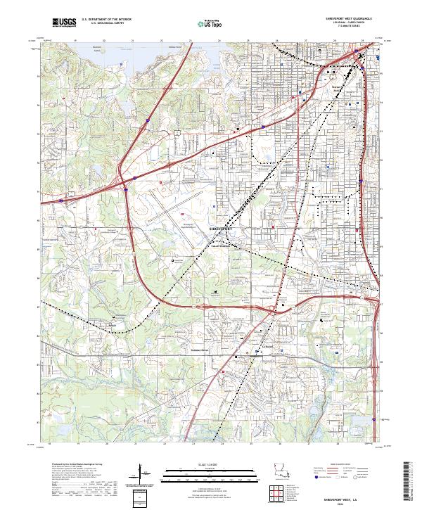 2024 Shreveport West2024 Print · USGSShreveport and the western reaches of Caddo Parish are shown here in the mid-2020s, highlighting the city's modern industrial and suburban footprint. Researchers can locate many local burial sites and landmarks like Jewella Cem, Summer Grove, and the Shreveport Regional Airport.
End of results
Showing maps 1-16 of 16
Top cities near Shreveport
- Bossier City historical maps
- Blanchard historical maps
- Greenwood historical maps
- Benton historical maps
- Stonewall historical maps
- Mooringsport historical maps
Top neighborhoods of Shreveport
- Pine Hill Estates historical maps
- Dorian Terrace historical maps
- Highland Square historical maps
- Gas Center historical maps
- Good Roads historical maps
- North Highlands historical maps
See more
Frequently asked questions
- What are the different types of historical maps available for Shreveport?
- What is the oldest map of Shreveport?
- Where can I purchase historical maps of Shreveport for my home or office?
- Where can I download high-res historical maps of Shreveport?
- Are there historical topographic maps available for Shreveport?
- Is there historical aerial imagery available for Shreveport?
- Where are historical maps of Shreveport sourced from?