Old Maps of Cameron, Louisiana for Metal Detecting
Plan your next treasure hunt with 19 historic maps of Cameron. Find old homesites, ghost towns, trails, and gathering spots that may be lost to time — perfect for identifying promising metal detecting locations.
- Locate forgotten sites: Uncover places like long-lost settlements, abandoned rail lines, or gathering spots.
- Plan better hunts: Use map overlays combined with LiDAR or satellite views to narrow in on historically rich areas.
- Made for detectorists: Thousands of hobbyists use these maps to discover relics, coins, and hidden history.
Use these historic maps to boost your research and find new opportunities beneath the surface of Cameron.
Cameron, LA maps
(19)- 1934 Map of Cameron, 1955 Print
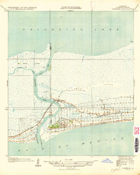
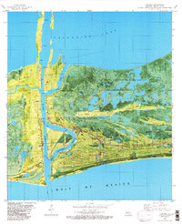
 1934 Cameron1955 Print · USGSCoastal Louisiana at the edge of the gulf is mapped here during the mid-1930s, showing a landscape of marsh ridges and vital waterways. Researchers can trace the layout of Cameron and locate local landmarks like the Rose Sch or the winding Calcasieu Pass.3 unique versions available
 - 1935 Map of Cameron
 1935 Cameron1935 Print · USGSCoastal Louisiana at the edge of the Gulf comes to life in the mid-1930s as the community of Cameron manages its vital waterways. Genealogists and local historians can trace early land lines and find landmarks like the Rose Sch and Calcasieu Light.
 - 1954 Map of Port Arthur
 1954 Port Arthur1954 Print · USGSThe Texas and Louisiana coastlines meet here in the mid-fifties, showing the industrial rise of Port Arthur alongside vast wildlife preserves. Researchers can trace remote coastal settlements and infrastructure like Pecan Island, the Sabine Pass Lighthouse, and the North Island School.
 - 1955 Map of Cameron, 1956 Print
 1955 Cameron1956 Print · USGSCoastal Louisiana in the mid-fifties reveals a landscape of sprawling wetlands and maritime industry centered around Calcasieu Lake. Researchers can trace old family sites like Kelly-Reser Cem or explore the early infrastructure of Cameron and Hackberry.3 unique versions available
 - 1956 Map of Port Arthur, 1965 Print
 1956 Port Arthur1965 Print · USGSThe Texas and Louisiana coastlines meet here in the mid-fifties, showing a landscape of sprawling marshes and growing refinery towns. Genealogists and historians can trace ridge settlements like Grand Cheniere or find the Sabine Pass Lighthouse and Pecan Island.3 unique versions available
 - 1958 Map of Port Arthur
 1958 Port Arthur1958 Print · USGSThe Texas and Louisiana coastlines meet in the late fifties at the busy industrial port of Port Arthur. Historians and genealogists can trace the early rail networks of the Southern Pacific and locate coastal settlements like Cameron, Pecan Island, and Abbeville.
 - 1959 Map of Port Arthur
 1959 Port Arthur1959 Print · USGSThe Texas and Louisiana coastlines meet in this late-fifties study of a landscape defined by industry and wildlife preserves. Trace the Intracoastal Waterway past Pecan Island and Abbeville, or locate the shipping channels at Sabine Pass.
 - 1960 Map of Cameron, 1976 Print
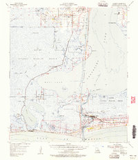
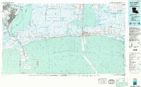
 1960 Cameron1976 Print · USGSThe coastal settlement of Cameron is captured in the mid-1970s at the vital intersection of marsh and sea. Trace the docks and development along Calcasieu Pass and the southern shoreline of Calcasieu Lake at the edge of the Gulf.
 - 1973 Map of Port Arthur, 1974 Print
 1973 Port Arthur1974 Print · USGSThe Texas-Louisiana borderlands in the early seventies reveal an intricate landscape of coastal marshes and heavy industry. Trace the growth of Port Arthur, the extent of the oil and gas fields, and old ridge settlements like Pecan Island.
 - 1975 Map of Cameron, 1976 Print
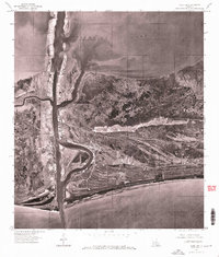
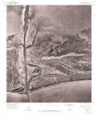 1975 Cameron1976 Print · USGSCoastal Louisiana in the mid-seventies is captured in this detailed aerial perspective of the marshland and maritime interface. Researchers can trace the mid-century layout of Cameron and the shipping infrastructure along Calcasieu Pass and Calcasieu Lake.
 - 1982 Map of Cameron
 1982 Cameron1982 Print · USGSCoastal Louisiana at the start of the 1980s reveals a hardworking landscape of energy extraction and maritime passage. Researchers can trace family sites like Wakefield Mem Cem alongside the heavy industry of the Cameron Oil and Gas Field.
 - 1983 Map of Port Arthur
 1983 Port Arthur1983 Print · USGSThe Texas and Louisiana coastline comes into sharp focus during the early 1980s, showcasing the industrial hubs of the Gulf. Trace the development of Port Arthur and Port Neches or locate specific facilities like St Gabriel Hospital and the West Hackberry Oil Field.
 - 1998 Map of Cameron, 2000 Print
 1998 Cameron2000 Print · USGSCoastal Louisiana near the close of the century reveals a landscape shaped by the energy industry and maritime commerce at the Gulf's edge. Researchers can trace family history at Wakefield Mem Cem or explore industrial roots through the Cameron Oil and Gas Field.
 - 2012 Map of Cameron, 2012 Print
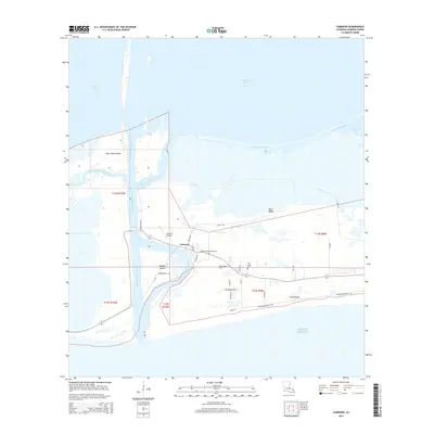
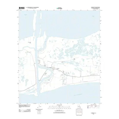 2012 Cameron2012 Print · USGSCovers Cameron, including Cameron Parish, United States, and other nearby areas
 - 2015 Map of Cameron, 2015 Print
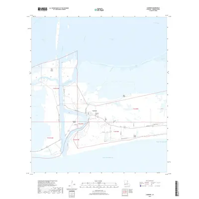
 2015 Cameron2015 Print · USGSCovers Cameron, including Cameron Parish, United States, and other nearby areas
 - 2018 Map of Cameron, 2018 Print
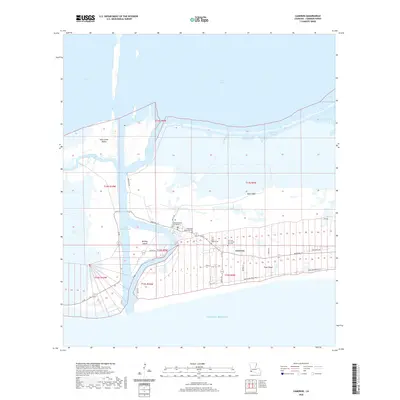
 2018 Cameron2018 Print · USGSCovers Cameron, including Cameron Parish, United States, and other nearby areas
 - 2020 Map of Cameron, 2020 Print
 2020 Cameron2020 Print · USGSCovers Cameron, including Cameron Parish, United States, and other nearby areas
 - 2024 Map of Cameron, 2024 Print
 2024 Cameron2024 Print · USGSCovers Cameron, including Cameron Parish, United States, and other nearby areas
 - 2025 Map of Cameron, 2025 Print
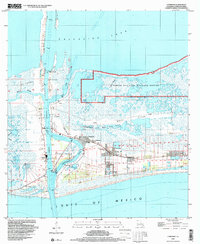
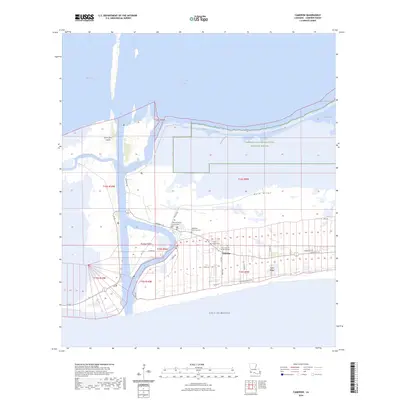
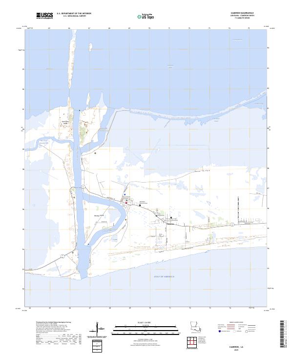 2025 Cameron2025 Print · USGSThe Louisiana coast at the mouth of the Calcasieu River comes into sharp focus in this mid-2020s study. Researchers can trace local lineage at Wakefield Memorial Cem or locate the Cameron Parish Courthouse near the docks of Monkey Island.
End of results
Showing maps 1-19 of 19
Frequently asked questions
- What are the different types of historical maps available for Cameron?
- What is the oldest map of Cameron?
- Where can I purchase historical maps of Cameron for my home or office?
- Where can I download high-res historical maps of Cameron?
- Are there historical topographic maps available for Cameron?
- Is there historical aerial imagery available for Cameron?
- Where are historical maps of Cameron sourced from?