Old Maps of Grant Parish, Louisiana for Hiking & Exploration
Hike through history with 175 historic maps of Grant Parish. Explore old trails, ghost towns, and forgotten backroads — perfect for outdoor adventurers and local explorers.
- Rediscover forgotten places: Map out old mining camps, roads, and footpaths that no longer exist on modern maps.
- Layer with modern tools: Combine with LiDAR or satellite views to plan hikes through historical terrain.
- Made for exploration: Popular among hikers, overlanders, and local history lovers.
Use these maps to find adventure and explore the hidden past of Grant Parish.
Grant Parish, LA maps
(175)- 1932 Map of Colfax NE
 1932 Colfax NE1932 Print · USGSGrant Parish was undergoing significant forestry management and rural development in the early 1930s. Genealogists and historians can locate the Williana Sch, Zion Hill Ch, and trace the path of the Louisiana and Arkansas railroad.
 - 1932 Map of Boyce NE
 1932 Boyce NE1932 Print · USGSThe border of Grant and Rapides Parishes is captured here in the early 1930s as the national forest and river bottomlands converge. Local historians can trace family locations near Frazier Cem, Mt Pleasant Sch, and the winding banks of Rigolette Bayou.
 - 1932 Map of Colfax SW
 1932 Colfax SW1932 Print · USGSThe Red River valley of Central Louisiana is captured here in the early 1930s as a landscape of rail-connected settlements and complex waterways. Genealogists and historians can trace the foundations of Colfax and locate rural landmarks like Lee Chapel, Ferenzi Ch, and the Lutesville Gravel Pit.
 - 1932 Map of Colfax SE
 1932 Colfax SE1932 Print · USGSGrant Parish in the early thirties shows a rural landscape defined by the nascent Kisatchie National Forest and local timber corridors. Researchers can locate community landmarks such as Faircloth, Dry Prong, and rural schoolhouses like Black Cr Sch.
 - 1932 Map of Colfax NW
 1932 Colfax NW1932 Print · USGSGrant and Winn Parishes come into focus during the early thirties, showing a rural Louisiana landscape defined by its bayous and creek bottoms. Local researchers can trace the locations of the Oak Grove School, Latt Church, and the winding course of Parasol Bayou.
 - 1935 Map of Verda
 1935 Verda1935 Print · USGSThe northern pine woods of Grant and Winn Parishes are documented here during the mid-1930s. Researchers can locate early homestead sites near Lanes Store, the old rail stop at Hargis, and the curiously named Six Bits Cem.
 - 1936 Map of Colfax
 1936 Colfax1936 Print · USGSGrant Parish in the mid-1930s is defined by the sweeping course of the Red River and the expanding reaches of Lake Iatt. Local researchers can trace old family sites and rural institutions like Parsons Cem, Summerfield, and the Oak Grove Sch.2 unique versions available
 - 1936 Map of Pollock
 1936 Pollock1936 Print · USGSThe Grant Parish pine woods and the winding Little River bottomlands are captured here in the mid-1930s. Researchers can locate vanished rural schoolhouses like Thayer Sch, early rail stops at Antonia and Sand Spur, and many family burial grounds including Pine Bluff Cem.2 unique versions available
 - 1937 Map of Aloha
 1937 Aloha1937 Print · USGSLouisiana's river country comes into focus in the 1930s as the Red River and Cane River carve through these rural parishes. Genealogists can locate family-named landmarks like Rachel Cem, Abrahams Sch, and the community of Aloha.
 - 1937 Map of Montgomery
 1937 Montgomery1937 Print · USGSThe Red River valley in the late thirties is captured here at the junction of three parishes during a period of active river commerce. Trace family roots and local history at Montgomery, Creola Cem, and rural school sites like Ebenezer Sch or Borden Sch.
 - 1937 Map of Cloutierville
 1937 Cloutierville1937 Print · USGSNatchitoches Parish comes to life in the late thirties as a landscape of winding oxbows and rural Catholic missions. Local historians can trace the foundations of Cloutierville, locate the St Augustine Ch, and follow the Texas and Pacific rail line through Derry.
 - 1941 Map of Jena, 1943 Print
 1941 Jena1943 Print · USGSLa Salle Parish at the start of the 1940s shows a landscape of timber towns and lowland lakes. Trace family roots at Fellowship Ch, see the industrial lines of the Louisiana & Arkansas RR, or locate old sites like Rhinehart and Nebo.
 - 1941 Map of Alexandria, 1944 Print
 1941 Alexandria1944 Print · USGSRapides and Grant Parishes are captured here in the early 1940s as massive military training grounds expanded alongside established rail towns. Trace the footprints of Camp Livingston and Camp Beauregard or locate local landmarks like the Philadelphia Ch and Kolin.
 - 1941 Map of Buckeye, 1944 Print
 1941 Buckeye1944 Print · USGSCentral Louisiana’s wetland and prairie interface is captured here in the early 1940s, showing the intricate water systems of the Rapides and La Salle parish lines. Genealogists can locate family landmarks like Barron Chapel, Guillory School, and the settlement of Holloway.2 unique versions available
 - 1941 Map of Pollock, 1944 Print
 1941 Pollock1944 Print · USGSGrant and La Salle Parishes are defined by the winding oxbows of the Little River and a thriving rail-and-timber network in the early 1940s. Genealogists can trace family roots at Pinebluff Cem, Hawthorne Cem, or the small settlement at Antonia.2 unique versions available
 - 1941 Map of Boyce, 1945 Print
 1941 Boyce1945 Print · USGSRapides Parish was a landscape of river plantations and pine forests in the early 1940s. Genealogists and historians can locate numerous rural landmarks like Hotwells, Fairmount Plantation, and the Israelite Ch Sch & Cem along the Red River.2 unique versions available
 - 1942 Map of Montgomery, 1956 Print
 1942 Montgomery1956 Print · USGSCentral Louisiana parish borders meet along the shifting bends of the Red River during the early 1940s. Genealogists and historians can trace the dense settlement of the Cane River valley through landmarks like Cloutierville, St Augustines Ch, and Melrose.
 - 1945 Map of Montgomery
 1945 Montgomery1945 Print · USGSCentral Louisiana life during the 1940s centered on the Red River and the expanding timber industry. Researchers can trace historic family landmarks through schools like Cockfield Sch, churches such as Mt Zion Ch, and the numerous bayous of the Kisatchie National Forest.
 - 1949 Map of Boyce NW
 1949 Boyce NW1949 Print · USGSThe Red River valley in the late 1940s reveals a landscape of oxbow lakes and essential rail junctions near the parish borders. Genealogists can locate family landmarks such as Zion Harp Ch, St Matthis Sch, and the small community of Zimmerman.
 - 1950 Map of Winnfield, 1960 Print
 1950 Winnfield1960 Print · USGSNorth-central Louisiana centers on the timber and rail hub of Winnfield in the years following World War II. Genealogists and local historians can trace rural roots through landmarks like Sardis Ch, Crockett Cem, and the old rail siding at Carla.3 unique versions available
 - 1951 Map of Winnfield
 1951 Winnfield1951 Print · USGSMid-century Winn Parish is a landscape of timber and transit, where major rail lines intersect in the piney woods. Genealogists can locate family sites like McCarty Sch No 1, Morning Star Cem, and the small settlement at Tannehill.2 unique versions available
 - 1953 Map of Alexandria, 1963 Print
 1953 Alexandria1963 Print · USGSCentral Louisiana during the early fifties is mapped here at the intersection of the piney woods and the Red River valley. Genealogists and historians can trace the rail-and-river network connecting towns like Alexandria, Natchitoches, and the grounds of Camp Beauregard.3 unique versions available
 - 1954 Map of Tullos, 1955 Print
 1954 Tullos1955 Print · USGSLouisiana's timber and oil heartland comes to life in this mid-century survey of LaSalle and Winn Parishes. Genealogists and researchers can trace family roots through numerous rural landmarks like Zion Hill Ch, Adams Cem, and the rail settlements of Urania and Tullos.4 unique versions available
 - 1955 Map of Alexandria
 1955 Alexandria1955 Print · USGSCentral Louisiana in the mid-fifties is a landscape of river-port cities, sprawling timberlands, and massive military reservations. Genealogists and historians can trace the rail networks of the Texas & Pacific RR and locate sites like Camp Polk Military Reservation and Natchitoches.
 - 1956 Map of Colfax, 1957 Print
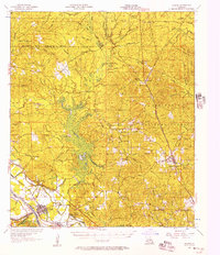 1956 Colfax1957 Print · USGSGrant and Winn Parishes come into focus during the mid-1950s, showing a landscape defined by forest reserves and rail-line settlements. Genealogists and historians can trace local roots through landmarks like Hebron Ch & Cem, Summerfield Sch, and McNeeley.3 unique versions available
Showing maps 1-25 of 175
Top cities of Grant Parish
- Colfax historical maps
- Montgomery historical maps
- Dry Prong historical maps
- Pollock historical maps
- Georgetown historical maps
Frequently asked questions
- What are the different types of historical maps available for Grant Parish?
- What is the oldest map of Grant Parish?
- Where can I purchase historical maps of Grant Parish for my home or office?
- Where can I download high-res historical maps of Grant Parish?
- Are there historical topographic maps available for Grant Parish?
- Is there historical aerial imagery available for Grant Parish?
- Where are historical maps of Grant Parish sourced from?