Old Maps of Jefferson Parish, Louisiana for Academic Research
Study the evolution of Jefferson Parish with 241 high-resolution historic maps. Whether you're teaching, researching, or modeling changes in land use, these maps provide essential visual documentation of urban, environmental, and geographic change.
- Analyze long-term change: Track patterns in development, transportation, and natural features.
- Ideal for environmental or urban studies: Support academic projects with primary historical map data.
- Use in the classroom or lab: Educators and researchers rely on these maps to bring historical context to life.
These maps are a powerful tool for teaching, research, and visualizing how Jefferson Parish has changed over the decades.
Jefferson Parish, LA maps
(241)- 1891 Map of Hahnville
 1891 Hahnville1891 Print · USGSSt. Charles Parish was a hub of river and rail commerce in the late nineteenth century, where new tracks began to bridge the gap between New Orleans and the southern bayous. Researchers can trace historic riverfront tracts at Hahnville and Luling or locate family-named landings such as Pecan Grove and Loquer.5 unique versions available
 - 1891 Map of Spanish Fort
 1891 Spanish Fort1891 Print · USGSThe New Orleans lakefront in the early 1890s was a landscape of emerging rail hubs and shoreline outposts. Trace the early footprints of Milneburg, Spanish Fort, and the lighthouse stations along Lake Pontchartrain during this pivotal era of coastal growth.4 unique versions available
 - 1891 Map of Pointe a La Hache
 1891 Pointe a La Hache1891 Print · USGSCoastal Plaquemines Parish and the Mississippi River delta appear here in the early 1890s, revealing a landscape of narrow riverfront plantations and rail-connected settlements. Researchers can trace the path of the New Orleans Ft Jackson and Grand Isl Railroad through historic sites like Pt A La Hache, Myrtle Grove, and Empire Mills.
 - 1891 Map of New Orleans
 1891 New Orleans1891 Print · USGSGreater New Orleans and the surrounding bayous are captured in the late Victorian era as the city's rail and canal networks expanded. Researchers can trace the development of riverfront communities like Gretna and Algiers or locate now-obscure landings such as Jesuit Bend and Amesville.5 unique versions available
 - 1892 Map of Barataria
 1892 Barataria1892 Print · USGSCoastal Jefferson and Plaquemines parishes appear in the late nineteenth century as a sprawling network of marshlands and navigable bayous. Researchers can trace the early rail influence of the N. O. F. J. & G. I. R. R. and locate family landmarks like John the Fool Island and the settlement of Barataria.3 unique versions available
 - 1892 Map of Cheniere Caminada
 1892 Cheniere Caminada1892 Print · USGSLouisiana's gulf coast appears in the early 1890s, shortly before a catastrophic hurricane forever changed the local landscape. Genealogists can trace the footprint of Cheniere Caminada and the early layout of Grand Isle near Caminada Pass.4 unique versions available
 - 1892 Map of Bonnet Carre
 1892 Bonnet Carre1892 Print · USGSThe Louisiana delta in the 1890s reveals a landscape of riverfront settlements and strategic rail lines at the edge of the lake. Trace the path of the Bonnet Carre Crevasse or locate old landings at Frenier, Lucy, and La Branche.3 unique versions available
 - 1892 Map of Creole
 1892 Creole1892 Print · USGSCoastal Lafourche and Jefferson parishes appear in the early 1890s as a complex of tidal wetlands and prairies. Genealogists and historians can trace the original watercourses of Bayou Lafourche, Little Lake, and the remote Shrimp Ids.4 unique versions available
 - 1892 Map of Pointe a La Hache, 1898 Print
 1892 Pointe a La Hache1898 Print · USGSThe lower Mississippi delta in the 1890s reveals a ribbon of riverfront settlements and competing rail lines. Genealogists and historians can trace family-named sites like Savoie and Nero or locate the Empire Mills (Martin) near Pt. A La Hache.
 - 1893 Map of Fort Livingston
 1893 Fort Livingston1893 Print · USGSThe Louisiana coast in the early 1890s is captured here as a sprawling network of tidal bayous and strategic passes. Local historians can trace maritime markers like Ft. Livingston and the Light on Grand Isle amid a maze of islands.3 unique versions available
 - 1932 Map of New Orleans NE
 1932 New Orleans NE1932 Print · USGSNew Orleans and the West Bank riverfront are seen in the early thirties, showing the dense grid of the French Quarter and the sprawling medical and university districts. Researchers can find old landmarks like St Louis Cathedral, the Custom House, and Gretna High School.
 - 1932 Map of New Orleans NW
 1932 New Orleans NW1932 Print · USGSJefferson Parish is caught in a moment of rapid transformation in the early thirties as New Orleans expands westward. Researchers can trace the rise of early suburbs like Bonnabel Place, the construction of the Huey P Long Bridge, and the location of the historic Wedell Williams Airport.
 - 1932 Map of New Orleans SE
 1932 New Orleans SE1932 Print · USGSThe Mississippi River delta south of the city was a maze of bayous and new industrial canals in the early 1930s. Genealogists and historians can trace riverside settlements like Bertrandville and Oakville or locate the early Wedell-Williams Landing Field.
 - 1932 Map of New Orleans SW
 1932 New Orleans SW1932 Print · USGSCoastal Louisiana marshes near the Jefferson and St. Charles Parish line are captured in the early thirties as dredging and canals reshaped the delta. Researchers can trace the original courses of Bayou Segnette and Bayou Couba near Woods Place.
 - 1932 Map of Hahnville NE
 1932 Hahnville NE1932 Print · USGSSt. Charles Parish and Jefferson Parish are mapped here in the early thirties as new highways began to parallel the river's path. Researchers can trace the riverfront rail economy and local landmarks like the Kenner Ferry Landing, Lone Star, and the Outfall Canal.
 - 1935 Map of Luling
 1935 Luling1935 Print · USGSSt. Charles Parish in the mid-1930s shows a landscape of riverfront settlements and vast wetlands managed by an intricate system of canals. Researchers can trace early railroad corridors and local landmarks like Lone Star, Ama, and the historic Davis Crevasse of 1884.
 - 1935 Map of Wilkinson Bay, 1954 Print
 1935 Wilkinson Bay1954 Print · USGSCoastal Plaquemines Parish is captured in the mid-1930s, showing a labyrinthine landscape of marsh and water where the boundary with Jefferson Parish was still indefinite. Genealogists and historians can locate isolated delta outposts like Manila Cabinash P O and Camp Dewey.
 - 1936 Map of Bonnet Carre, 1937 Print
 1936 Bonnet Carre1937 Print · USGSThe Louisiana river parishes are shown in transition during the 1930s as massive flood control projects reshape the landscape. Genealogists and researchers can trace the historic Woodland Plantation, locate the Killona Sch, or study the footprints of rail-side towns like Frenier and Laplace.
 - 1936 Map of Spanish Fort, 1938 Print
 1936 Spanish Fort1938 Print · USGSThe New Orleans lakefront in the mid-1930s reveals a landscape of leisure and engineering as the city expanded toward the water. Trace the footprints of Pontchartrain Beach Amusement Park, the historic docks at Milneburg, and the path of the Old Spanish Trail.
 - 1938 Map of Spanish Fort
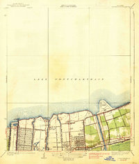 1938 Spanish Fort1938 Print · USGSThe southern shore of Lake Pontchartrain comes alive in the late 1930s as New Orleans expands toward the water. Trace the footprints of Shushan Airport, the historic Milneburg settlement, and leisure landmarks like Pontchartrain Beach and the Southern Yacht Club.2 unique versions available
 - 1938 Map of New Orleans West
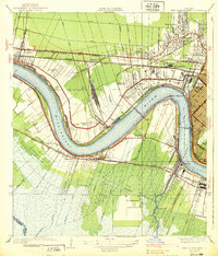 1938 New Orleans West1938 Print · USGSJefferson Parish emerges as a vital transportation hub during the mid-thirties, dominated by the massive river bend and the rise of suburban Metairie. Genealogists and historians can trace the early footprints of Bonnabel Place and Kenner, or locate the historic Deckbar Sch and the U S Marine Hospital.3 unique versions available
 - 1938 Map of La Branche
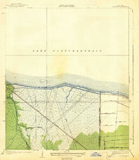 1938 La Branche1938 Print · USGSCoastal St. Charles Parish is captured here in the late 1930s, showing a transition from natural marshland to a managed hydraulic landscape. Researchers can trace the Illinois Central railroad through Labranche and locate the engineered Bonnet Carre Floodway.2 unique versions available
 - 1938 Map of Indian Beach
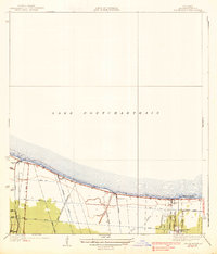 1938 Indian Beach1938 Print · USGSThe Jefferson Parish shoreline in the late 1930s reveals a landscape of early suburban growth defined by drainage canals and pumping stations. Researchers can trace the development of Bonnabel Place and the winding course of Bayou Tchoupitoulas near the southern edge of Lake Pontchartrain.3 unique versions available
 - 1938 Map of Luling
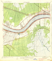 1938 Luling1938 Print · USGSThe Mississippi River corridor between Luling and Kenner is captured here in the mid-1930s, showing the early integration of the Airline Highway into the landscape. Genealogists can locate old family land tracts and settlements such as Lone Star, St Rose, and Ama, while researchers can trace the site of the historic Davis Crevasse of 1884.3 unique versions available
 - 1939 Map of New Orleans East
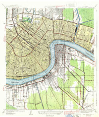 1939 New Orleans East1939 Print · USGSThe crescent city and its surrounding river parishes are captured in the late 1930s, showing New Orleans' transition into a modern port and educational hub. Genealogists can trace family roots through neighborhoods like Algiers and Arabi, or locate ancestors in St Louis Cem and Metairie Cemetery.3 unique versions available
Showing maps 1-25 of 241
Top cities of Jefferson Parish
- Metairie historical maps
- Kenner historical maps
- Gretna historical maps
- Waggaman historical maps
- Westwego historical maps
- Harahan historical maps
See more
Frequently asked questions
- What are the different types of historical maps available for Jefferson Parish?
- What is the oldest map of Jefferson Parish?
- Where can I purchase historical maps of Jefferson Parish for my home or office?
- Where can I download high-res historical maps of Jefferson Parish?
- Are there historical topographic maps available for Jefferson Parish?
- Is there historical aerial imagery available for Jefferson Parish?
- Where are historical maps of Jefferson Parish sourced from?