Old Maps of Lewiston, Louisiana for Hiking & Exploration
Hike through history with 11 historic maps of Lewiston. Explore old trails, ghost towns, and forgotten backroads — perfect for outdoor adventurers and local explorers.
- Rediscover forgotten places: Map out old mining camps, roads, and footpaths that no longer exist on modern maps.
- Layer with modern tools: Combine with LiDAR or satellite views to plan hikes through historical terrain.
- Made for exploration: Popular among hikers, overlanders, and local history lovers.
Use these maps to find adventure and explore the hidden past of Lewiston.
Lewiston, LA maps
(11)- 1953 Map of Alexandria, 1963 Print
 1953 Alexandria1963 Print · USGSCentral Louisiana during the early fifties is mapped here at the intersection of the piney woods and the Red River valley. Genealogists and historians can trace the rail-and-river network connecting towns like Alexandria, Natchitoches, and the grounds of Camp Beauregard.3 unique versions available
 - 1955 Map of Alexandria
 1955 Alexandria1955 Print · USGSCentral Louisiana in the mid-fifties is a landscape of river-port cities, sprawling timberlands, and massive military reservations. Genealogists and historians can trace the rail networks of the Texas & Pacific RR and locate sites like Camp Polk Military Reservation and Natchitoches.
 - 1956 Map of Forest Hill, 1957 Print
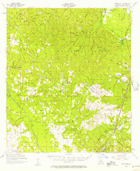 1956 Forest Hill1957 Print · USGSRapides Parish was a landscape of timber and rural industry in the mid-fifties, shaped by the Missouri Pacific rail line and forest preserves. Genealogists and historians can trace family-named sites like Swann Cem, Elmer, and Amiable Ch.3 unique versions available
 - 1971 Map of Elmer, 1973 Print
 1971 Elmer1973 Print · USGSRapides Parish was a landscape of dense timber and small rural communities during the early 1970s. You can trace family roots at St Peter Cem and Swann Cem, or locate landmarks like the Oak Hill High Sch and the Old Railroad Grade.2 unique versions available
 - 1986 Map of Alexandria
 1986 Alexandria1986 Print · USGSCentral Louisiana in the mid-eighties shows a landscape of strategic military installations and deep river-valley agriculture. Researchers can trace the footprints of England Air Force Base, Camp Beauregard, and the extensive Kisatchie National Forest.2 unique versions available
 - 2003 Map of Elmer, 2005 Print
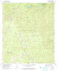
 2003 Elmer2005 Print · USGSRapides Parish was a center of federal forestry research and military training during the early twenty-first century. Researchers can trace rural lineages through sites like Rougeau Cem and Oak Hill High Sch, or locate the Hineston Lookout.
 - 2012 Map of Elmer, 2012 Print
 2012 Elmer2012 Print · USGSCovers Lewiston, including Otis, Lisso, and other nearby areas
 - 2015 Map of Elmer, 2015 Print
 2015 Elmer2015 Print · USGSCovers Lewiston, including Otis, Lisso, and other nearby areas
 - 2018 Map of Elmer, 2018 Print
 2018 Elmer2018 Print · USGSCovers Lewiston, including Otis, Lisso, and other nearby areas
 - 2020 Map of Elmer, 2020 Print
 2020 Elmer2020 Print · USGSCovers Lewiston, including Otis, Lisso, and other nearby areas
 - 2024 Map of Elmer, 2024 Print
 2024 Elmer2024 Print · USGSRapides Parish in the early 2020s remains a landscape of dense national forest and scattered rural settlements. Researchers can trace family history through numerous local landmarks like Saint Peter Cem, Marler Cem, and the communities of Elmer and Otis.
End of results
Showing maps 1-11 of 11
Top cities near Lewiston
- Alexandria historical maps
- Glenmora historical maps
- Boyce historical maps
- Forest Hill historical maps
- McNary historical maps
Frequently asked questions
- What are the different types of historical maps available for Lewiston?
- What is the oldest map of Lewiston?
- Where can I purchase historical maps of Lewiston for my home or office?
- Where can I download high-res historical maps of Lewiston?
- Are there historical topographic maps available for Lewiston?
- Is there historical aerial imagery available for Lewiston?
- Where are historical maps of Lewiston sourced from?