1950s Maps of Saint Bernard Parish, Louisiana
Explore 53 historic maps of Saint Bernard Parish from the 1950s. These maps offer a rare glimpse into what life looked like during the 1950s — showing old roads, neighborhoods, homes, and landmarks that have changed or disappeared over time.
Whether you're researching your family's past, planning a metal detecting trip, or studying how Saint Bernard Parish's landscape evolved across the 1950s, these high-resolution maps are a powerful tool for exploring the history of this region.
- Focus on a specific era: All maps on this page are from the 1950s, giving you a focused view of this time period.
- See what’s changed: Compare century-old streets, trails, and buildings to today's modern landscape using overlays and satellite layers.
- Research with precision: Use these maps for genealogy, historical research, land use analysis, or educational projects.
- View, download, or print: Maps are fully viewable online in high resolution, and can be downloaded or printed for your own records.
Start exploring Saint Bernard Parish's history through authentic maps from the 1950s. This is your window into the past.
Saint Bernard Parish, LA maps
(53)- 1950 Map of Dog Keys Pass, 1958 Print
 1950 Dog Keys Pass1958 Print · USGSThe Mississippi barrier islands and their deep-water channels are captured here at mid-century, documenting the coastal boundary between Harrison and Jackson counties. Marine researchers and historians can trace the 1950s shorelines of Ship Island and Horn Island near the vital Dog Keys Pass.3 unique versions available
 - 1950 Map of Ship Island, 1958 Print
 1950 Ship Island1958 Print · USGSCoastal Mississippi in the 1950s is defined here by the thin, strategic arc of Ship Island before modern storms reshaped its shores. Trace the maritime history of the sound through landmarks like Old Fort Massachusetts and the Ship Island Lighthouse.3 unique versions available
 - 1950 Map of New Orleans, 1966 Print
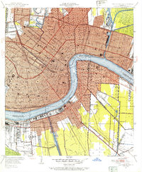
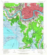 1950 New Orleans1966 Print · USGSMid-century New Orleans and its surrounding bayous are captured here at a peak of rail and river industry. Genealogists and historians can trace family roots through riverside settlements like McDonoghville and Arabi or locate landmarks like Olive Branch Cem and Rosethorn Sch.
 - 1951 Map of Chef Menteur, 1952 Print
 1951 Chef Menteur1952 Print · USGSCoastal Orleans Parish in the early fifties is a labyrinth of tidal marshes and vital transit corridors. Researchers can trace the ruins of Fort Macomb guarding Chef Menteur Pass or locate old landings along Bayou Sauvage and the Louisville and Nashville rail line.2 unique versions available
 - 1951 Map of Martello Castle, 1952 Print
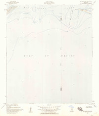
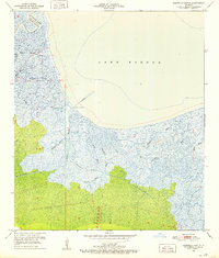 1951 Martello Castle1952 Print · USGSThe coastal marsh of St. Bernard Parish is shown in the early fifties, before decades of shoreline change. Trace the labyrinth of delta waterways including Bayou Dupre, the Lake Borgne Canal, and the historic site of Martello Castle.2 unique versions available
 - 1951 Map of Delacroix, 1952 Print
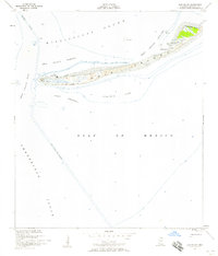
 1951 Delacroix1952 Print · USGSCoastal St. Bernard Parish in the early fifties shows a landscape of linear bayou settlements and expansive marshland. Genealogists and local historians can trace family locations along the Bayou in communities like Delacroix, Reggio, and Verret.
 - 1951 Map of Belle Chasse, 1952 Print
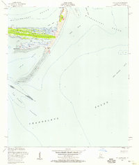
 1951 Belle Chasse1952 Print · USGSLower Plaquemines Parish in the early fifties is captured here as a critical industrial and rail hub along the Mississippi. Researchers can trace riverfront life from Stella to Poydras, or locate mid-century landmarks like Callender Airport and the Sea Train Terminal.2 unique versions available
 - 1951 Map of Little Woods, 1953 Print
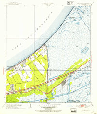 1951 Little Woods1953 Print · USGSCoastal Orleans Parish comes into focus during the early fifties, showing the development of Little Woods and Lincoln Beach along the lake. Genealogists and local historians can trace the grid of the Southern Railway and the industrial roots of Michoud near the Intracoastal Waterway.2 unique versions available
 - 1951 Map of New Orleans East, 1953 Print
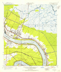
 1951 New Orleans East1953 Print · USGSNew Orleans and its surrounding parishes are shown in the early fifties as the city’s footprint expanded along the river’s great bend. Genealogists and historians can locate family landmarks like St Louis Cem, St Louis Cathedral, and the Metairie Cemetery.2 unique versions available
 - 1951 Map of Chalmette, 1953 Print
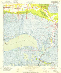
 1951 Chalmette1953 Print · USGSCoastal St. Bernard Parish comes to life in the early fifties as suburban growth meets the industrial riverfront. Genealogists and historians can trace family locations in Fazandeville, Stanton, and Meraux or locate the Chalmette Nat Cem.2 unique versions available
 - 1951 Map of North Islands, 1958 Print
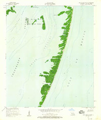
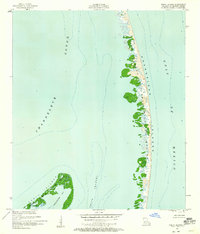 1951 North Islands1958 Print · USGSThe Louisiana coast in the early fifties reveals a fragile chain of barrier islands and wildlife habitat before modern erosion took its toll. Trace the intricate shorelines of the Breton National Wildlife Refuge and the sandy reaches of the North Islands.3 unique versions available
 - 1951 Map of Cat Island, 1958 Print
 1951 Cat Island1958 Print · USGSCat Island sits at the edge of the Mississippi Sound in the early fifties, preserving the legacy of the Juan De Cuevas Claim. Maritime history enthusiasts can trace coastal landmarks like the Great Sand Hill, Negro Point, and the Flowing Well along the eastern shore.3 unique versions available
 - 1951 Map of New Harbor Islands, 1958 Print
 1951 New Harbor Islands1958 Print · USGSThe Louisiana coast in the early fifties reveals a shifting landscape of barrier islands and tidal channels. Trace the coastal geography of the Chandeleur Islands and New Harbor Islands before decades of storms altered these shores.3 unique versions available
 - 1951 Map of Stake Islands, 1958 Print
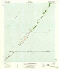 1951 Stake Islands1958 Print · USGSThe Louisiana coast in the early fifties is captured here through the shifting barrier chains of the Stake Islands. Trace the delicate shoreline of the Palos Islands and the boundaries of the Chandeleur National Wildlife Refuge.2 unique versions available
 - 1951 Map of Freemason Island, 1958 Print
 1951 Freemason Island1958 Print · USGSCoastal Louisiana in the early fifties is defined here by the fragile barrier islands and sounds of St. Bernard Parish. Maritime researchers can trace the shifting sands of Freemason Island and the protected grounds of Breton National Wildlife Refuge.3 unique versions available
 - 1951 Map of Chandeleur Light, 1958 Print
 1951 Chandeleur Light1958 Print · USGSThe Louisiana coast at the start of the 1950s reveals the fragile barrier chain of the Chandeleur Islands during a period of relative stability. Maritime researchers can trace the exact footprint of Chandeleur Light and the boundaries of the Breton National Wildlife Refuge.2 unique versions available
 - 1953 Map of Mobile, 1968 Print
 1953 Mobile1968 Print · USGSThe Gulf Coast comes alive in this mid-century survey, from the streets of Mobile to the marshes of New Orleans. Trace family roots in coastal towns like Pass Christian and Bayou La Batre or locate military landmarks including Keesler AFB.3 unique versions available
 - 1954 Map of Lake Eugenie
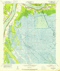
 1954 Lake Eugenie1954 Print · USGSCoastal St. Bernard Parish comes into focus in the mid-fifties, revealing the intricate delta geography of Louisiana before decades of coastal erosion. Trace the tidal waterways from Bay Bodreau to Lake Eugenie, noting landmarks like Indian Mound and Wild Goose I.
 - 1954 Map of Isle Au Pitre
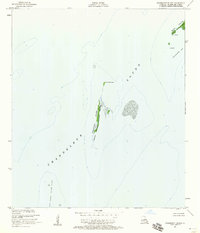
 1954 Isle Au Pitre1954 Print · USGSThe coastal boundary of Louisiana and Mississippi is captured mid-century, documenting the shifting marshlands of the Mississippi Sound. Researchers can trace historical navigation markers like Cat Island LH and the wetlands around Isle Au Pitre and Bayou Pierre.
 - 1954 Map of Malheureux Point
 1954 Malheureux Point1954 Print · USGSCoastal St. Bernard Parish is depicted here in the mid-1950s, showing the intricate marshlands where the sound meets the lake. Researchers can trace the shifting shorelines of Malheureux Pt and the remote islands of Le Petit Pass Id and Raccoon Id.
 - 1954 Map of Mitchell Keys
 1954 Mitchell Keys1954 Print · USGSThe outer marshlands of St. Bernard Parish appear here as they were surveyed in the mid-twentieth century. Researchers can trace the complex delta shoreline through Mitchell Keys, Martin Island, and the fishing waters of Redfish Bend.
 - 1954 Map of Morgan Harbor
 1954 Morgan Harbor1954 Print · USGSCoastal St. Bernard Parish in the mid-twentieth century is shown here as an intricate network of tidal bays and bayous. Researchers can trace historic waterways and island points like Bayou La Loutre, Treasure Bay, and the Chandeleur Islands.
 - 1954 Map of Oak Mound Bayou
 1954 Oak Mound Bayou1954 Print · USGSCoastal St. Bernard Parish is seen here in the mid-1930s, showing the intricate tidal marsh and bay systems of the Louisiana gulf coast. Researchers can trace the complex network of waterways between Shell Island Lake and Drum Bay, including Deadmans Bayou and Oak Mound Bayou.
 - 1954 Map of English Lookout
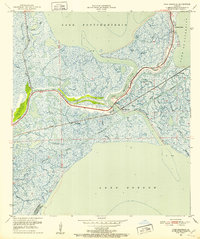
 1954 English Lookout1954 Print · USGSCoastal St. Tammany Parish comes alive in the mid-1950s, showing the intersection of heavy rail and the Mississippi delta. You can trace the Louisville and Nashville R R through English Lookout and explore bayous like Grassy Bayou and Kopman Bayou.
 - 1954 Map of Lake Eloi
 1954 Lake Eloi1954 Print · USGSSt. Bernard Parish coastal marshlands are captured in detail during the mid-twentieth century. Maritime historians can trace the intricate network of Bayou La Loutre past Christmas Camp and into the waters of Half Moon Lake.
Showing maps 1-25 of 53
Top cities of Saint Bernard Parish
Frequently asked questions
- What are the different types of historical maps available for Saint Bernard Parish?
- What is the oldest map of Saint Bernard Parish?
- Where can I purchase historical maps of Saint Bernard Parish for my home or office?
- Where can I download high-res historical maps of Saint Bernard Parish?
- Are there historical topographic maps available for Saint Bernard Parish?
- Is there historical aerial imagery available for Saint Bernard Parish?
- Where are historical maps of Saint Bernard Parish sourced from?