Old Maps of Saint Bernard Parish, Louisiana for Hiking & Exploration
Hike through history with 393 historic maps of Saint Bernard Parish. Explore old trails, ghost towns, and forgotten backroads — perfect for outdoor adventurers and local explorers.
- Rediscover forgotten places: Map out old mining camps, roads, and footpaths that no longer exist on modern maps.
- Layer with modern tools: Combine with LiDAR or satellite views to plan hikes through historical terrain.
- Made for exploration: Popular among hikers, overlanders, and local history lovers.
Use these maps to find adventure and explore the hidden past of Saint Bernard Parish.
Saint Bernard Parish, LA maps
(393)- 1891 Map of New Orleans
 1891 New Orleans1891 Print · USGSGreater New Orleans and the surrounding bayous are captured in the late Victorian era as the city's rail and canal networks expanded. Researchers can trace the development of riverfront communities like Gretna and Algiers or locate now-obscure landings such as Jesuit Bend and Amesville.5 unique versions available
 - 1892 Map of Chef Menteur
 1892 Chef Menteur1892 Print · USGSThe marshlands of eastern Orleans Parish appear here in the 1890s as a strategic coastal corridor of railroads and water passages. Researchers can trace the early rail stops at Micheaud and Lee, or locate the historic site of Ft Macomb near the Chef Menteur crossing.5 unique versions available
 - 1892 Map of St. Bernard
 1892 St. Bernard1892 Print · USGSCoastal Louisiana in the early 1890s is captured here as a landscape of river-bend settlements and expanding rail lines. Genealogists and historians can trace family land and depots at Poydras, St Bernard, and the New Orleans and Gulf Railroad stops.4 unique versions available
 - 1893 Map of Cat Island
 1893 Cat Island1893 Print · USGSThe Louisiana-Mississippi coastal border appears here in the late nineteenth century, charting the vital islands and channels of the Gulf. Researchers can trace the early maritime landscape of Cat Island, the position of Cat Island Light, and the reaches of Isle A Pitre.4 unique versions available
 - 1893 Map of Rigolets
 1893 Rigolets1893 Print · USGSCoastal Louisiana and Mississippi meet at the turn of the century along a labyrinth of marshlands and railroad trestles. Researchers can trace the early path of the Louisville and Nashville Railroad past Ft. Pike and through the Little Lake region.5 unique versions available
 - 1893 Map of La Fortuna
 1893 La Fortuna1893 Print · USGSSt. Bernard Parish’s coastal marshes and sounds are documented here in the late nineteenth century before major modern shoreline changes. Trace the original hydrology of the bayous including Bayou Terre Aux Boeufs, Lake La Fortuna, and Eloi Bay.3 unique versions available
 - 1893 Map of Chandeleur
 1893 Chandeleur1893 Print · USGSThe Louisiana barrier islands and outer marshes are captured in the late 1890s, revealing a coastline since reshaped by nature. Trace historical maritime markers like Keelboat Pass, Mitchell Key, and the remote Barrel Key.3 unique versions available
 - 1893 Map of Shell Beach
 1893 Shell Beach1893 Print · USGSSt. Bernard Parish in the 1890s shows a landscape of coastal settlements and fishing villages connected by rail and water. You can trace the Shell Beach Railroad to its coastal terminus and find old sites like Florissant, Yscloskey, and St. Malo.3 unique versions available
 - 1893 Map of Toulme
 1893 Toulme1893 Print · USGSThe coastal marshlands of Hancock County are captured in the late 1890s, where the rail line meets the sound. Genealogists and maritime historians can trace the lonely locations of the St. Joseph Island Light, the settlement at Toulme, and the intricate reaches of Heron Bay.4 unique versions available
 - 1893 Map of Dime, 1901 Print
 1893 Dime1901 Print · USGSThe Plaquemines parish riverfront and its vast coastal marshes appear here in the final decade of the nineteenth century. Genealogists can trace the river settlements of Dime and Happy Jack along the N. O. Ft. J. & G. I. R. R. line.2 unique versions available
 - 1895 Map of Bodreau
 1895 Bodreau1895 Print · USGSCoastal St. Bernard Parish is shown in the late nineteenth century as a vast labyrinth of salt marshes and tidal bayous. Historians and researchers can trace the old water routes through Bayou La Loutre and locate landmarks like the Indian Mound or Morgan Harbor.2 unique versions available
 - 1932 Map of New Orleans NE
 1932 New Orleans NE1932 Print · USGSNew Orleans and the West Bank riverfront are seen in the early thirties, showing the dense grid of the French Quarter and the sprawling medical and university districts. Researchers can find old landmarks like St Louis Cathedral, the Custom House, and Gretna High School.
 - 1935 Map of English Lookout
 1935 English Lookout1935 Print · USGSThe coastal marshlands at the Louisiana-Mississippi line are captured in the mid-1930s as the rail line bridges the delta. Trace the historic route of the Louisville and Nashville railroad through English Lookout and across the waters of Little Lake.
 - 1935 Map of Morgan Harbor
 1935 Morgan Harbor1935 Print · USGSCoastal St. Bernard Parish is revealed in the mid-1930s as a complex network of bayous and islands accessible only by water. Historians and genealogists can trace the traditional waterways of Bayou La Loutre, Comfort Island, and the distinctive Deadman Pt.
 - 1935 Map of Lake Athanasio
 1935 Lake Athanasio1935 Print · USGSCoastal St. Bernard Parish was a complex network of marsh and open water in the mid-1930s, just as aerial surveying began to map the delta in detail. Researchers can trace the historic shoreline from Coon Nest I down to Mozambique Pt, including the named waters of Seven Dollar Bay.
 - 1935 Map of Delacroix
 1935 Delacroix1935 Print · USGSCoastal St. Bernard Parish and its marshland communities appear in the mid-1930s as a complex network of bayous, canals, and rail. Researchers can trace the extension of the Louisiana Southern railroad to fishing outposts like Delacroix and Reggio.
 - 1935 Map of Grand Island Pass
 1935 Grand Island Pass1935 Print · USGSThe maritime boundary between Mississippi and Louisiana is captured here in the mid-1930s, centering on the tidal marshes of Grand Island. Researchers can trace the winding paths of Gauthier Bayou and West Bayou through the coastal wetlands.2 unique versions available
 - 1935 Map of Mitchell Keys
 1935 Mitchell Keys1935 Print · USGSCoastal St. Bernard Parish is captured here in the mid-1930s, showing the complex marshland before decades of shoreline retreat. Researchers can trace the original footprints of Mitchell Keys, Martin Island, and the winding Live Oak Bayou.
 - 1935 Map of Lake Calebasse
 1935 Lake Calebasse1935 Print · USGSCoastal Louisiana marshlands appear as a dense network of bayous and lagoons in the mid-1930s, documenting the intricate boundary of St. Bernard and Plaquemines Parishes. Researchers can trace the winding Bayou Terre Aux Boeufs and find isolated landmarks like Coquille and Greaseboat Island.
 - 1936 Map of Chef Menteur, 1938 Print
 1936 Chef Menteur1938 Print · USGSCoastal New Orleans and the Rigolets area are shown in the mid-1930s as drainage projects and rail lines reshaped the marshlands. Researchers can trace early settlements at Little Woods and Micheaud, or locate sites like Fort Macomb and the Dead Cypress Swamp.2 unique versions available
 - 1936 Map of Rigolets, 1949 Print
 1936 Rigolets1949 Print · USGSCoastal Louisiana and Mississippi meet in the mid-1930s where the Pearl River delta fragments into a maze of islands and bayous. Researchers can trace the early path of Highway No 90, the defenses at Fort Pike, and settlements like Pearlington or Baldwin Lodge.
 - 1937 Map of Chef Menteur
 1937 Chef Menteur1937 Print · USGSCoastal Orleans Parish in the late 1930s was a critical junction of rail and water traffic between the great lakes of the Gulf. You can trace the historic site of Ft Mc Comb and the original path of the Louisville and Nashville railroad across Chef Menteur Pass.
 - 1938 Map of Little Woods
 1938 Little Woods1938 Print · USGSThe eastern reaches of New Orleans are shown in the late 1930s as modern drainage and rail lines began to transform the coastal marsh. Researchers can trace the development of Little Woods, Edge Lake, and the rail-side industries near Micheaud and Sugar Mill Lake.2 unique versions available
 - 1939 Map of Shell Beach
 1939 Shell Beach1939 Print · USGSCoastal St. Bernard Parish is captured here in the late thirties, showing a landscape defined by tidewater bayous and early fishing settlements. Genealogists and local historians can trace the foundations of Alluvial City and Yscloskey or locate the site of Old Ft Beauregard.
 - 1939 Map of New Orleans East
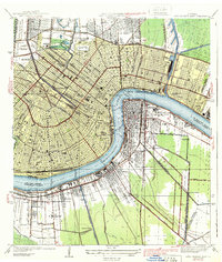 1939 New Orleans East1939 Print · USGSThe crescent city and its surrounding river parishes are captured in the late 1930s, showing New Orleans' transition into a modern port and educational hub. Genealogists can trace family roots through neighborhoods like Algiers and Arabi, or locate ancestors in St Louis Cem and Metairie Cemetery.3 unique versions available
Showing maps 1-25 of 393
Top cities of Saint Bernard Parish
Frequently asked questions
- What are the different types of historical maps available for Saint Bernard Parish?
- What is the oldest map of Saint Bernard Parish?
- Where can I purchase historical maps of Saint Bernard Parish for my home or office?
- Where can I download high-res historical maps of Saint Bernard Parish?
- Are there historical topographic maps available for Saint Bernard Parish?
- Is there historical aerial imagery available for Saint Bernard Parish?
- Where are historical maps of Saint Bernard Parish sourced from?