Old Maps of Vernon Parish, Louisiana for Hiking & Exploration
Hike through history with 269 historic maps of Vernon Parish. Explore old trails, ghost towns, and forgotten backroads — perfect for outdoor adventurers and local explorers.
- Rediscover forgotten places: Map out old mining camps, roads, and footpaths that no longer exist on modern maps.
- Layer with modern tools: Combine with LiDAR or satellite views to plan hikes through historical terrain.
- Made for exploration: Popular among hikers, overlanders, and local history lovers.
Use these maps to find adventure and explore the hidden past of Vernon Parish.
Vernon Parish, LA maps
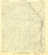
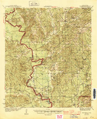
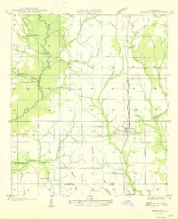
(269)- 1937 Map of Chopin SW
 1937 Chopin SW1937 Print · USGSThe timber-rich borderlands of Natchitoches, Rapides, and Vernon parishes are captured here in the late thirties as logging operations dominated the landscape. Researchers can trace old Logging Railroad routes and find long-established sites like Comrade Cem and Burnstown.
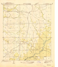
 - 1937 Map of Chopin SE
 1937 Chopin SE1937 Print · USGSThe timber country of central Louisiana comes into focus during the late Depression years, showing a landscape carved by industry. Genealogists and historians can trace the paths of the Logging Railroad and locate local landmarks like Jericho and the Clifton Sch.
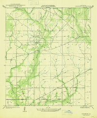
 - 1941 Map of Leesville
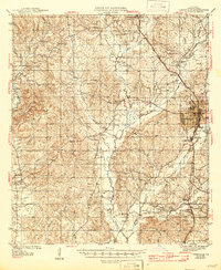
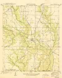
 1941 Leesville1941 Print · USGSVernon Parish at the start of the 1940s reveals a transition from a logging-dependent economy to a more established network of rural towns. Researchers can trace family roots at Bill Cem, locate the old Cooper Sch, or follow the path of the Kansas City Southern Railroad through Newllano.
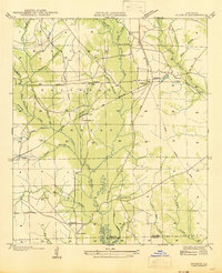
 - 1941 Map of Slagle
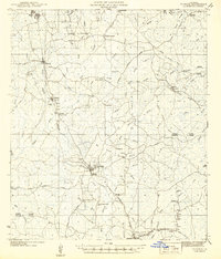
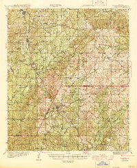
 1941 Slagle1941 Print · USGSVernon Parish at the start of the 1940s reveals a landscape rapidly adapting to military mobilization. Genealogists and historians can trace the foundations of Camp Polk alongside rural community landmarks like Slagle, Ebenezer Ch, and the Big Creek Sch.
 - 1942 Map of Florien
 1942 Florien1942 Print · USGSThe timber and rail corridor of the Louisiana pinewoods is captured here in the early 1940s as the Kansas City Southern railroad links small mill towns. Family historians can trace local roots through numerous rural landmarks like Sibley Cem, Mount Carmel, and Pine Grove Ch.
 - 1942 Map of Kisatchie
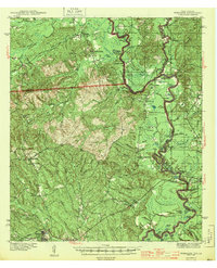
 1942 Kisatchie1942 Print · USGSThe timberlands of Natchitoches and Vernon Parishes are captured here in the early 1940s, showing the dense network of company towns and rail lines. Genealogists and researchers can locate timber settlements like Alco, Kurthwood, and Hutton, plus the CCC Camp and Silver Creek Church.
 - 1943 Map of Leesville
 1943 Leesville1943 Print · USGSVernon Parish during the early 1940s reveals a landscape of timber-driven growth and rural crossroads. Genealogists and historians can trace family locations near Leesville, identify old cemetery sites like Kay Cem, and locate the Old Logging Railroad grades.
 - 1943 Map of Leander
 1943 Leander1943 Print · USGSVernon and Rapides Parishes are shown in the early 1940s as the regional economy shifted from timber production to military training. Researchers can trace the Old Logging Railroad and locate vanished company centers like Fullerton or rural landmarks like Mt Moriah Ch.2 unique versions available
 - 1943 Map of Kisatchie
 1943 Kisatchie1943 Print · USGSDuring the early 1940s, this portion of Natchitoches Parish was a hive of timber activity centered around the Red River and Gulf Railroad. Researchers can trace old industry sites like Kurthwood and Alco or locate family sites at Robinson Cem and Kisatchie Union Ch.
 - 1944 Map of Negreet
 1944 Negreet1944 Print · USGSThe Sabine River valley at the height of the Second World War shows a landscape of river sloughs and forest communities before the arrival of the great reservoirs. Genealogists can trace family roots through numerous rural landmarks like Beulah Ch, Redland Cem, and the old Negreet School.
 - 1944 Map of Wiergate
 1944 Wiergate1944 Print · USGSNewton County and the Sabine River borderlands are captured here in the mid-1940s during the peak of the local timber era. Genealogists and researchers can trace family landmarks like Toledo Cem, the Gulf Northern rail line, and the rural Mayflower Sch.2 unique versions available
 - 1944 Map of Chopin
 1944 Chopin1944 Print · USGSCentral Louisiana during the early 1940s shows a landscape defined by timber harvesting and the winding Red River. Local historians can trace logging tracks and old community centers like Zimmerman Camp, Mora Ch, and Galbraith Sta.
 - 1944 Map of Florien
 1944 Florien1944 Print · USGSMid-century Sabine and Vernon Parishes center on the timber and rail economy along the Kansas City Southern. Genealogists can trace family roots through numerous rural landmarks like Lewing Cem, Plainview Sch, and Pratts Chapel.
 - 1944 Map of Slagle
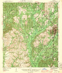
 1944 Slagle1944 Print · USGSVernon Parish is shown at the height of World War II activity as the massive Camp Polk Military Reservation expands across the landscape. Genealogists and historians can trace local landmarks like Slagle, Big Creek Sch, and Zion Hill Cem alongside the complex web of an active Logging Railroad.
 - 1946 Map of Leesville
 1946 Leesville1946 Print · USGSVernon Parish at the height of the 1940s reveals a landscape still defined by its timber heritage and rural crossroads. Genealogists and historians can locate vanished landmarks like the Old Logging Railroad, family burial sites at Kay Cem, and early schools like Pickering Sch.
 - 1946 Map of Merryville
 1946 Merryville1946 Print · USGSMerryville and the Sabine River basin are shown here during the mid-forties, capturing the intersection of river transport and the timber industry. Genealogists can locate family landmarks like Hennigan Cem, Bethlehem Ch, and the site of Clines Ferry.
 - 1947 Map of Pujo
 1947 Pujo1947 Print · USGSLouisiana's timber country near the border of Vernon and Beauregard Parishes is captured here just after the war. You can trace the legacy of the local lumber industry through several segments of Old Logging Railroad Grade and find family-history landmarks like Damascene Ch and Neale.
 - 1947 Map of Steep Gully
 1947 Steep Gully1947 Print · USGSLouisiana timber and rail history converge here in the mid-1930s at the junction of Vernon, Rapides, and Allen parishes. Researchers can trace the legacy of logging via the old logging railroad grades or locate family sites at Tenmile Cem and Occupy Sch.
 - 1947 Map of Rosepine
 1947 Rosepine1947 Print · USGSLouisiana's western pine forests come into focus in the mid-1940s as the logging industry evolved along the rail corridors. Genealogists and researchers can trace the old paths between Neame and Rosepine, locating family landmarks like Walnut Grove Ch and Miller Cem.
 - 1947 Map of Knight
 1947 Knight1947 Print · USGSLouisiana's timber country comes into focus in the mid-1940s, showing a landscape shaped by logging and early parish roads. Genealogists and historians can trace the foundations of local life at Mt Carmel Ch and the path of the Logging Railroad.
 - 1947 Map of Chasmore
 1947 Chasmore1947 Print · USGSThe timberlands of Vernon and Beauregard Parishes are captured here in the mid-1940s, highlighting the industrial footprint of the Kisatchie National Forest. Researchers can trace old logging lines and family landmarks like Davis Mill Sch, Chasmore, and Providence Ch.
 - 1947 Map of Sugrue
 1947 Sugrue1947 Print · USGSCentral Louisiana's pine woods and logging country are shown in the late 1940s, featuring the early roads and rail lines of Vernon Parish. Researchers can trace rural life via Gravel Hill Ch, Cravens, and the extensive Old Logging Railroad.
 - 1947 Map of Pitkin
 1947 Pitkin1947 Print · USGSVernon Parish at the end of the 1940s is a landscape of timber history and emerging highway networks. Trace genealogical roots through rural landmarks like Simmons Mill Ch or the tracks of the Gulf Colorado and Santa Fe Railroad near Pitkin.
 - 1948 Map of Leesville, 1954 Print
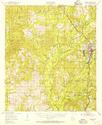 1948 Leesville1954 Print · USGSVernon Parish at the dawn of the fifties shows a landscape shaped by the Kansas City Southern Railway and military growth. Genealogists can trace family roots through rural landmarks like Pickering Sch, Beech Grove Ch Cem, and Anacoco.
 - 1948 Map of Wiergate, 1954 Print
 1948 Wiergate1954 Print · USGSThe Sabine River bottomlands and the timbered hills of Newton County are mapped here in the late 1940s. Genealogists and historians can trace rural life through landmarks like Anthonys Ferry, Scott Cem, and the old Sycamore Sch in the heart of the Sabine National Forest.
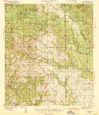
Showing maps 1-25 of 269
Top cities of Vernon Parish
- Leesville historical maps
- New Llano historical maps
- Rosepine historical maps
- Anacoco historical maps
- Simpson historical maps
- Hornbeck historical maps
Frequently asked questions
- What are the different types of historical maps available for Vernon Parish?
- What is the oldest map of Vernon Parish?
- Where can I purchase historical maps of Vernon Parish for my home or office?
- Where can I download high-res historical maps of Vernon Parish?
- Are there historical topographic maps available for Vernon Parish?
- Is there historical aerial imagery available for Vernon Parish?
- Where are historical maps of Vernon Parish sourced from?