1970s Maps of Kennebec County, Maine
Explore 17 historic maps of Kennebec County from the 1970s. These maps offer a rare glimpse into what life looked like during the 1970s — showing old roads, neighborhoods, homes, and landmarks that have changed or disappeared over time.
Whether you're researching your family's past, planning a metal detecting trip, or studying how Kennebec County's landscape evolved across the 1970s, these high-resolution maps are a powerful tool for exploring the history of this region.
- Focus on a specific era: All maps on this page are from the 1970s, giving you a focused view of this time period.
- See what’s changed: Compare century-old streets, trails, and buildings to today's modern landscape using overlays and satellite layers.
- Research with precision: Use these maps for genealogy, historical research, land use analysis, or educational projects.
- View, download, or print: Maps are fully viewable online in high resolution, and can be downloaded or printed for your own records.
Start exploring Kennebec County's history through authentic maps from the 1970s. This is your window into the past.
Kennebec County, ME maps
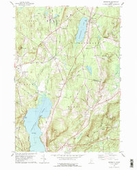
(17)- 1970 Map of Wiscasset, 1974 Print
 1970 Wiscasset1974 Print · USGSCoastal Lincoln County is documented here during the early 1970s, showing the intricate relationship between the Sheepscot River and the village of Wiscasset. Genealogists can trace family landmarks across several townships, from Dresden Mills to ancestral burial sites like Herriman Cem and Marston Cem.2 unique versions available
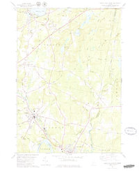
 - 1970 Map of East Pittston, 1974 Print
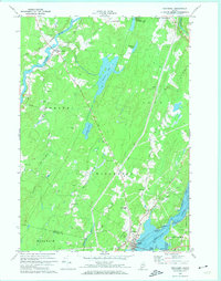
 1970 East Pittston1974 Print · USGSCoastal Kennebec County as it appeared in the early seventies shows a landscape of tidal rivers and quiet crossroads. Genealogists can trace established family names and burial sites at Butman Cem, Goodspeed Cem, and Trainor Corner.2 unique versions available
 - 1975 Map of Waterville NE, 1980 Print
 1975 Waterville NE1980 Print · USGSKennebec County farmland and riverfronts are captured in the mid-seventies, documenting the rural character of the Maine interior. Trace old field patterns and property lines near Clinton, Shawmut, and the Sebasticook River.
 - 1975 Map of Waterville SE, 1980 Print
 1975 Waterville SE1980 Print · USGSThe Kennebec and Sebasticook River corridors in the mid-1970s reveal a landscape of riverside industry and expanding rural neighborhoods. Genealogists and local historians can trace the footprints of Waterville, Winslow, and the outlying settlement at Goodwin Corner.
 - 1975 Map of Norridgewock SE, 1980 Print
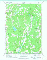
 1975 Norridgewock SE1980 Print · USGSThe Belgrade Lakes region comes into sharp focus in the mid-1970s through this detailed orthophoto. Researchers can trace the exact development of shoreline settlements and rural crossroads like North Belgrade, Tyler Corner, and Rome.
 - 1975 Map of Burnham SE, 1980 Print
 1975 Burnham SE1980 Print · USGSWaldo County at the height of the 1970s shows a landscape of enduring rural character and organized woodlots. Local historians can trace family locations and land use patterns around Unity, Freedom, and the crossroads at Knox Corner.
 - 1975 Map of Burnham SW, 1980 Print
 1975 Burnham SW1980 Print · USGSKennebec County as it appeared in the mid-seventies, showing the agricultural and forested landscape of central Maine. Genealogists and researchers can trace local landmarks like Albion, South Albion, and the winding Fifteenmile Stream.
 - 1975 Map of Norridgewock SW, 1980 Print
 1975 Norridgewock SW1980 Print · USGSThe Kennebec County lakeland is seen from above in the mid-seventies, showing the literal footprint of woods and water. Trace the rural landscape between Belgrade Lakes and Rome Corner, including the shores of Long Pond.
 - 1975 Map of Vassalboro NE, 1980 Print
 1975 Vassalboro NE1980 Print · USGSCentral Maine in the mid-1970s is shown in this aerial survey focused on the waters of China Lake. Local historians can trace the rural layouts of North Vassalboro, South China, and Dirigo Corner exactly as they appeared then.
 - 1975 Map of Burnham NW, 1980 Print
 1975 Burnham NW1980 Print · USGSWaldo County and the Sebasticook River valley are captured in high-altitude detail during the mid-seventies. Genealogists and local historians can trace the precise layouts of Burnham, Winnecook, and Clinton as they appeared decades ago.
 - 1975 Map of Vassalboro SE, 1980 Print
 1975 Vassalboro SE1980 Print · USGSKennebec County agriculture and river-valley settlements are captured in high detail in the mid-1970s. Genealogists and local historians can trace the exact buildings and field patterns of rural centers like Weeks Mills, Coopers Mills, and Windsorville.
 - 1975 Map of Vassalboro NW, 1980 Print
 1975 Vassalboro NW1980 Print · USGSThe Kennebec River valley in the mid-seventies is documented here through high-resolution aerial photography. Genealogists and local historians can pinpoint exact homesteads and field boundaries near North Vassalboro, Riverside, and Webber Pond.
 - 1975 Map of Waterville NW, 1980 Print
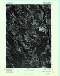 1975 Waterville NW1980 Print · USGSNorth Fairfield and the Kennebec River valley are captured in the mid-seventies just as the rural landscape of central Maine was entering a new era of growth. Local historians can trace the footprint of crossroads settlements like Holway Corner and the riverfront community of Hinckley.
 - 1975 Map of Waterville SW, 1980 Print
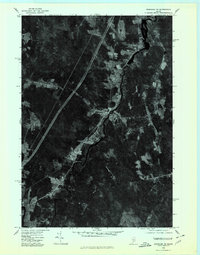
 1975 Waterville SW1980 Print · USGSThe mid-1970s landscape of Kennebec County is captured in this aerial survey, showcasing the urban layout and industrial riverfronts of central Maine. Local historians can trace the growth of Waterville and Oakland alongside the Kennebec River.
 - 1975 Map of Vassalboro SW, 1981 Print
 1975 Vassalboro SW1981 Print · USGSMaine's mid-coast interior is captured during the mid-seventies in this detailed aerial orthophoto. Researchers can trace the rural layout of Chelsea and the area around Togus to identify old property boundaries and local landmarks like the Brook.
 - 1979 Map of Monmouth
 1979 Monmouth1979 Print · USGSAndroscoggin and Kennebec Counties are shown in the late seventies as a landscape of interconnected ponds, ridges, and small rail-side hamlets. Genealogists can locate family sites near Leeds Plain Cem, the old Sprague Mill, or the community hub at Wales Corner.
 - 1979 Map of Lisbon Falls North
 1979 Lisbon Falls North1979 Print · USGSLisbon and Sabattus appear at a crossroads of industry and tradition in the late seventies as the river-driven economy continued to shape the county. Researchers can trace family roots through numerous small burial grounds like Furbush Cem and Spear Cem or locate the old Webster School.3 unique versions available
End of results
Showing maps 1-17 of 17
Top cities of Kennebec County
- Augusta historical maps
- Waterville historical maps
- Winslow historical maps
- Oakland historical maps
- Winthrop historical maps
- Gardiner historical maps
See more
Frequently asked questions
- What are the different types of historical maps available for Kennebec County?
- What is the oldest map of Kennebec County?
- Where can I purchase historical maps of Kennebec County for my home or office?
- Where can I download high-res historical maps of Kennebec County?
- Are there historical topographic maps available for Kennebec County?
- Is there historical aerial imagery available for Kennebec County?
- Where are historical maps of Kennebec County sourced from?