1950s Maps of Kennebec County, Maine
Explore 14 historic maps of Kennebec County from the 1950s. These maps offer a rare glimpse into what life looked like during the 1950s — showing old roads, neighborhoods, homes, and landmarks that have changed or disappeared over time.
Whether you're researching your family's past, planning a metal detecting trip, or studying how Kennebec County's landscape evolved across the 1950s, these high-resolution maps are a powerful tool for exploring the history of this region.
- Focus on a specific era: All maps on this page are from the 1950s, giving you a focused view of this time period.
- See what’s changed: Compare century-old streets, trails, and buildings to today's modern landscape using overlays and satellite layers.
- Research with precision: Use these maps for genealogy, historical research, land use analysis, or educational projects.
- View, download, or print: Maps are fully viewable online in high resolution, and can be downloaded or printed for your own records.
Start exploring Kennebec County's history through authentic maps from the 1950s. This is your window into the past.
Kennebec County, ME maps
(14)- 1950 Map of Lewiston
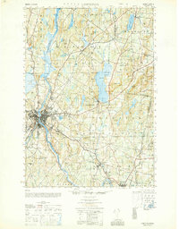 1950 Lewiston1950 Print · USGSAndroscoggin County at mid-century shows a landscape of busy industrial centers and quiet crossroad hamlets connected by the river. Genealogists can trace family names at Jordan Corners or Blake Corners and locate rural landmarks like Sprague Mill and Ridge Sch.
 - 1950 Map of Liberty
 1950 Liberty1950 Print · USGSMid-century Waldo County and its neighbors are defined here by a network of crossroad hamlets and upland ridges just after the war. Local historians can trace the foundations of The Kingdom, identify family sites near Hutchins Corner, or locate rural schoolhouses like Hallidale Sch.
 - 1950 Map of Lewiston
 1950 Lewiston1950 Print · USGSThe Maine and New Hampshire borderlands come alive in this post-war survey of the White Mountains and Androscoggin valley. Genealogists and historians can trace rail lines like the Maine Central Railroad and find high-altitude landmarks from Mount Washington to Bretton Woods.2 unique versions available
 - 1956 Map of Lewiston, 1958 Print
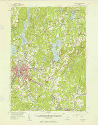 1956 Lewiston1958 Print · USGSThe industrial twin cities of Lewiston and Auburn thrive along the Androscoggin River during the mid-fifties. Genealogists and historians can trace the legacy of Bates College, the busy Maine Central Railroad corridors, and dozens of rural burying grounds like St Peters Cem.4 unique versions available
 - 1956 Map of Norridgewock, 1958 Print
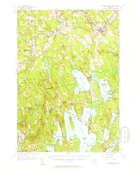 1956 Norridgewock1958 Print · USGSSomerset and Kennebec counties are shown here in the mid-1950s, centered on the river convergence at Norridgewock. Genealogists and historians can trace local school districts like Whittier Sch and explore lakefront landmarks including Camp Abena and The Serpentine.3 unique versions available
 - 1956 Map of Vassalboro, 1958 Print
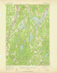 1956 Vassalboro1958 Print · USGSThe Kennebec River valley and the shores of China Lake are captured here during the mid-fifties. Researchers can trace historic institutions and rural centers like the Oak Grove Seminary, Erskine Academy, and the Windsor Fairgrounds.3 unique versions available
 - 1956 Map of Augusta, 1958 Print
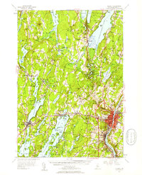 1956 Augusta1958 Print · USGSMaine’s capital city and the surrounding lake country appear here in the mid-fifties as the region’s recreation and rail economies thrived. Genealogists and local historians can locate many small family cemeteries like Tiffany Cem and Stevens Cem, or trace the old rail stops at Readfield Sta.4 unique versions available
 - 1956 Map of Farmington, 1959 Print
 1956 Farmington1959 Print · USGSMid-century Franklin County, Maine, reveals a landscape of river-driven industry and upland farming. Researchers can trace the rail connections through Wilton Station or locate family roots near Knowltons Corner, Intervale School, and Savage Cemetery.3 unique versions available
 - 1956 Map of Bangor, 1966 Print
 1956 Bangor1966 Print · USGSMid-century Maine comes alive in this survey of the rugged coast and river valleys during the 1950s. Genealogists and historians can trace the vital rail corridors of the Maine Central RR connecting timber towns like Old Town to the coast at Bar Harbor.3 unique versions available
 - 1956 Map of Lewiston, 1975 Print
 1956 Lewiston1975 Print · USGSThe Northern New England interior is documented here in the mid-fifties, from the industrial Androscoggin River to the high peaks of the White Mountains. Trace the Grand Trunk Railway through mountain passes or locate family landmarks near Sabbathday Lake and Bretton Woods.
 - 1957 Map of Wiscasset, 1959 Print
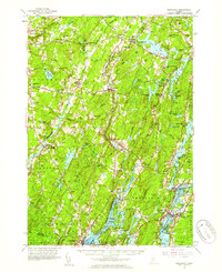 1957 Wiscasset1959 Print · USGSThe Sheepscot and Damariscotta river valleys are shown in the late 1950s, a landscape of tidal flats and inland ponds. Genealogists can trace family landmarks like Goodspeed Cem, St Denis Ch, and the old settlements at Head Tide or Dresden Mills.4 unique versions available
 - 1957 Map of Waterville, 1959 Print
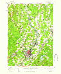 1957 Waterville1959 Print · USGSThe Kennebec River valley in the late fifties shows a bustling industrial landscape centered on the rail-and-river hub of Waterville. Researchers can trace historic institutions like Colby College, the Central Maine Sanatorium, and family-named sites such as Pishon Ferry or Ten Lots Chapel.3 unique versions available
 - 1957 Map of Burnham, 1959 Print
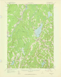 1957 Burnham1959 Print · USGSCentral Maine in the late 1950s reveals a landscape of tight-knit crossroads and small academies centered on the Unity Pond basin. Genealogists can trace family names through landmarks like Reynolds Corner, Freedom Academy, and the winding Belfast and Moosehead Lake Railroad.2 unique versions available
 - 1957 Map of Gardiner, 1959 Print
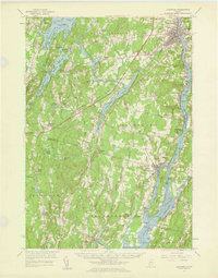 1957 Gardiner1959 Print · USGSThe Kennebec River valley in the late fifties shows a landscape of riverfront industry and rural crossroads. Genealogists and historians can trace family-named sites like Batchelders Crossing or Litchfield Academy and explore the complex waters of Swan Island.3 unique versions available
End of results
Showing maps 1-14 of 14
Top cities of Kennebec County
- Augusta historical maps
- Waterville historical maps
- Winslow historical maps
- Oakland historical maps
- Winthrop historical maps
- Gardiner historical maps
See more
Frequently asked questions
- What are the different types of historical maps available for Kennebec County?
- What is the oldest map of Kennebec County?
- Where can I purchase historical maps of Kennebec County for my home or office?
- Where can I download high-res historical maps of Kennebec County?
- Are there historical topographic maps available for Kennebec County?
- Is there historical aerial imagery available for Kennebec County?
- Where are historical maps of Kennebec County sourced from?