1950s Maps of Penobscot County, Maine
Explore 26 historic maps of Penobscot County from the 1950s. These maps offer a rare glimpse into what life looked like during the 1950s — showing old roads, neighborhoods, homes, and landmarks that have changed or disappeared over time.
Whether you're researching your family's past, planning a metal detecting trip, or studying how Penobscot County's landscape evolved across the 1950s, these high-resolution maps are a powerful tool for exploring the history of this region.
- Focus on a specific era: All maps on this page are from the 1950s, giving you a focused view of this time period.
- See what’s changed: Compare century-old streets, trails, and buildings to today's modern landscape using overlays and satellite layers.
- Research with precision: Use these maps for genealogy, historical research, land use analysis, or educational projects.
- View, download, or print: Maps are fully viewable online in high resolution, and can be downloaded or printed for your own records.
Start exploring Penobscot County's history through authentic maps from the 1950s. This is your window into the past.
Penobscot County, ME maps
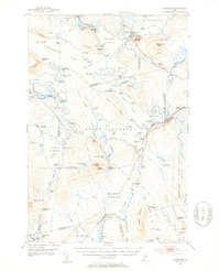
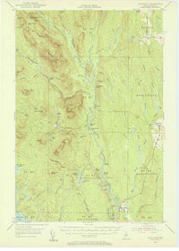
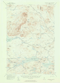
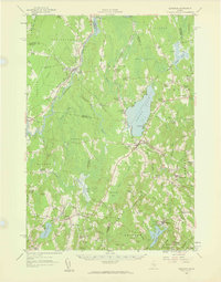
(26)- 1951 Map of Boyd Lake
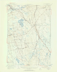
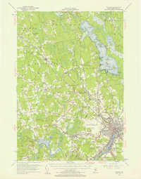
 1951 Boyd Lake1951 Print · USGSPenobscot and Piscataquis Counties are captured here in the early 1950s, showing a landscape of timber-rail economies and scattered rural schoolhouses. Genealogists can trace family footprints at Bradford Center, the Hoxie Sch, or along the Bangor and Aroostook rail line.
 - 1951 Map of Norcross, 1953 Print
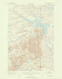
 1951 Norcross1953 Print · USGSThe Maine North Woods at mid-century reveal a complex logging and sporting landscape centered on the village of Norcross. Researchers can trace the legacy of the timber trade and wilderness camps at the Boom House, Ambajejus Camps, and Stephensons Landing.5 unique versions available
 - 1951 Map of Millinocket, 1953 Print
 1951 Millinocket1953 Print · USGSThe river-driven industrial landscape of northern Maine comes into focus in the early fifties, where the Penobscot forks meet at Medway. Genealogists and historians can trace the Bangor and Aroostook rail line and locate Bethel Ch or the Lynch Cem.4 unique versions available
 - 1953 Map of Stacyville, 1956 Print
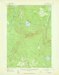
 1953 Stacyville1956 Print · USGSThe North Woods of Penobscot County come into focus during the early 1950s, showing a landscape of logging camps and mountain lookouts. Researchers can locate remote sites like Hunt Farm, the Fire Tower on Deasey Mtn, and the old Deasey Dam along the riverbanks.4 unique versions available
 - 1954 Map of Shin Pond, 1956 Print
 1954 Shin Pond1956 Print · USGSThe Maine North Woods in the 1950s remained a landscape of isolated timber farms and sporting camps. Researchers can trace the early logging infrastructure and river camps at Seboeis Farm, Bowlin Camps, and the settlement at Allsbury.4 unique versions available
 - 1954 Map of Millinocket Lake, 1958 Print
 1954 Millinocket Lake1958 Print · USGSThe Maine north woods are documented here during the mid-fifties, showing a landscape of unorganized townships and timberlands. Researchers can trace historic logging routes along the Tote Road and locate remote outposts like Libby Camp and the Forest Service Camp.3 unique versions available
 - 1954 Map of Grand Lake Seboeis, 1958 Print
 1954 Grand Lake Seboeis1958 Print · USGSThe North Maine Woods in the mid-fifties reveal a rugged landscape of sporting camps and timber townships along the Aroostook River. Genealogists and historians can trace the locations of isolated outposts like Junkins Camp, the Forest Service Camp, and the distant Cunningham Mine.3 unique versions available
 - 1954 Map of Presque Isle, 1968 Print
 1954 Presque Isle1968 Print · USGSNorth Woods logging and rail history come alive in this mid-century survey of the Maine-Quebec borderlands. Genealogists and historians can trace the Bangor and Aroostook railroad through timber hubs like Ashland, Smyrna Mills, and Presque Isle.2 unique versions available
 - 1954 Map of Millinocket, 1968 Print
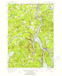
 1954 Millinocket1968 Print · USGSMaine's North Woods and the Penobscot Valley are captured here during the mid-century era of logging and rail dominance. You can trace the path of the Bangor and Aroostook Railroad through timber towns like Millinocket, Mattawamkeag, and Silver Ridge.3 unique versions available
 - 1955 Map of Traveler Mountain, 1956 Print
 1955 Traveler Mountain1956 Print · USGSNorthern Maine's timberlands and early park boundaries are detailed here in the mid-fifties. Researchers can locate remote logging outposts like Trout Brook Farm, early dams at Norway Dam, and the historic Indian Carry near Grand Pitch.4 unique versions available
 - 1955 Map of Orland, 1956 Print
 1955 Orland1956 Print · USGSCoastal Maine in the mid-fifties is captured here as a landscape of interconnected ponds and granite ridges. Genealogists and historians can trace family-named landmarks like Condon Hill, locate the U S Fish Hatchery, and find the Annear Copper Mine.4 unique versions available
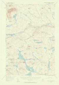
 - 1955 Map of Boyd Lake, 1956 Print
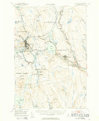
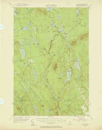
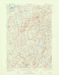
 1955 Boyd Lake1956 Print · USGSPenobscot and Piscataquis counties are captured here in the mid-fifties as the rail-and-river economy supported towns like Milo and Derby. Genealogists can locate family landmarks such as the Orneville Sch, Williams Cem, and the Bradford High Sch.4 unique versions available
 - 1955 Map of Pittsfield, 1957 Print
 1955 Pittsfield1957 Print · USGSSomerset County in the mid-fifties is a landscape of established rail towns and quiet lakeside camps. Genealogists and historians can trace family-named crossroads like Nutter Corner, visit the Fern-Dale Cem, or locate the Gale Sch and Wild Goose Club.2 unique versions available
 - 1955 Map of Orono, 1957 Print
 1955 Orono1957 Print · USGSThe Penobscot river valley thrived as a center of education and industry in the mid-fifties, anchored by Indian Island and the university. Genealogists and historians can trace family-named sites from French Settlement to Clewleyville Corners and the Old Gold Mine.4 unique versions available
 - 1955 Map of Bucksport, 1957 Print
 1955 Bucksport1957 Print · USGSThe Penobscot River valley thrives as a rail and maritime corridor during the mid-fifties, anchored by the industrial activities at Mt Waldo. Genealogists and historians can locate legacy family sites including Wiswell Cem, Nealys Corner, and the historic Fort Knox State Park.4 unique versions available
 - 1955 Map of Bangor, 1957 Print
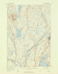
 1955 Bangor1957 Print · USGSBangor and the surrounding Penobscot Valley are captured here in the mid-fifties, showing a landscape defined by riverside industry and lakefront life. Researchers can trace historic rail connections at Northern Maine Junction and locate family landmarks like Lakeside Ldg or Evergreen Cem.3 unique versions available
 - 1955 Map of Brooks, 1957 Print
 1955 Brooks1957 Print · USGSMid-century Waldo County is captured here as a network of rural hamlets and upland farms before modern development. Genealogists and historians can trace family locations through numerous named corners, country schools like Knowlton Sch, and local mills including Rollins Mills.4 unique versions available
 - 1955 Map of Stetson, 1957 Print
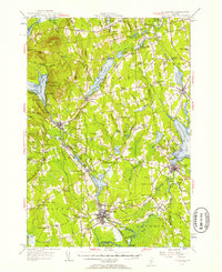
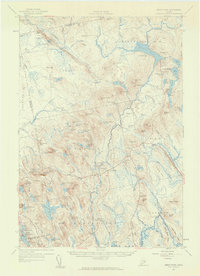
 1955 Stetson1957 Print · USGSPenobscot County in the mid-1950s is shown as a thriving landscape of rural corner settlements and lakeside communities. Genealogists and historians can trace family lines through numerous rural burying grounds like Corinthian Cem or locate the site of the Longfellow Sch and Durham Bridge.3 unique versions available
 - 1956 Map of Bangor, 1966 Print
 1956 Bangor1966 Print · USGSMid-century Maine comes alive in this survey of the rugged coast and river valleys during the 1950s. Genealogists and historians can trace the vital rail corridors of the Maine Central RR connecting timber towns like Old Town to the coast at Bar Harbor.3 unique versions available
 - 1957 Map of Lincoln, 1959 Print
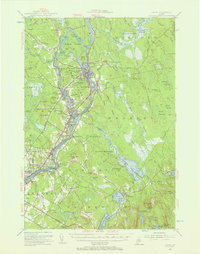
 1957 Lincoln1959 Print · USGSPenobscot River towns and the Maine woods are captured here in the late fifties, showing the vital rail-and-river corridor. Genealogists and historians can trace rail lines like the Maine Central, locate the Fairfield Sch, and find the remote Mattamiscontis Club Camp.3 unique versions available
 - 1957 Map of Burnham, 1959 Print
 1957 Burnham1959 Print · USGSCentral Maine in the late 1950s reveals a landscape of tight-knit crossroads and small academies centered on the Unity Pond basin. Genealogists can trace family names through landmarks like Reynolds Corner, Freedom Academy, and the winding Belfast and Moosehead Lake Railroad.2 unique versions available
 - 1957 Map of Great Pond, 1959 Print
 1957 Great Pond1959 Print · USGSHancock County's interior townships are shown here in the late fifties as military recreation and training sites integrated with traditional rural settlements. Researchers can locate the Hadley Cem and several community schools like Monticello Sch and Caruso Sch.4 unique versions available
 - 1957 Map of Saponac, 1959 Print
 1957 Saponac1959 Print · USGSPenobscot and Hancock counties are shown here in the late fifties, during a period of rural stability in the Maine north woods. Researchers can locate family landmarks like Mt Repose Cem, the Thirty-Nine Tannery, and the Corner Sch in Lowell.4 unique versions available
 - 1957 Map of Fredericton, 1981 Print
 1957 Fredericton1981 Print · USGSThe New Brunswick and Maine borderlands come into focus in the mid-fifties, dominated by the Saint John River and massive military tracts. Genealogists can locate riverfront hamlets like Maugerville or inland sites like Scotch Settlement along the Canadian Pacific rail line.
 - 1958 Map of Presque Isle
 1958 Presque Isle1958 Print · USGSThe Aroostook timber and potato country is captured here during the late fifties, showing the vital rail-to-river network of Northern Maine. Genealogists and historians can trace the Bangor & Aroostook RR through Mapleton and Ashland, or locate remote sites like Chamberlain Farm and Seven Islands.
Showing maps 1-25 of 26
Top cities of Penobscot County
- Bangor historical maps
- Orono historical maps
- Brewer historical maps
- Hampden historical maps
- Old Town historical maps
- Hermon historical maps
See more
Frequently asked questions
- What are the different types of historical maps available for Penobscot County?
- What is the oldest map of Penobscot County?
- Where can I purchase historical maps of Penobscot County for my home or office?
- Where can I download high-res historical maps of Penobscot County?
- Are there historical topographic maps available for Penobscot County?
- Is there historical aerial imagery available for Penobscot County?
- Where are historical maps of Penobscot County sourced from?