1900s (20th Century) Maps of Piscataquis County, Maine
Explore 262 historic maps of Piscataquis County from the 1900s (20th Century). These maps offer a rare glimpse into what life looked like during the 1900s — showing old roads, neighborhoods, homes, and landmarks that have changed or disappeared over time.
Whether you're researching your family's past, planning a metal detecting trip, or studying how Piscataquis County's landscape evolved across the 1900s, these high-resolution maps are a powerful tool for exploring the history of this region.
- Focus on a specific era: All maps on this page are from the 1900s, giving you a focused view of this time period.
- See what’s changed: Compare century-old streets, trails, and buildings to today's modern landscape using overlays and satellite layers.
- Research with precision: Use these maps for genealogy, historical research, land use analysis, or educational projects.
- View, download, or print: Maps are fully viewable online in high resolution, and can be downloaded or printed for your own records.
Start exploring Piscataquis County's history through authentic maps from the 1900s. This is your window into the past.
Piscataquis County, ME maps
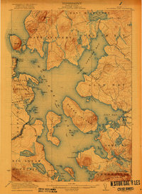
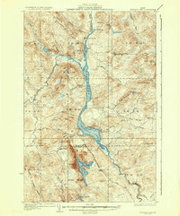
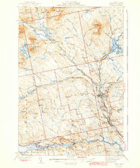
(262)- 1905 Map of The Forks, 1954 Print
 1905 The Forks1954 Print · USGSCovers Piscataquis County, including Caratunk, West Forks, and other nearby areas
 - 1907 Map of The Forks
 1907 The Forks1907 Print · USGSCovers Piscataquis County, including Caratunk, West Forks, and other nearby areas4 unique versions available
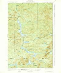
 - 1920 Map of Moosehead Lake, 1955 Print
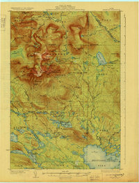
 1920 Moosehead Lake1955 Print · USGSCovers Piscataquis County, including Greenville, Beaver Cove, and other nearby areas
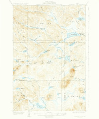
 - 1921 Map of Brassua Lake
 1921 Brassua Lake1921 Print · USGSCovers Piscataquis County, including Misery Gore, Tomhegan Township, and other nearby areas3 unique versions available
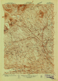
 - 1922 Map of Moosehead Lake
 1922 Moosehead Lake1922 Print · USGSCovers Piscataquis County, including Greenville, Beaver Cove, and other nearby areas7 unique versions available
 - 1923 Map of Brassua Lake
 1923 Brassua Lake1923 Print · USGSCovers Piscataquis County, including Misery Gore, Tomhegan Township, and other nearby areas4 unique versions available
 - 1927 Map of Katahdin
 1927 Katahdin1927 Print · USGSCovers Piscataquis County, including T4 R10 WELS, Ambejejus Lake, and other nearby areas
 - 1930 Map of Moosehead Lake
 1930 Moosehead Lake1930 Print · USGSCovers Piscataquis County, including Greenville, Beaver Cove, and other nearby areas
 - 1930 Map of Katahdin
 1930 Katahdin1930 Print · USGSCovers Piscataquis County, including T4 R10 WELS, Ambejejus Lake, and other nearby areas6 unique versions available
 - 1931 Map of Mooseleuk Lake
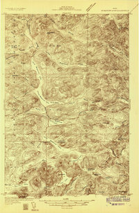
 1931 Mooseleuk Lake1931 Print · USGSCovers Piscataquis County, including T12 R9 WELS, T12 R8 WELS, and other nearby areas2 unique versions available
 - 1932 Map of Umsaskis Lake
 1932 Umsaskis Lake1932 Print · USGSCovers Piscataquis County, including T10 R14 WELS, T10 R12 WELS, and other nearby areas4 unique versions available
 - 1932 Map of Dover-Foxcroft
 1932 Dover-Foxcroft1932 Print · USGSCovers Piscataquis County, including Dover-Foxcroft, Dexter, and other nearby areas4 unique versions available
 - 1932 Map of Musquacook Lakes
 1932 Musquacook Lakes1932 Print · USGSCovers Piscataquis County, including T12 R10 WELS, T12 R11 WELS, and other nearby areas4 unique versions available
 - 1933 Map of Boyd Lake
 1933 Boyd Lake1933 Print · USGSCovers Piscataquis County, including Corinth, Milo, and other nearby areas
 - 1933 Map of Guilford, 1958 Print
 1933 Guilford1958 Print · USGSCovers Piscataquis County, including Dover-Foxcroft, Dexter, and other nearby areas5 unique versions available
 - 1935 Map of Umsaskis Lake
 1935 Umsaskis Lake1935 Print · USGSCovers Piscataquis County, including T10 R14 WELS, T10 R12 WELS, and other nearby areas3 unique versions available
 - 1935 Map of Musquacook Lakes
 1935 Musquacook Lakes1935 Print · USGSCovers Piscataquis County, including T12 R10 WELS, T12 R11 WELS, and other nearby areas3 unique versions available
 - 1935 Map of Dover-Foxcroft
 1935 Dover-Foxcroft1935 Print · USGSCovers Piscataquis County, including Dover-Foxcroft, Dexter, and other nearby areas2 unique versions available
 - 1935 Map of Mooseleuk Lake
 1935 Mooseleuk Lake1935 Print · USGSCovers Piscataquis County, including T12 R9 WELS, T12 R8 WELS, and other nearby areas3 unique versions available
 - 1937 Map of Guilford
 1937 Guilford1937 Print · USGSCovers Piscataquis County, including Dover-Foxcroft, Dexter, and other nearby areas2 unique versions available
 - 1940 Map of Sebec
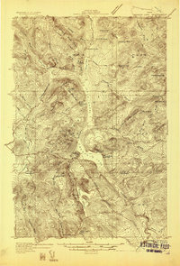
 1940 Sebec1940 Print · USGSCovers Piscataquis County, including Dover-Foxcroft, Milo, and other nearby areas4 unique versions available
 - 1943 Map of Sebec
 1943 Sebec1943 Print · USGSCovers Piscataquis County, including Dover-Foxcroft, Milo, and other nearby areas4 unique versions available
 - 1944 Map of Brassua Lake
 1944 Brassua Lake1944 Print · USGSCovers Piscataquis County, including Misery Gore, Tomhegan Township, and other nearby areas
 - 1944 Map of Moosehead Lake
 1944 Moosehead Lake1944 Print · USGSCovers Piscataquis County, including Greenville, Beaver Cove, and other nearby areas
 - 1947 Map of Schoodic, 1956 Print
 1947 Schoodic1956 Print · USGSCovers Piscataquis County, including Milo, Brownville, and other nearby areas3 unique versions available
Showing maps 1-25 of 262
Top cities of Piscataquis County
- Dover-Foxcroft historical maps
- Milo historical maps
- Greenville historical maps
- Sangerville historical maps
- Guilford historical maps
- Brownville historical maps
See more
Frequently asked questions
- What are the different types of historical maps available for Piscataquis County?
- What is the oldest map of Piscataquis County?
- Where can I purchase historical maps of Piscataquis County for my home or office?
- Where can I download high-res historical maps of Piscataquis County?
- Are there historical topographic maps available for Piscataquis County?
- Is there historical aerial imagery available for Piscataquis County?
- Where are historical maps of Piscataquis County sourced from?