1970s Maps of Piscataquis County, Maine
Explore 77 historic maps of Piscataquis County from the 1970s. These maps offer a rare glimpse into what life looked like during the 1970s — showing old roads, neighborhoods, homes, and landmarks that have changed or disappeared over time.
Whether you're researching your family's past, planning a metal detecting trip, or studying how Piscataquis County's landscape evolved across the 1970s, these high-resolution maps are a powerful tool for exploring the history of this region.
- Focus on a specific era: All maps on this page are from the 1970s, giving you a focused view of this time period.
- See what’s changed: Compare century-old streets, trails, and buildings to today's modern landscape using overlays and satellite layers.
- Research with precision: Use these maps for genealogy, historical research, land use analysis, or educational projects.
- View, download, or print: Maps are fully viewable online in high resolution, and can be downloaded or printed for your own records.
Start exploring Piscataquis County's history through authentic maps from the 1970s. This is your window into the past.
Piscataquis County, ME maps
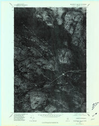
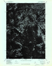
(77)- 1975 Map of The Traveler
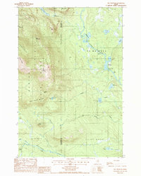 1975 The Traveler1975 Print · USGSBaxter State Park and the surrounding wildlands of the Maine North Woods appear in high detail during the mid-1980s. Trace the mountain geography from The Traveler to Old City, or follow the river system through Stair Falls and the Haskell Deadwater.2 unique versions available
 - 1975 Map of Kingsbury NE, 1980 Print
 1975 Kingsbury NE1980 Print · USGSThe woods and waters of Piscataquis County appear in stark detail in the mid-1970s before modern development altered these forest tracts. Researchers can trace the winding Piscataquis River and locate remote landmarks like Thorn Pond and Foss Pond.
 - 1975 Map of Dover-Foxcroft NW, 1980 Print
 1975 Dover-Foxcroft NW1980 Print · USGSPiscataquis County's river valley and rural crossroads are captured in this mid-seventies aerial survey. Researchers can trace the layout of historic settlements like Dover-Foxcroft and East Dover or locate family-named intersections such as Goffs Corner.
 - 1975 Map of Guilford NW, 1980 Print
 1975 Guilford NW1980 Print · USGSPiscataquis County settlements like Guilford and Abbot Village are shown in detail during the mid-seventies. This orthophoto allows you to trace the landscape from the banks of the Piscataquis River to the shores of Harlow Pond.
 - 1975 Map of Guilford SW, 1980 Print
 1975 Guilford SW1980 Print · USGSCentral Maine's wooded landscape is documented in the mid-1970s through this detailed aerial survey. Researchers can trace the rural layouts of Cambridge and Pingree Center alongside the natural courses of the Sebasticook and Main Stream.
 - 1975 Map of Kingsbury SW, 1980 Print
 1975 Kingsbury SW1980 Print · USGSSomerset County's upland forests and small settlements are shown as they appeared in the mid-1970s through this aerial orthophotograph. Researchers can trace the clearings around Kingsbury and Brighton or locate the peaks of Foss Mountain and Bald Mountain.
 - 1975 Map of Kingsbury NW, 1980 Print
 1975 Kingsbury NW1980 Print · USGSCentral Maine forest land is captured in this mid-seventies aerial orthophoto, showing the remote timberlands of Somerset County. Trace the wild shorelines of Spectacle Pond and Palmer Pond or locate landmarks like Foss Hill Ridge.
 - 1975 Map of Guilford NE, 1980 Print
 1975 Guilford NE1980 Print · USGSCentral Maine's forest and farm country is captured in the mid-1970s as the Piscataquis River flows past timberlands and small settlements. Researchers can trace land use patterns near Guilford Center, Dunham Corner, and East Sangerville.
 - 1975 Map of Dover-Foxcroft SE, 1980 Print
 1975 Dover-Foxcroft SE1980 Print · USGSCentral Maine agriculture and woodland are captured in the mid-seventies via aerial imagery. Researchers can trace rural property lines and historic crossroads like Hicks Corner, Rollins Mill, and West Charleston.
 - 1975 Map of Guilford SE, 1980 Print
 1975 Guilford SE1980 Print · USGSPenobscot County farmland and woods are captured in this mid-seventies aerial survey during the height of the autumn season. Genealogists and local historians can trace exact property clearings and structures near North Dexter, Gilman Corner, and the shores of Center Pond.
 - 1975 Map of Dover-Foxcroft SW, 1980 Print
 1975 Dover-Foxcroft SW1980 Print · USGSPenobscot County is captured in the mid-seventies, showing the intersection of Maine's timberlands and rural farming life. Genealogists and local historians can trace the precise 1975 building footprints at Dover South Mills, Garland, and Carr Corner.
 - 1975 Map of Kingsbury SE, 1980 Print
 1975 Kingsbury SE1980 Print · USGSThe rural crossroads of Piscataquis County are seen here in the mid-seventies through detailed orthophoto imagery. Genealogists and local historians can trace the precise boundaries and farmsteads near Hunt Corner, Huff Corner, and Hardin Corner.
 - 1975 Map of Dover-Foxcroft NE, 1980 Print
 1975 Dover-Foxcroft NE1980 Print · USGSPiscataquis County timberland and river settlements are captured in high-contrast detail during the mid-seventies. Local historians can trace the clearings of South Sebec and the small industrial footprint at Atkinson Mills along the riverbanks.
 - 1975 Map of Mooseleuk Lake SE, 1981 Print
 1975 Mooseleuk Lake SE1981 Print · USGSAroostook County's deep woods are captured during the mid-seventies in this detailed aerial survey of the Maine timberlands. Researchers can trace the exact footprint of forest management and natural watercourses like Chase Brook near the slopes of Spectacle Mountain.
 - 1975 Map of Traveler Mountain NW, 1981 Print
 1975 Traveler Mountain NW1981 Print · USGSMaine's northern timberlands are captured in high-detail aerial photography during the mid-seventies. Researchers can trace the wild shoreline of Grand Lake Matagamon and the winding paths of Webster Brook and Trout Brook.
 - 1975 Map of Millinocket Lake NW, 1981 Print
 1975 Millinocket Lake NW1981 Print · USGSPiscataquis County's deep timberlands are seen in the mid-seventies through this detailed aerial orthophotograph. Researchers can trace the logging roads and natural drainage patterns surrounding Munsungan Lake and the slopes of Willard Mountain.
 - 1975 Map of Mooseleuk Lake SW, 1981 Print
 1975 Mooseleuk Lake SW1981 Print · USGSThe North Woods of Maine are seen here in the mid-1970s through detailed aerial imagery of the Piscataquis wilderness. Trace the remote waterways of Big Hudson Brook and Spring Brook or locate the shoreline of Mooseleuk Lake.
 - 1975 Map of Millinocket Lake SE, 1981 Print
 1975 Millinocket Lake SE1981 Print · USGSThe Maine North Woods are captured in detailed aerial photography during the mid-1970s, showing a landscape of dense timber and vast waterways. Trace the winding path of the Aroostook River and the expansive shorelines of Millinocket Lake and Millimagassett Lake.
 - 1975 Map of Bradford, 1981 Print
 1975 Bradford1981 Print · USGSPenobscot County agriculture and woodlands are shown in detail during the mid-seventies in this aerial-based survey. Researchers can trace rural property lines and homestead footprints near Bradford, Bradford Center, and the banks of Little Pushaw Pond.
 - 1975 Map of Millinocket Lake SW, 1981 Print
 1975 Millinocket Lake SW1981 Print · USGSThe Maine wilderness of the mid-seventies is captured here in stark aerial detail. Genealogists and historians can trace the remote shoreline of MILLINOCKET LAKE and the high ground of Caribou Ridge across this uninhabited woodland expanse.
 - 1975 Map of Millinocket Lake NE, 1981 Print
 1975 Millinocket Lake NE1981 Print · USGSAroostook County's deep timberlands are captured in the mid-1970s through this aerial orthophotoquad of the Maine wilderness. Researchers can trace the winding course of Mooseleuk Stream and identify early logging tracks near Middle Brook Mountain.
 - 1975 Map of Traveler Mountain SW, 1981 Print
 1975 Traveler Mountain SW1981 Print · USGSThe Maine North Woods are revealed in this mid-seventies aerial survey of the Piscataquis County wilderness. Researchers can study the untouched timberlands and natural drainage surrounding Wassataquoik Lake and North Pogy Mountain.
 - 1975 Map of Traveler Mountain NE, 1981 Print
 1975 Traveler Mountain NE1981 Print · USGSNorth-central Maine is captured in the mid-seventies in this detailed aerial study of the wilderness around the Penobscot woods. Researchers can trace the shoreline of Grand Lake Matagamon and locate the historic site of Trout Brook Farm.
 - 1977 Map of Monson East, 1981 Print
 1977 Monson East1981 Print · USGSMonson and the Piscataquis County woods are shown through late-seventies aerial imagery, revealing the exact footprint of Maine's inland settlements and timberlands. Researchers can trace land use around Monson and Willimantic or locate Finn Hall.
 - 1977 Map of Socatean Bay, 1981 Print
 1977 Socatean Bay1981 Print · USGSThe timberlands of Somerset County are captured in the late seventies, showing the intersection of Maine's deep woods and the shoreline. Trace the winding paths of logging roads near Socatean Bay and the drainage of Williams Brook.
Showing maps 1-25 of 77
Top cities of Piscataquis County
- Dover-Foxcroft historical maps
- Milo historical maps
- Greenville historical maps
- Sangerville historical maps
- Guilford historical maps
- Brownville historical maps
See more
Frequently asked questions
- What are the different types of historical maps available for Piscataquis County?
- What is the oldest map of Piscataquis County?
- Where can I purchase historical maps of Piscataquis County for my home or office?
- Where can I download high-res historical maps of Piscataquis County?
- Are there historical topographic maps available for Piscataquis County?
- Is there historical aerial imagery available for Piscataquis County?
- Where are historical maps of Piscataquis County sourced from?