1960s Maps of Somerset County, Maine
Explore 13 historic maps of Somerset County from the 1960s. These maps offer a rare glimpse into what life looked like during the 1960s — showing old roads, neighborhoods, homes, and landmarks that have changed or disappeared over time.
Whether you're researching your family's past, planning a metal detecting trip, or studying how Somerset County's landscape evolved across the 1960s, these high-resolution maps are a powerful tool for exploring the history of this region.
- Focus on a specific era: All maps on this page are from the 1960s, giving you a focused view of this time period.
- See what’s changed: Compare century-old streets, trails, and buildings to today's modern landscape using overlays and satellite layers.
- Research with precision: Use these maps for genealogy, historical research, land use analysis, or educational projects.
- View, download, or print: Maps are fully viewable online in high resolution, and can be downloaded or printed for your own records.
Start exploring Somerset County's history through authentic maps from the 1960s. This is your window into the past.
Somerset County, ME maps
(13)- 1960 Map of Presque Isle
 1960 Presque Isle1960 Print · USGSNorthern Maine during the mid-century was a land of timber, rails, and strategic airfields. Genealogists and historians can trace the growth of Presque Isle and Ashland or explore the remote northern reaches of Baxter State Park and Presque Isle AFB.3 unique versions available
 - 1960 Map of Bangor
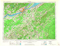
 1960 Bangor1960 Print · USGSCentral Maine in the sixties reveals a landscape of river-powered industry and sprawling coastal island chains. Researchers can trace the rail corridors of the Maine Central or locate mid-century aviation landmarks like Dow Air Force Base.
 - 1960 Map of Millinocket
 1960 Millinocket1960 Print · USGSThe Maine North Woods and Penobscot River valley are captured at mid-century during the height of the paper milling era. Researchers can trace the Appalachian Trail near Mount Katardin or locate family roots in towns like Dover-Foxcroft and Milo.3 unique versions available
 - 1961 Map of Bangor
 1961 Bangor1961 Print · USGSMid-century Maine comes alive through its busy river ports and rocky archipelagoes during a period of steady maritime and rail commerce. Researchers can trace the path of the Maine Central railroad and locate coastal landmarks from Acadia National Park to Vinalhaven Island.
 - 1961 Map of Lewiston
 1961 Lewiston1961 Print · USGSWestern Maine and the White Mountains appear here during the early sixties, showing the industrial river towns and vast timberlands before the modern interstate era. Genealogists and historians can trace the Grand Trunk RR through Berlin or locate landmarks like Old Speck Mountain and Elephant Mountain.
 - 1961 Map of Allagash Lake, 1964 Print
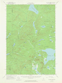 1961 Allagash Lake1964 Print · USGSThe Maine north woods in the early sixties remain a vast network of timberlands and interconnected waterways. Researchers can trace remote logging infrastructure and forestry outposts like the Lookout Tower on Allagash Mtn and the Forest Service Camp near Allagash Lake.3 unique versions available
 - 1962 Map of Lewiston
 1962 Lewiston1962 Print · USGSThe industrial river valleys and high peaks of Maine and New Hampshire define the region in the early sixties. Trace the rail-and-river network from Lewiston to the White Mountains, passing through mill towns like Berlin and Rumford.
 - 1962 Map of Baker Lake, 1964 Print
 1962 Baker Lake1964 Print · USGSNorth Maine Woods townships were largely defined by timber and water during the early sixties. Researchers can trace remote logging infrastructure and river systems like the Baker Branch St John River, Baker Lake, and the Forest Service Camp.2 unique versions available
 - 1962 Map of Quebec, 1966 Print
 1962 Quebec1966 Print · USGSThe cross-border region between Quebec and Northern Maine is captured here during the mid-1960s, showing the dense settlement of the St. Lawrence valley and the rugged timberlands of the frontier. Genealogists can trace family roots through numerous parishes like St-Joseph-de-Beauce or locate the industrial hubs of Thetford Mines and Levis.3 unique versions available
 - 1963 Map of Jackman
 1963 Jackman1963 Print · USGSThe international borderlands of Maine and Quebec come alive in the mid-twentieth century, showing a landscape of timber towns and rail connections. Genealogists and historians can trace the paths of the Canadian Pacific Railway through Jackman or locate families in Sherbrooke and Megantic.
 - 1966 Map of Sherbrooke
 1966 Sherbrooke1966 Print · USGSThe borderlands of Quebec and Maine come alive in the mid-1960s, documenting the industrial towns and deep woods of the Northeast. Genealogists can trace family lines through Sherbrooke and Coaticook, or locate remote logging outposts along the Moose River and Flagstaff Lake.
 - 1968 Map of New Sharon, 1971 Print
 1968 New Sharon1971 Print · USGSFranklin County in the late sixties shows a landscape defined by riverside settlements and upland farms. Researchers can trace historic burial sites like Village Cem or locate the old mill sites at Allens Mills and Weeks Mills along the Sandy River.
 - 1969 Map of Lewiston
 1969 Lewiston1969 Print · USGSThe northern New England highlands come into focus during the mid-fifties, showing the vital rail and river networks connecting industrial centers to the deep woods. Researchers can trace the path of the Grand Trunk RR or locate landmarks like Mt Washington and Rangeley Lake.
End of results
Showing maps 1-13 of 13
Top cities of Somerset County
- Fairfield historical maps
- Skowhegan historical maps
- Madison historical maps
- Pittsfield historical maps
- Norridgewock historical maps
- Anson historical maps
See more
Frequently asked questions
- What are the different types of historical maps available for Somerset County?
- What is the oldest map of Somerset County?
- Where can I purchase historical maps of Somerset County for my home or office?
- Where can I download high-res historical maps of Somerset County?
- Are there historical topographic maps available for Somerset County?
- Is there historical aerial imagery available for Somerset County?
- Where are historical maps of Somerset County sourced from?