1970s Maps of Somerset County, Maine
Explore 90 historic maps of Somerset County from the 1970s. These maps offer a rare glimpse into what life looked like during the 1970s — showing old roads, neighborhoods, homes, and landmarks that have changed or disappeared over time.
Whether you're researching your family's past, planning a metal detecting trip, or studying how Somerset County's landscape evolved across the 1970s, these high-resolution maps are a powerful tool for exploring the history of this region.
- Focus on a specific era: All maps on this page are from the 1970s, giving you a focused view of this time period.
- See what’s changed: Compare century-old streets, trails, and buildings to today's modern landscape using overlays and satellite layers.
- Research with precision: Use these maps for genealogy, historical research, land use analysis, or educational projects.
- View, download, or print: Maps are fully viewable online in high resolution, and can be downloaded or printed for your own records.
Start exploring Somerset County's history through authentic maps from the 1970s. This is your window into the past.
Somerset County, ME maps
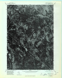
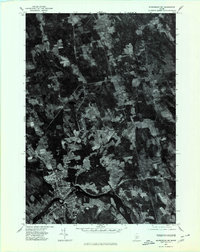
(90)- 1970 Map of Skinner, 1973 Print
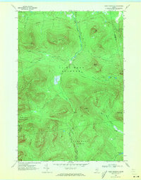
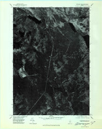
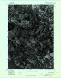
 1970 Skinner1973 Print · USGSThe international border and the high timberlands of Franklin County are captured here in the early 1970s. Researchers can trace the Canadian Pacific rail line as it passes the remote outposts of Skinner and Keough along the Moose River.2 unique versions available
 - 1970 Map of Kibby Mountain, 1973 Print
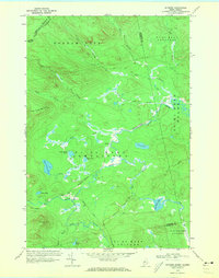
 1970 Kibby Mountain1973 Print · USGSThe Maine highlands and timberlands of Franklin County are shown here in the early seventies, centered on the heights of Kibby Mountain. Researchers can trace the mid-century logging roads and remote water bodies like Caribou Pond and Spencer Bog.2 unique versions available
 - 1970 Map of Skinner NE, 1973 Print
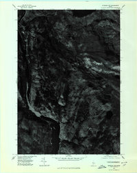
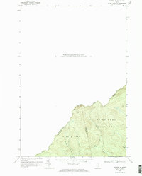 1970 Skinner NE1973 Print · USGSThe international boundary between Maine and Quebec is documented in detail here during the early 1970s. Researchers can trace the remote drainage of the West Branch Gulf Stream and locate wilderness landmarks like Sixtynine Mtn and Turner Pond.2 unique versions available
 - 1975 Map of Pittsfield SW, 1980 Print
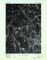 1975 Pittsfield SW1980 Print · USGSSomerset County, Maine, is captured in this mid-seventies aerial survey during a period of steady rural character. Researchers can trace the exact buildings and field lines of historic crossroads like West Palmyra, Emerson Corner, and Pittsfield.
 - 1975 Map of Waterville NE, 1980 Print
 1975 Waterville NE1980 Print · USGSKennebec County farmland and riverfronts are captured in the mid-seventies, documenting the rural character of the Maine interior. Trace old field patterns and property lines near Clinton, Shawmut, and the Sebasticook River.
 - 1975 Map of Bingham SE, 1980 Print
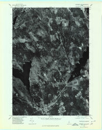
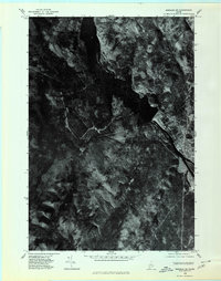
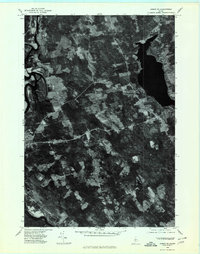
 1975 Bingham SE1980 Print · USGSIn the mid-1970s, this Somerset County landscape was a mosaic of timberland and winding waterways. Researchers can trace the path of the Kennebec River and locate isolated features like Withee Pond or the heights of Johnson Mountain.
 - 1975 Map of Pittsfield NW, 1980 Print
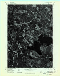
 1975 Pittsfield NW1980 Print · USGSSomerset County's lake-strewn woods and small villages are captured from above in the mid-1970s. Genealogists and local historians can trace the rural layouts of St Albans and Hartland alongside landmarks like Great Moose Lake.
 - 1975 Map of Waterville SE, 1980 Print
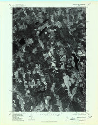
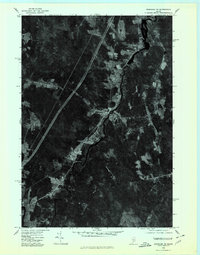
 1975 Waterville SE1980 Print · USGSThe Kennebec and Sebasticook River corridors in the mid-1970s reveal a landscape of riverside industry and expanding rural neighborhoods. Genealogists and local historians can trace the footprints of Waterville, Winslow, and the outlying settlement at Goodwin Corner.
 - 1975 Map of Pittsfield NE, 1980 Print
 1975 Pittsfield NE1980 Print · USGSSomerset County, Maine, is shown in high detail during the mid-seventies through this aerial orthophotograph. Researchers can trace rural family-named crossroads like Pleasant Vale Corner and Sanborn Corner or the path of the Mulligan Stream.
 - 1975 Map of Skowhegan SE, 1980 Print
 1975 Skowhegan SE1980 Print · USGSSomerset County in the mid-1970s is seen here through detailed aerial imagery, showing the patchwork of timber and farmland before later development. Researchers can trace the layout of small communities like Browns Corner or Mitchell Corner and locate family-named landmarks such as Whitten Hill.
 - 1975 Map of Norridgewock NE, 1980 Print
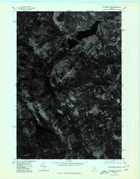
 1975 Norridgewock NE1980 Print · USGSSomerset County's riverfront and woodlands are captured here in the mid-seventies, showing the intersection of rural life and the Kennebec River. Trace land use patterns near Norridgewock, the rise of Mount Tom, and the shorelines of North Pond.
 - 1975 Map of Bingham NE, 1980 Print
 1975 Bingham NE1980 Print · USGSThe Maine woods of the mid-1970s are captured in this aerial orthophotograph of the Somerset County backcountry. Researchers can trace the timber roads and drainage patterns around Austin Pond and Dimmick Mountain.
 - 1975 Map of Norridgewock SE, 1980 Print
 1975 Norridgewock SE1980 Print · USGSThe Belgrade Lakes region comes into sharp focus in the mid-1970s through this detailed orthophoto. Researchers can trace the exact development of shoreline settlements and rural crossroads like North Belgrade, Tyler Corner, and Rome.
 - 1975 Map of Bingham NW, 1980 Print
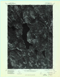
 1975 Bingham NW1980 Print · USGSThe Maine woods and the upper Kennebec River are captured in high detail in the mid-1970s. Researchers can trace the terrain and water systems of Somerset County, from the depths of Pleasant Pond to the peaks of Moxie Mountain.
 - 1975 Map of Skowhegan NE, 1980 Print
 1975 Skowhegan NE1980 Print · USGSSomerset County, Maine, is captured in this mid-seventies orthophotograph showing the rural transition between forest and farmland. Genealogists and local historians can trace the clearings around Harmony and Mainstream or study the shoreline of Moose Pond.
 - 1975 Map of Guilford SW, 1980 Print
 1975 Guilford SW1980 Print · USGSCentral Maine's wooded landscape is documented in the mid-1970s through this detailed aerial survey. Researchers can trace the rural layouts of Cambridge and Pingree Center alongside the natural courses of the Sebasticook and Main Stream.
 - 1975 Map of Burnham NE, 1980 Print
 1975 Burnham NE1980 Print · USGSWaldo County's rural landscape is captured from above in the mid-1970s, revealing the intricate patterns of forest and farmland. Researchers can trace the layout of small settlements like Greens Corner and Reynolds Corner near the shores of Unity Pond.
 - 1975 Map of Norridgewock SW, 1980 Print
 1975 Norridgewock SW1980 Print · USGSThe Kennebec County lakeland is seen from above in the mid-seventies, showing the literal footprint of woods and water. Trace the rural landscape between Belgrade Lakes and Rome Corner, including the shores of Long Pond.
 - 1975 Map of Kingsbury SW, 1980 Print
 1975 Kingsbury SW1980 Print · USGSSomerset County's upland forests and small settlements are shown as they appeared in the mid-1970s through this aerial orthophotograph. Researchers can trace the clearings around Kingsbury and Brighton or locate the peaks of Foss Mountain and Bald Mountain.
 - 1975 Map of Kingsbury NW, 1980 Print
 1975 Kingsbury NW1980 Print · USGSCentral Maine forest land is captured in this mid-seventies aerial orthophoto, showing the remote timberlands of Somerset County. Trace the wild shorelines of Spectacle Pond and Palmer Pond or locate landmarks like Foss Hill Ridge.
 - 1975 Map of Bingham SW, 1980 Print
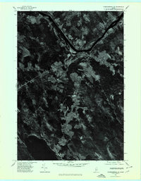
 1975 Bingham SW1980 Print · USGSThe upper Kennebec River valley is captured here in the mid-1970s through high-resolution aerial imagery. Genealogists and researchers can trace the exact footprint of settlements in Bingham and Moscow or locate terrain features like Old Bluff Mountain.
 - 1975 Map of Burnham NW, 1980 Print
 1975 Burnham NW1980 Print · USGSWaldo County and the Sebasticook River valley are captured in high-altitude detail during the mid-seventies. Genealogists and local historians can trace the precise layouts of Burnham, Winnecook, and Clinton as they appeared decades ago.
 - 1975 Map of Anson NW, 1980 Print
 1975 Anson NW1980 Print · USGSCentral Somerset County is captured in the mid-1970s through this detailed orthophotograph of the northern Maine woods. Researchers can trace the timbered shorelines of Embden Pond and follow the paths of the Kennebec River and Carrabassett River.
 - 1975 Map of Skowhegan SW, 1980 Print
 1975 Skowhegan SW1980 Print · USGSSkowhegan and the Kennebec River valley are captured in this mid-seventies aerial survey of central Maine. Trace the historical footprints of industrial sites like Malbons Mills and Lower Mill or the shoreline of Wesserunsett Lake.
 - 1975 Map of Anson SE, 1980 Print
 1975 Anson SE1980 Print · USGSSomerset County land and river patterns are captured in high detail in the mid-1970s. Researchers can trace the winding Kennebec River and identify family-named crossroads like Blackwell Corner and Martin Corner.
Showing maps 1-25 of 90
Top cities of Somerset County
- Fairfield historical maps
- Skowhegan historical maps
- Madison historical maps
- Pittsfield historical maps
- Norridgewock historical maps
- Anson historical maps
See more
Frequently asked questions
- What are the different types of historical maps available for Somerset County?
- What is the oldest map of Somerset County?
- Where can I purchase historical maps of Somerset County for my home or office?
- Where can I download high-res historical maps of Somerset County?
- Are there historical topographic maps available for Somerset County?
- Is there historical aerial imagery available for Somerset County?
- Where are historical maps of Somerset County sourced from?