1970s Maps of Waldo County, Maine
Explore 15 historic maps of Waldo County from the 1970s. These maps offer a rare glimpse into what life looked like during the 1970s — showing old roads, neighborhoods, homes, and landmarks that have changed or disappeared over time.
Whether you're researching your family's past, planning a metal detecting trip, or studying how Waldo County's landscape evolved across the 1970s, these high-resolution maps are a powerful tool for exploring the history of this region.
- Focus on a specific era: All maps on this page are from the 1970s, giving you a focused view of this time period.
- See what’s changed: Compare century-old streets, trails, and buildings to today's modern landscape using overlays and satellite layers.
- Research with precision: Use these maps for genealogy, historical research, land use analysis, or educational projects.
- View, download, or print: Maps are fully viewable online in high resolution, and can be downloaded or printed for your own records.
Start exploring Waldo County's history through authentic maps from the 1970s. This is your window into the past.
Waldo County, ME maps
(15)- 1973 Map of Cape Rosier, 1976 Print
 1973 Cape Rosier1976 Print · USGSCoastal Hancock County in the early seventies shows a landscape of granite heights and tidal reaches. Genealogists and historians can trace family-named sites like John B Mtn or find old burial grounds at Evergreen Cem and Bayview Cem.3 unique versions available
 - 1973 Map of Searsport, 1976 Print
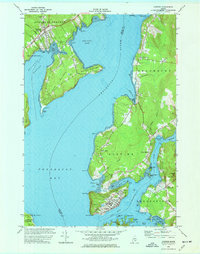
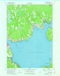 1973 Searsport1976 Print · USGSSearsport and the Waldo County coastline come alive in the 1970s as industrial rail lines meet the Atlantic. Researchers can trace family history through sites like Ford Chapel and Elmwood Cem, or explore the shoreline from Sears Island to Bayside.2 unique versions available
 - 1973 Map of Islesboro, 1976 Print
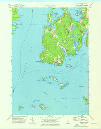
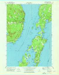 1973 Islesboro1976 Print · USGSThe islands of Penobscot Bay appear in the 1970s, showcasing the maritime connections of Islesboro and Dark Harbor. Trace local genealogy and landmarks across Seven Hundred Acre Island, the Saturday Cove Cem, and the Islesboro Ferry Toll.2 unique versions available
 - 1973 Map of Castine, 1977 Print
 1973 Castine1977 Print · USGSThe Maine coast near the confluence of the Penobscot and Bagaduce Rivers is captured here in the early 1970s. Local historians can trace the foundations of Ft George, the route of the British Canal, and the grounds of the Maritime Academy in Castine.3 unique versions available
 - 1975 Map of Pittsfield SW, 1980 Print
 1975 Pittsfield SW1980 Print · USGSSomerset County, Maine, is captured in this mid-seventies aerial survey during a period of steady rural character. Researchers can trace the exact buildings and field lines of historic crossroads like West Palmyra, Emerson Corner, and Pittsfield.
 - 1975 Map of Burnham NE, 1980 Print
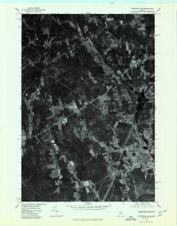
 1975 Burnham NE1980 Print · USGSWaldo County's rural landscape is captured from above in the mid-1970s, revealing the intricate patterns of forest and farmland. Researchers can trace the layout of small settlements like Greens Corner and Reynolds Corner near the shores of Unity Pond.
 - 1975 Map of Brooks NW, 1980 Print
 1975 Brooks NW1980 Print · USGSMid-seventies central Maine comes into sharp focus in this aerial survey of Penobscot and Waldo Counties. Researchers can trace rural property lines and woodlots surrounding North Dixmont, East Troy, and the slopes of Mount Harris.
 - 1975 Map of Burnham SE, 1980 Print
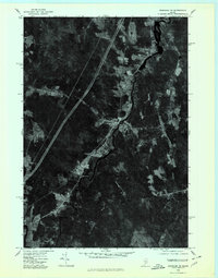
 1975 Burnham SE1980 Print · USGSWaldo County at the height of the 1970s shows a landscape of enduring rural character and organized woodlots. Local historians can trace family locations and land use patterns around Unity, Freedom, and the crossroads at Knox Corner.
 - 1975 Map of Burnham SW, 1980 Print
 1975 Burnham SW1980 Print · USGSKennebec County as it appeared in the mid-seventies, showing the agricultural and forested landscape of central Maine. Genealogists and researchers can trace local landmarks like Albion, South Albion, and the winding Fifteenmile Stream.
 - 1975 Map of Brooks SE, 1980 Print
 1975 Brooks SE1980 Print · USGSMid-century Waldo County comes into view in this 1970s orthophoto survey of the Maine countryside. Genealogists and local historians can trace field boundaries and homesteads near Nickerson Mills, Town House Corners, and along the banks of Marsh Stream.
 - 1975 Map of Burnham NW, 1980 Print
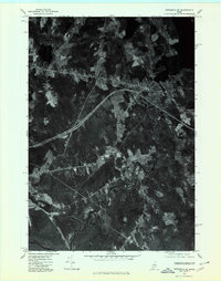
 1975 Burnham NW1980 Print · USGSWaldo County and the Sebasticook River valley are captured in high-altitude detail during the mid-seventies. Genealogists and local historians can trace the precise layouts of Burnham, Winnecook, and Clinton as they appeared decades ago.
 - 1975 Map of Vassalboro SE, 1980 Print
 1975 Vassalboro SE1980 Print · USGSKennebec County agriculture and river-valley settlements are captured in high detail in the mid-1970s. Genealogists and local historians can trace the exact buildings and field patterns of rural centers like Weeks Mills, Coopers Mills, and Windsorville.
 - 1975 Map of Pittsfield SE, 1980 Print
 1975 Pittsfield SE1980 Print · USGSSomerset County's rural landscape is documented here during the mid-seventies, showing the precise layout of farms and forests. Researchers can trace land use patterns near Detroit and Houston Corner or follow the East Branch Sebasticook River.
 - 1975 Map of Brooks NE, 1980 Print
 1975 Brooks NE1980 Print · USGSPenobscot County communities appear in high-resolution detail during the mid-seventies in this aerial orthophotoquad. Genealogists and local historians can trace the exact layouts of rural settlements like Dixmont Center, East Dixmont, and Newburg.
 - 1975 Map of Brooks SW, 1980 Print
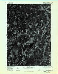
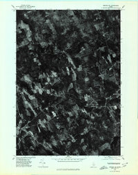 1975 Brooks SW1980 Print · USGSWaldo County's rural landscape is preserved in this mid-1970s orthophotograph, revealing the actual texture of the woods and fields in the Maine interior. Researchers can pinpoint specific homesteads and landmarks like Knox Center, Ray Corner, and Lake Passagassawakeag.
End of results
Showing maps 1-15 of 15
Top cities of Waldo County
- Belfast historical maps
- Winterport historical maps
- Searsport historical maps
- Lincolnville historical maps
- Unity historical maps
- Palermo historical maps
See more
Frequently asked questions
- What are the different types of historical maps available for Waldo County?
- What is the oldest map of Waldo County?
- Where can I purchase historical maps of Waldo County for my home or office?
- Where can I download high-res historical maps of Waldo County?
- Are there historical topographic maps available for Waldo County?
- Is there historical aerial imagery available for Waldo County?
- Where are historical maps of Waldo County sourced from?