1990s Maps of Worcester County, Maryland
Explore 6 historic maps of Worcester County from the 1990s. These maps offer a rare glimpse into what life looked like during the 1990s — showing old roads, neighborhoods, homes, and landmarks that have changed or disappeared over time.
Whether you're researching your family's past, planning a metal detecting trip, or studying how Worcester County's landscape evolved across the 1990s, these high-resolution maps are a powerful tool for exploring the history of this region.
- Focus on a specific era: All maps on this page are from the 1990s, giving you a focused view of this time period.
- See what’s changed: Compare century-old streets, trails, and buildings to today's modern landscape using overlays and satellite layers.
- Research with precision: Use these maps for genealogy, historical research, land use analysis, or educational projects.
- View, download, or print: Maps are fully viewable online in high resolution, and can be downloaded or printed for your own records.
Start exploring Worcester County's history through authentic maps from the 1990s. This is your window into the past.
Worcester County, MD maps
(6)- 1992 Map of Assawoman Bay
 1992 Assawoman Bay1992 Print · USGSCoastal Delaware and Maryland meet in the early nineties along a landscape of shifting barrier islands and growing waterfront communities. Trace the shoreline development of Fenwick Island and Maryland Beach, or locate historic landmarks like the Fenwick Island Lighthouse and Peppers Landing.
 - 1992 Map of Whaleysville
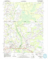 1992 Whaleysville1992 Print · USGSThe Maryland-Delaware borderlands appear in the early nineties as a landscape of swamp-fringed settlements and agricultural ridges. Genealogists can trace family names and local landmarks through Pulletts Chapel, the Willards Sch, and the Bethel Cem near Gumboro.
 - 1992 Map of Selbyville
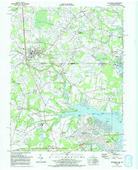 1992 Selbyville1992 Print · USGSThe Delaware-Maryland border region near Selbyville is captured in the early nineties as modern residential growth meets rural crossroads. Trace family history at Old St Martins Ch or explore the tidal reaches of the St Martin River and Shingle Landing Prong.
 - 1997 Map of Assawoman Bay, 2000 Print
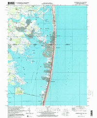 1997 Assawoman Bay2000 Print · USGSThe coastal borderlands of Delaware and Maryland are captured here just before the millennium, showing the dense development of the barrier islands. Genealogists and local historians can trace family landmarks like Drum Cem, the Fenwick Island Lighthouse, and the St George Ch.
 - 1998 Map of Tingles Island, 2000 Print
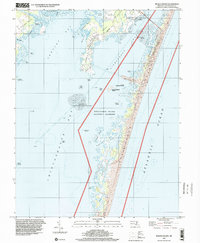 1998 Tingles Island2000 Print · USGSCoastal Worcester County is captured here in the late nineties, documenting the shifting sands and protected wetlands of the Atlantic shore. Researchers can trace the shoreline of Assateague Island and find landmarks like Tingles Island and Sandy Point Island.
 - 1998 Map of Ocean City, 2000 Print
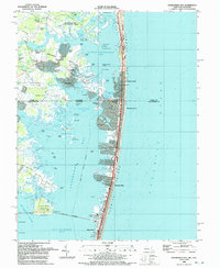
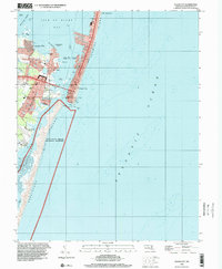 1998 Ocean City2000 Print · USGSOcean City and the Maryland coast are captured here in the late 1990s, showing the dense development of the barrier island alongside protected shorelines. Trace the urban grid from the Boardwalk to the Ocean City Inlet, or locate mainland landmarks like Captains Hill and the Ocean City Airport.
End of results
Showing maps 1-6 of 6
Top cities of Worcester County
- Ocean Pines historical maps
- Ocean City historical maps
- West Ocean City historical maps
- Pocomoke City historical maps
- Berlin historical maps
- Snow Hill historical maps
Frequently asked questions
- What are the different types of historical maps available for Worcester County?
- What is the oldest map of Worcester County?
- Where can I purchase historical maps of Worcester County for my home or office?
- Where can I download high-res historical maps of Worcester County?
- Are there historical topographic maps available for Worcester County?
- Is there historical aerial imagery available for Worcester County?
- Where are historical maps of Worcester County sourced from?