Old Maps of Worcester County, Maryland for Metal Detecting
Plan your next treasure hunt with 170 historic maps of Worcester County. Find old homesites, ghost towns, trails, and gathering spots that may be lost to time — perfect for identifying promising metal detecting locations.
- Locate forgotten sites: Uncover places like long-lost settlements, abandoned rail lines, or gathering spots.
- Plan better hunts: Use map overlays combined with LiDAR or satellite views to narrow in on historically rich areas.
- Made for detectorists: Thousands of hobbyists use these maps to discover relics, coins, and hidden history.
Use these historic maps to boost your research and find new opportunities beneath the surface of Worcester County.
Worcester County, MD maps
(170)- 1901 Map of Snow Hill
 1901 Snow Hill1901 Print · USGSSnow Hill and the surrounding Worcester County wetlands are captured at the opening of the twentieth century, when the Pocomoke River was a vital Steamboat Route. Researchers can trace the Waterman culture through historic sites like Public Landing and the railway hubs at Girdletree and Stockton.4 unique versions available
 - 1901 Map of Salisbury
 1901 Salisbury1901 Print · USGSWicomico County at the turn of the century centered on the steamboat and rail traffic through Salisbury. Trace historic family-named locations and rural infrastructure like Fooks School, Minksville, and the steam route at Shad Pt.4 unique versions available
 - 1901 Map of Green Run
 1901 Green Run1901 Print · USGSThe Maryland and Virginia coastline at the start of the century was a land of life-saving stations and isolated landings. Trace the maritime heritage of the barrier islands through North Beach L.S.S. and the commercial roots of Scotts Landing.4 unique versions available
 - 1901 Map of Ocean City
 1901 Ocean City1901 Print · USGSThe Maryland and Delaware coastlines were still largely defined by maritime labor and new rail lines at the turn of the century. You can trace the early streets of Ocean City and Berlin or locate landmarks like the Fenwick Island Lighthouse and Muskrattown.5 unique versions available
 - 1902 Map of Pittsville
 1902 Pittsville1902 Print · USGSEastern Shore life at the turn of the century is centered on the Baltimore Chesapeake and Atlantic rail line and the Pocomoke River. Genealogists can locate family-named sites like Tilghman Pond and Hearns or trace the old rail stop at Ironshire Station.4 unique versions available
 - 1938 Map of Green Run, 1960 Print
 1938 Green Run1960 Print · USGSAssateague Island and the Delmarva coast appear here in the late 1930s, showing a landscape of maritime outposts and undeveloped barrier beaches. Researchers can trace the early locations of North Beach and Green Run Inlet Coast Guard Stations.
 - 1942 Map of Ocean City
 1942 Ocean City1942 Print · USGSThe Maryland and Delaware coastline at the onset of the 1940s reveals a region of tidal bays and rail-dependent coastal towns. Genealogists and historians can trace family roots in early settlements like Berlin, Sinepuxent, and Bishopville or locate maritime landmarks including Fenwick Island Lighthouse.2 unique versions available
 - 1942 Map of Kingston, 1962 Print
 1942 Kingston1962 Print · USGSSomerset County's Eastern Shore landscapes are captured here during the 1940s, showing a world of river-fed marshes and rural crossroads. Genealogists can trace family landmarks at Pauls Corner or locate historic pulpits like Holly Grove Ch and Union Ch.2 unique versions available
 - 1942 Map of Ninepin, 1962 Print
 1942 Ninepin1962 Print · USGSThe lowlands of Maryland's Eastern Shore are captured in the early 1940s, highlighting a landscape of extensive wetlands and drainage ditches. Researchers can trace rail-era sites like Ironshire Sta and local gathering spots such as Mt Pleasant Ch and Adkins Pond.
 - 1942 Map of Snow Hill, 1962 Print
 1942 Snow Hill1962 Print · USGSSnow Hill and the winding Pocomoke River are captured in the early 1940s, showing a landscape of state forests and riparian landings. Genealogists and historians can trace the Pennsylvania rail line or locate rural landmarks like the Nassawango Ch and the historic Furnace site.
 - 1942 Map of Ocean City, 1962 Print
 1942 Ocean City1962 Print · USGSMaryland's Atlantic coast is seen here during the early years of the Second World War as the resort town began its modern expansion. Genealogists and historians can trace the early layout of Ocean City and landmarks like the Coast Guard Sta and Ocean City Inlet.
 - 1942 Map of Wango, 1962 Print
 1942 Wango1962 Print · USGSThe Wicomico and Worcester County line ran through a landscape of managed wetlands and experimental timber lands during the early 1940s. Genealogists and historians can trace rural life through sites like Powellville, St Johns Cem, and Mt Zion Ch.
 - 1942 Map of Tingles Island, 1962 Print
 1942 Tingles Island1962 Print · USGSThe Worcester County coastline at the start of the 1940s reveals a maritime landscape of shifting sands and tidal marshes. Researchers can trace the early footprint of the Coast Guard Sta on Assateague Island or the intricate channels of Tingles Narrows.
 - 1942 Map of Wesley, 1962 Print
 1942 Wesley1962 Print · USGSCoastal Worcester County at the start of the 1940s reveals a landscape of tidal necks and railroad hamlets. Genealogists and historians can trace family locations near Basket Switch, Snow Hill Landing, and the rural Mt Wesley Ch.
 - 1942 Map of Whaleysville, 1962 Print
 1942 Whaleysville1962 Print · USGSThe Maryland and Delaware borderlands were defined by the rail-and-water economy during the early 1940s. Genealogists and local historians can trace the foundations of communities like Whaleysville and Willards, along with rural landmarks like Pulletts Chapel and Newhope Cem.3 unique versions available
 - 1942 Map of Dividing Creek, 1962 Print
 1942 Dividing Creek1962 Print · USGSMaryland's Eastern Shore during the early 1940s is defined here by the winding marshlands of Dividing Creek and the small crossroads that sustained rural life. Genealogists can locate family landmarks like Friendship Ch, Adkinson Sch, and the quiet settlement of Whiteburg.
 - 1942 Map of Salisbury, 1962 Print
 1942 Salisbury1962 Print · USGSMaryland's Eastern Shore hub of Salisbury and the nearby settlement of Fruitland are seen here in the early 1940s. Genealogists and historians can trace rail routes like the Pennsylvania RR and find rural landmarks like St Lukes Ch and the Wicomico Orphanage.2 unique versions available
 - 1943 Map of Snow Hill
 1943 Snow Hill1943 Print · USGSSnow Hill and the surrounding Worcester County wetlands are captured here during the early years of the war. Genealogists and historians can trace the Pennsylvania RR line to sites like Scarboro, Nassawango Church, and the river landings at Mattaponi Landing.
 - 1943 Map of Ninepin
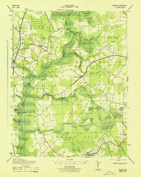 1943 Ninepin1943 Print · USGSWorcester County is characterized by its vast swamp systems and small rail-side hamlets in the years following the Great Depression. Genealogists and local historians can trace family locations near Mt Pleasant Church or follow the old Pennsylvania Railroad line through Queponco Sta and Newark.
 - 1943 Map of Selbyville
 1943 Selbyville1943 Print · USGSDelaware and Maryland borderlands come to life in this mid-century survey of the Selbyville area, showing the region just as wartime mapping efforts reached their peak. Genealogists can trace family footprints through historic centers like Bishopville, Showell, and St Martins Church.2 unique versions available
 - 1943 Map of Boxiron
 1943 Boxiron1943 Print · USGSThe Maryland-Virginia borderlands are captured here during the mid-century, showing a landscape of tidal marshes and remote coastal landings. Researchers can trace historic access points like George Island Landing and family-named features such as Robbins Tump or Purnell Pond.
 - 1943 Map of Dividing Creek
 1943 Dividing Creek1943 Print · USGSThe rural borderlands of Somerset and Worcester Counties are captured here during the early 1940s. Genealogists and local historians can trace family locations near Oakville and West, or locate rural landmarks like Olivet Cem and Ridgehill School.
 - 1943 Map of Whittington Point
 1943 Whittington Point1943 Print · USGSAssateague Island and the surrounding waters are captured during the war years, when coastal security was a high priority. Genealogists and historians can trace the state border from the Boundary Monument or locate maritime landmarks like Scotts Landing and Pope Island Coast Guard Station.
 - 1943 Map of Berlin
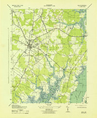 1943 Berlin1943 Print · USGSCoastal Worcester County during the war years shows a landscape of strategic rail junctions and tidewater necks. Genealogists can locate family landmarks like Buckingham Cem, the Newbay Ferry, and the military grounds at Camp Decatur.2 unique versions available
 - 1943 Map of Salisbury
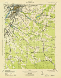 1943 Salisbury1943 Print · USGSWicomico County at the height of the war years reveals a bustling Salisbury and the surrounding agricultural tidewater districts. Researchers can trace historic family properties near Nassawango Church, Mt Hermon, and along the Pennsylvania Railroad corridor.
Showing maps 1-25 of 170
Top cities of Worcester County
- Ocean Pines historical maps
- Ocean City historical maps
- West Ocean City historical maps
- Pocomoke City historical maps
- Berlin historical maps
- Snow Hill historical maps
Frequently asked questions
- What are the different types of historical maps available for Worcester County?
- What is the oldest map of Worcester County?
- Where can I purchase historical maps of Worcester County for my home or office?
- Where can I download high-res historical maps of Worcester County?
- Are there historical topographic maps available for Worcester County?
- Is there historical aerial imagery available for Worcester County?
- Where are historical maps of Worcester County sourced from?