2020s Maps of Worcester County, Maryland
Explore 18 historic maps of Worcester County from the 2020s. These maps offer a rare glimpse into what life looked like during the 2020s — showing old roads, neighborhoods, homes, and landmarks that have changed or disappeared over time.
Whether you're researching your family's past, planning a metal detecting trip, or studying how Worcester County's landscape evolved across the 2020s, these high-resolution maps are a powerful tool for exploring the history of this region.
- Focus on a specific era: All maps on this page are from the 2020s, giving you a focused view of this time period.
- See what’s changed: Compare century-old streets, trails, and buildings to today's modern landscape using overlays and satellite layers.
- Research with precision: Use these maps for genealogy, historical research, land use analysis, or educational projects.
- View, download, or print: Maps are fully viewable online in high resolution, and can be downloaded or printed for your own records.
Start exploring Worcester County's history through authentic maps from the 2020s. This is your window into the past.
Worcester County, MD maps
(18)- 2022 Map of Hallwood, 2022 Print
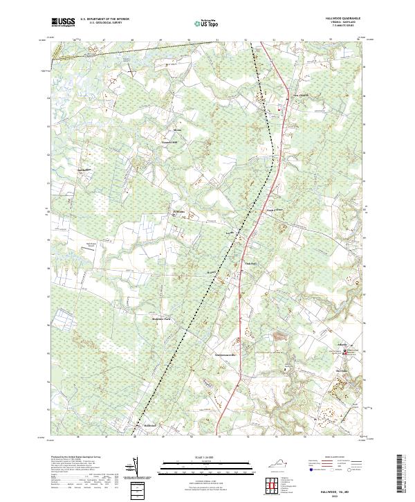 2022 Hallwood2022 Print · USGSThe Virginia and Maryland border region of the Eastern Shore is captured here in a period of rural continuity. Researchers can trace family roots through the John W Taylor Cem, locate the site of Tunnels Mill, or explore the small settlements of New Church and Temperanceville.
 - 2023 Map of Ninepin Branch, 2023 Print
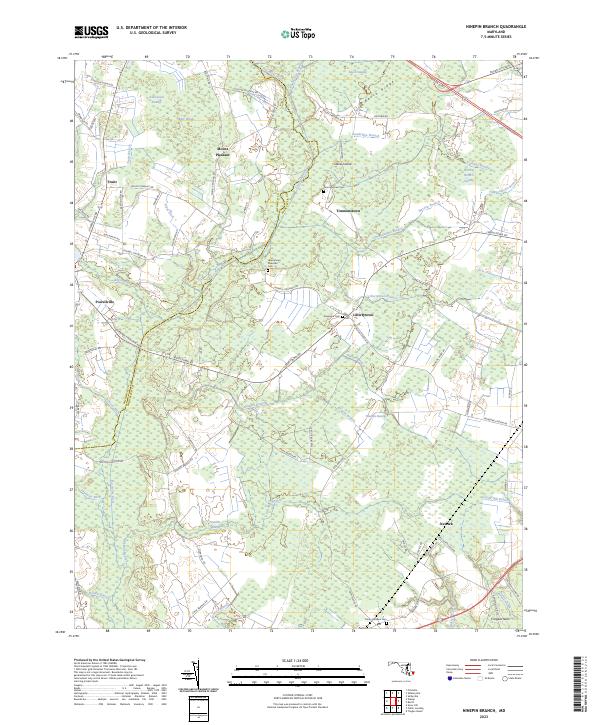 2023 Ninepin Branch2023 Print · USGSMaryland's Eastern Shore interior remains a landscape of historic wetlands and rural crossings at the edge of the Wicomico and Worcester county lines. Researchers can trace ancestral locations at Timmonstown Cem, Libertytown, and old family landmarks along Ninepin Branch.
 - 2023 Map of Kingston, 2023 Print
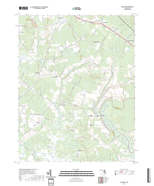 2023 Kingston2023 Print · USGSMaryland's Eastern Shore is captured here in a period of modern stability, showing the rural reaches of Somerset County. Researchers can pinpoint specific family history sites like Saint Marks Episcopal Cem or trace the small-town layouts of Kingston and Westover.
 - 2023 Map of Assawoman Bay, 2023 Print
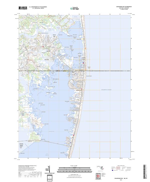 2023 Assawoman Bay2023 Print · USGSThe coastal border between Maryland and Delaware comes into focus during this period of maritime development. Genealogists and historians can trace the street grids of Ocean City and Maryland Beach or explore inland reaches like Swann Keys and Mattapany.
 - 2023 Map of Wango, 2023 Print
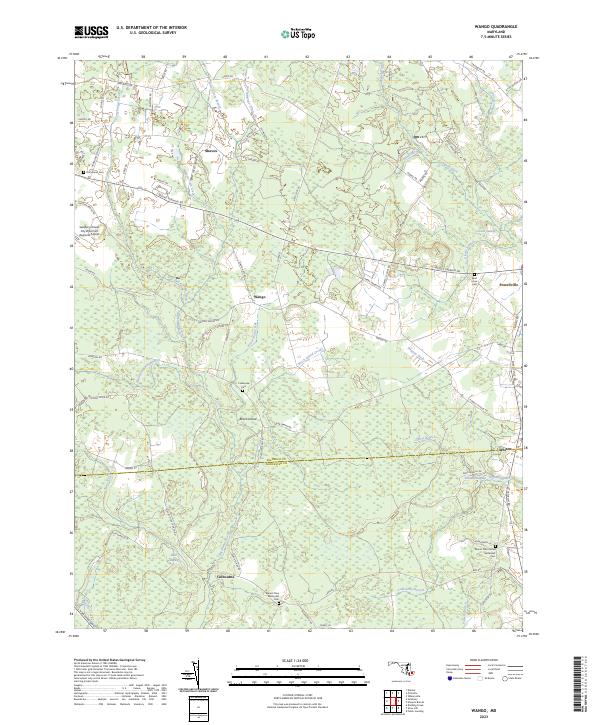 2023 Wango2023 Print · USGSThe Maryland coastal plain on the Wicomico and Worcester county line is captured in this modern survey. Researchers can trace rural lineages at Hammond Cem and Saint Johns Cem or explore the drainage of Nassawango Creek.
 - 2023 Map of Selbyville, 2023 Print
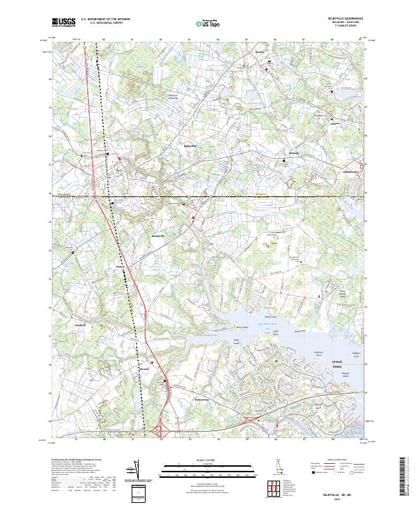 2023 Selbyville2023 Print · USGSThe Delaware-Maryland border country comes into focus in this recent survey of Sussex and Worcester counties. Researchers can trace family history through a dense network of local landmarks, including the Old Sound Methodist Church, Showell School, and Red Men Cem.
 - 2023 Map of Whittington Point, 2023 Print
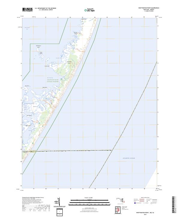 2023 Whittington Point2023 Print · USGSAssateague Island stands as a preserved coastal wilderness at the Maryland-Virginia border in this recent survey. Researchers can trace the shoreline geography of Chincoteague National Wildlife Refuge, naming points like Whittington Point and Pirate Islands.
 - 2023 Map of Ocean City, 2023 Print
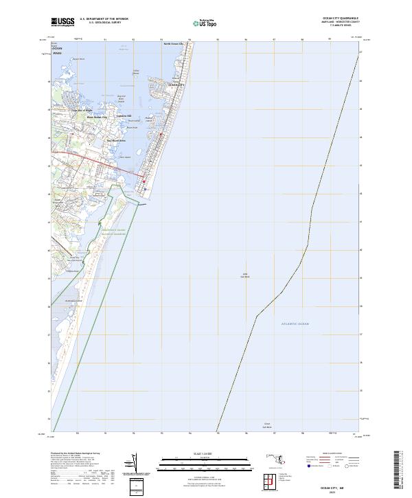 2023 Ocean City2023 Print · USGSMaryland's famous barrier island resorts and the protected southern coast are captured here at the start of the 2020s. Trace the transition from the dense streets of Ocean City to the quiet marshes of Assateague Island National Seashore and the mainland community of Ocean Pines.
 - 2023 Map of Dividing Creek, 2023 Print
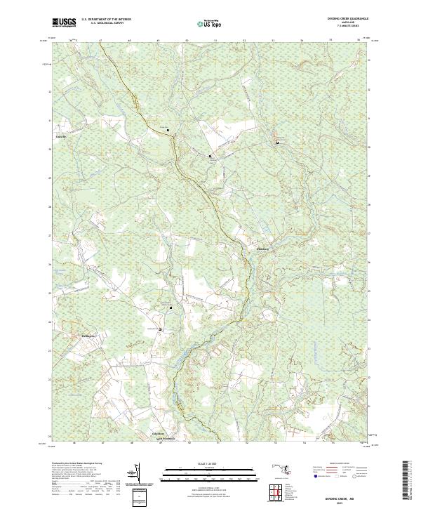 2023 Dividing Creek2023 Print · USGSThe borderlands of Somerset and Worcester Counties are revealed in this modern survey, showing a landscape defined by Dividing Creek. Genealogists can trace family sites at Nazareth Church Cem or the settlements of Oakville and Cokesbury.
 - 2023 Map of Snow Hill, 2023 Print
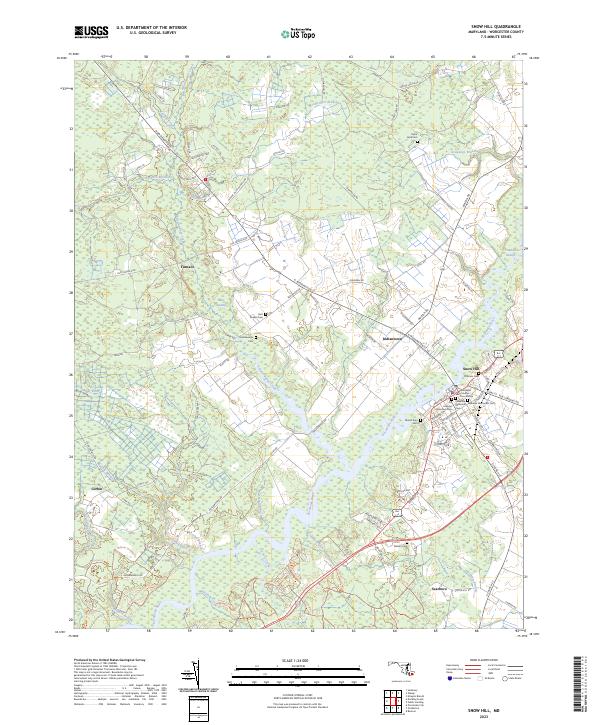 2023 Snow Hill2023 Print · USGSSnow Hill and the Pocomoke River valley are captured in this contemporary look at one of Maryland's oldest colonial-era seats. Researchers can locate historic burial grounds like Ebenezer Methodist Cem and trace old routes through Indiantown and Bear Swamp.
 - 2023 Map of Tingles Island, 2023 Print
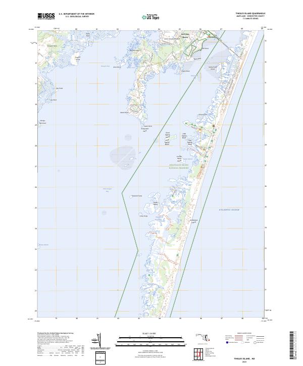 2023 Tingles Island2023 Print · USGSAssateague Island and the Worcester County coastline are shown here in detail during the early 2020s. Researchers can trace the modern road networks near Lower Sinepuxent Neck or locate specific marsh features like Tingles Island and Robins Marsh.
 - 2023 Map of Girdletree, 2023 Print
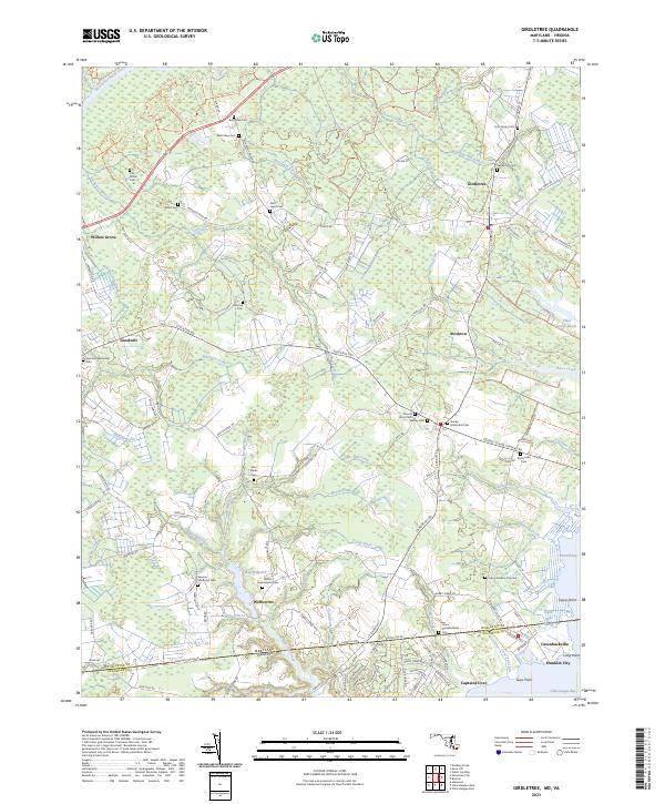 2023 Girdletree2023 Print · USGSThe Maryland and Virginia state line comes to life in this coastal survey, showing the interconnected communities of the Eastern Shore in the early twenty-first century. Researchers can trace numerous local family burial sites like Beth Eden Cem and Mount Hope Baptist Cem or explore the waterfront history of Franklin City.
 - 2023 Map of Whaleyville, 2023 Print
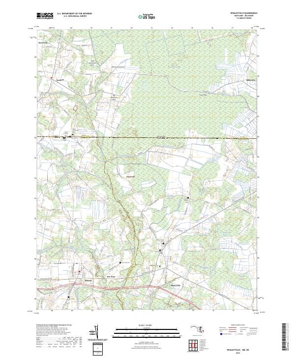 2023 Whaleyville2023 Print · USGSThe Maryland-Delaware borderlands near Whaleyville are shown here in modern detail, highlighting a landscape defined by the Cypress Swamp. Genealogists can locate family burial sites like the Twilley Family Cem and Littleton Family Cem or the historic Bethel Church.
 - 2023 Map of Salisbury, 2023 Print
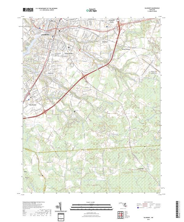 2023 Salisbury2023 Print · USGSThe Delmarva landscape around Salisbury comes into focus in this recent survey, capturing the city’s growth alongside its riverine heritage. Researchers can trace local history through sites like the Wicomico County Courthouse, Salisbury University, and the waters of Coulbourn Millpond.
 - 2023 Map of Public Landing, 2023 Print
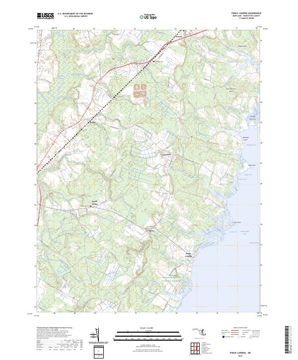 2023 Public Landing2023 Print · USGSCoastal Worcester County is captured in this recent survey as it meets the shores of Chincoteague Bay. Researchers can trace family history through sites like Old Trinity Cem and Ebenezer Cem or explore the landscape around Public Landing and Cedartown.
 - 2023 Map of Boxiron, 2023 Print
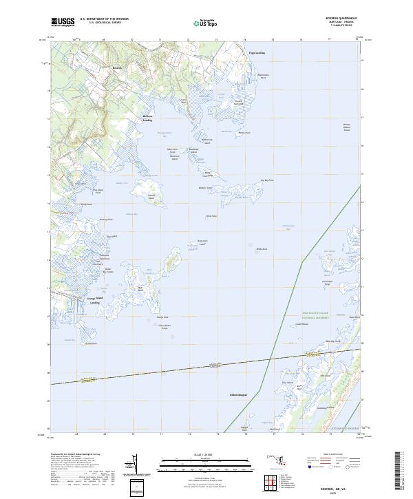 2023 Boxiron2023 Print · USGSCoastal Maryland and Virginia meet in this coastal study of the marshes and landings surrounding Chincoteague Bay. Genealogists and local historians can trace family-named sites like Boxiron, Figgs Landing, and the many islands including Mills Island and Hog Island.
 - 2023 Map of Berlin, 2023 Print
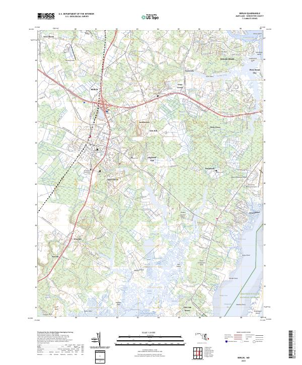 2023 Berlin2023 Print · USGSCoastal Worcester County in the early 2020s shows the continued growth of Berlin and Ocean Pines against a backdrop of tidal creeks and bays. Genealogists and local historians can trace family locations at Tyree Cem or follow the old routes to the Newbay Ferry.
 - 2023 Map of Pocomoke City, 2023 Print
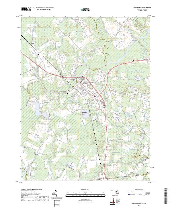 2023 Pocomoke City2023 Print · USGSPocomoke City and the lower Eastern Shore are mapped here in the early twenty-first century, showing the intersection of river commerce and coastal wetlands. Genealogists can trace a remarkable number of historic burial grounds like Pitts Creek Presbyterian Cem and Saint Marys Episcopal Cem.
End of results
Showing maps 1-18 of 18
Top cities of Worcester County
- Ocean Pines historical maps
- Ocean City historical maps
- West Ocean City historical maps
- Pocomoke City historical maps
- Berlin historical maps
- Snow Hill historical maps
Frequently asked questions
- What are the different types of historical maps available for Worcester County?
- What is the oldest map of Worcester County?
- Where can I purchase historical maps of Worcester County for my home or office?
- Where can I download high-res historical maps of Worcester County?
- Are there historical topographic maps available for Worcester County?
- Is there historical aerial imagery available for Worcester County?
- Where are historical maps of Worcester County sourced from?