Old Maps of Nantucket, Massachusetts for Academic Research
Study the evolution of Nantucket with 83 high-resolution historic maps. Whether you're teaching, researching, or modeling changes in land use, these maps provide essential visual documentation of urban, environmental, and geographic change.
- Analyze long-term change: Track patterns in development, transportation, and natural features.
- Ideal for environmental or urban studies: Support academic projects with primary historical map data.
- Use in the classroom or lab: Educators and researchers rely on these maps to bring historical context to life.
These maps are a powerful tool for teaching, research, and visualizing how Nantucket has changed over the decades.
Nantucket, MA maps
(83)- 1887 Map of Muskeget
 1887 Muskeget1887 Print · USGSThe western reaches of Nantucket and its offshore islands are surveyed here in the late nineteenth century. Trace maritime history through landmarks like Maddaket Harbor, the isolated Muskeget Id., and the Cross Rip Shoal Light Ship.
 - 1889 Map of Muskeget
 1889 Muskeget1889 Print · USGSThe western reaches of Nantucket and its outlying islands are detailed here in the late nineteenth century. Maritime researchers can trace the intricate tidal channels of Maddequet Harbor and the isolated shorelines of Muskeget Id. and Tuckernuck Id..
 - 1889 Map of Nantucket
 1889 Nantucket1889 Print · USGSNantucket Island at the close of the 1880s reveals a maritime community before the automobile, connected by the narrow-gauge Nantucket Railroad. Genealogists and historians can trace old lineages through landmarks like Foulger's Hill and the remote outpost at Siasconsett.
 - 1893 Map of Nantucket
 1893 Nantucket1893 Print · USGSNantucket in the late Victorian era is captured here as a maritime and burgeoning resort community. Genealogists and historians can trace the early Nantucket Railroad route or locate the Life Saving Station and Sankaty Head Lt. along the shore.2 unique versions available
 - 1893 Map of Muskeget
 1893 Muskeget1893 Print · USGSNantucket's western islands and shoals are frozen in time during the late Victorian era. Maritime historians can trace the old coastal configuration of Tuckernuck Id. and its ponds, or explore the tidal creeks near Maddequet Harbor and Eel Point.
 - 1899 Map of Muskeget
 1899 Muskeget1899 Print · USGSNantucket's western reaches and isolated outer islands appear here in the late nineteenth century as maritime commerce relied on light ships and life-saving crews. Trace early coastal geography at Maddaket, the lonely L.S.S. on Muskeget Id., and the ponds of Tuckernuck Id.5 unique versions available
 - 1901 Map of Nantucket
 1901 Nantucket1901 Print · USGSNantucket Island at the start of the twentieth century shows a landscape tied to the sea and the rails. Trace the path of the Nantucket Central R. R. connecting Nantucket town to the coastal village of Siasconset.5 unique versions available
 - 1942 Map of Nantucket, 1943 Print
 1942 Nantucket1943 Print · USGSNantucket and Chappaquiddick Islands are captured here during the early years of the Second World War. Genealogists and historians can trace the early roads to Siasconset, the Steamship Ferry route, and the locations of Madd Aket LSS and Coskata LSS.
 - 1944 Map of Tuckernuck Island
 1944 Tuckernuck Island1944 Print · USGSThe isolated outposts of Nantucket Sound are captured here during the 1940s, showing the fragile geography of Tuckernuck Island and Muskeget Island. Researchers can trace the old path of Smith Point Road and the coastal contours of Maddeket Harbor.3 unique versions available
 - 1945 Map of Nantucket
 1945 Nantucket1945 Print · USGSNantucket during the mid-forties reveals a coastal landscape of tight-knit town streets and sprawling marshlands. Genealogists and historians can trace old property lines and landmarks from Old North Cem to the outskirts of Maddaket and Surfside.2 unique versions available
 - 1945 Map of Siasconset
 1945 Siasconset1945 Print · USGSNantucket's eastern shore and interior moors are captured here in the mid-1940s, documenting the island's road and rail history. Trace the Abandoned Railroad Grade past the large Cranberry Bog to the coastal village of Siasconset.2 unique versions available
 - 1945 Map of Great Point
 1945 Great Point1945 Print · USGSThe northern tip of Nantucket is captured during the mid-1940s, showing the slender barrier beaches of Great Point. Researchers can locate maritime landmarks like the Coskata C G Station and the secluded Coskata Pond.2 unique versions available
 - 1947 Map of Providence, 1948 Print
 1947 Providence1948 Print · USGSSouthern New England is captured in the mid-1940s, showing a landscape defined by busy industrial ports and expanding military installations. Researchers can trace the rail lines of the N.Y. N.H. & H. RR or locate coastal defenses like Fort Adams and Quonset Point.5 unique versions available
 - 1948 Map of Providence, 1951 Print
 1948 Providence1951 Print · USGSSouthern New England’s coastal reaches are captured here in the late 1940s, from the industrial heart of Providence to the tip of Provincetown. Genealogists and historians can trace rail lines like the Central Vermont Railway and locate active military sites such as Otis Air Force Base and Fort Rodman.
 - 1951 Map of Tuckernuck Island
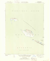 1951 Tuckernuck Island1951 Print · USGSNantucket's western outposts of Tuckernuck and Muskeget Islands are captured here in the early fifties, showing a landscape of shifting shoals and isolated ponds. Trace the old winding path of Smith Point Road or locate the solitary Tower on Muskeget Island.3 unique versions available
 - 1951 Map of Great Point
 1951 Great Point1951 Print · USGSNantucket's northern reaches are captured here in the early fifties, showing the precarious coastal spit where the sound meets the sea. Coastal researchers can trace the mid-century shoreline at Great Point and the sheltered waters of Coskata Pond.4 unique versions available
 - 1951 Map of Siasconset
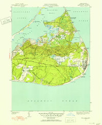 1951 Siasconset1951 Print · USGSNantucket's eastern shore is captured in the early fifties as the island's maritime traditions met new aviation and navigation technology. Trace the Abandoned Railroad Grade into Siasconset or locate the old Coast Guard Loran Station near Tom Nevers Head.4 unique versions available
 - 1951 Map of Nantucket
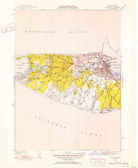 1951 Nantucket1951 Print · USGSMid-century Nantucket Island comes to life here, showing the town's historic core and the wild western shore just after the war. Researchers can trace ancestral plots in Old North Cem, locate the Cyrus Peirce Sch, or explore the dunes near Eel Point.5 unique versions available
 - 1957 Map of Providence
 1957 Providence1957 Print · USGSCoastal New England at the height of the mid-century era shows a landscape shaped by maritime industry and Cold War defense. Genealogists and historians can trace the reach of the New York, New Haven & Hartford RR and locate legacy sites like Fort Adams and Quonset Point Naval Air Station.
 - 1958 Map of Providence
 1958 Providence1958 Print · USGSThe Rhode Island and Massachusetts coastlines are shown in detail during the late 1950s, from the urban cores to the tips of the islands. Researchers can trace the mid-century footprint of Quonset Point Naval Air Station, the defense works at Fort Adams, and the rail network of the New York, New Haven and Hartford RR.
 - 1963 Map of Providence
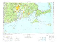 1963 Providence1963 Print · USGSSouthern New England's coastal and industrial heartland is captured here in the early sixties, from the Rhode Island mainland to the far reaches of the Cape. Researchers can trace mid-century growth in Providence or locate landmarks on Marthas Vineyard and Nantucket Island.
 - 1972 Map of Tuckernuck Island, 1973 Print
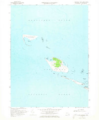 1972 Tuckernuck Island1973 Print · USGSNantucket's western outposts are frozen in time during the early seventies, showing the shifting shoals of the sound. Trace the coastal landforms of Tuckernuck Island and Esther Island, including the Landing Strip and Madaket Harbor.3 unique versions available
 - 1972 Map of Nantucket, 1973 Print
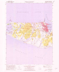 1972 Nantucket1973 Print · USGSNantucket Island's coastal and village life is captured here in the early seventies, from the busy wharves to the quiet ponds of the interior. Researchers can trace historic family connections at the Old Settlers Graves, Brant Pt Lighthouse, and Academy Hill Sch.4 unique versions available
 - 1972 Map of Great Point, 1973 Print
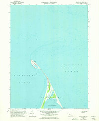 1972 Great Point1973 Print · USGSNantucket Island's northern tip is captured in the early seventies, showing a landscape shaped by shifting sands and maritime history. Trace the solitary Jeep Trail leading past Coskata Pond to the iconic Lighthouse at Great Point.3 unique versions available
 - 1972 Map of Siasconset, 1973 Print
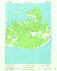 1972 Siasconset1973 Print · USGSNantucket's eastern shore comes to life in the early seventies, showing the transition from historic maritime hamlets to modern island infrastructure. Trace the Old Railroad Grade, locate the Sankaty Head lighthouse, and explore the interior bogs near Gibbs Pond.5 unique versions available
Showing maps 1-25 of 83
Top cities of Nantucket
Frequently asked questions
- What are the different types of historical maps available for Nantucket?
- What is the oldest map of Nantucket?
- Where can I purchase historical maps of Nantucket for my home or office?
- Where can I download high-res historical maps of Nantucket?
- Are there historical topographic maps available for Nantucket?
- Is there historical aerial imagery available for Nantucket?
- Where are historical maps of Nantucket sourced from?