1950s Maps of Worcester County, Massachusetts
Explore 45 historic maps of Worcester County from the 1950s. These maps offer a rare glimpse into what life looked like during the 1950s — showing old roads, neighborhoods, homes, and landmarks that have changed or disappeared over time.
Whether you're researching your family's past, planning a metal detecting trip, or studying how Worcester County's landscape evolved across the 1950s, these high-resolution maps are a powerful tool for exploring the history of this region.
- Focus on a specific era: All maps on this page are from the 1950s, giving you a focused view of this time period.
- See what’s changed: Compare century-old streets, trails, and buildings to today's modern landscape using overlays and satellite layers.
- Research with precision: Use these maps for genealogy, historical research, land use analysis, or educational projects.
- View, download, or print: Maps are fully viewable online in high resolution, and can be downloaded or printed for your own records.
Start exploring Worcester County's history through authentic maps from the 1950s. This is your window into the past.
Worcester County, MA maps
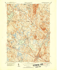
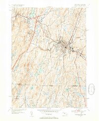
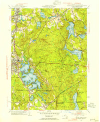
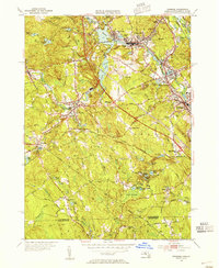
(45)- 1950 Map of Townsend, 1952 Print
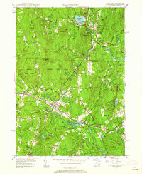 1950 Townsend1952 Print · USGSMid-century Middlesex County and southern New Hampshire centers on the rail-and-river corridor of Townsend. Genealogists and historians can trace the Boston and Maine Railroad through Townsend Harbor and locate family sites like Hillside Cem and Barker Hill.2 unique versions available
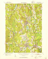
 - 1950 Map of Clinton, 1952 Print
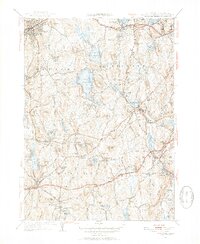
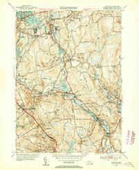
 1950 Clinton1952 Print · USGSMid-century Worcester County comes to life here, showing the busy industrial valley of the Nashua River and the expanding Wachusett Reservoir shoreline. Trace the footprints of South Lancaster institutions and vanished landmarks like the Bolton Airport and Ponakin Mill.4 unique versions available
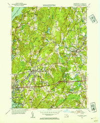
 - 1950 Map of Ashby, 1952 Print
 1950 Ashby1952 Print · USGSThe Massachusetts-New Hampshire borderlands near Ashby are captured in the mid-twentieth century as the region balanced its rural character with state forest expansion. Genealogists can locate family sites near Glenwood Cem, the Lyman Sch, and the old rail stop at Mason Sta.4 unique versions available
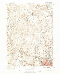
 - 1950 Map of Sterling, 1952 Print
 1950 Sterling1952 Print · USGSThe Sterling area in the early fifties shows a landscape shaped by the Wachusett Reservoir and the Boston and Maine Railroad. Trace family history at Legge Cem, visit the Sterling Camp Grounds, or locate the Butterick Sch.4 unique versions available
 - 1950 Map of Ashburnham, 1952 Print
 1950 Ashburnham1952 Print · USGSMid-century Worcester County comes to life as a landscape of interconnected glacial lakes and upland ridges during the postwar years. Genealogists and local historians can trace the foundations of Ashburnham, Lane Village, and the remote Old North Ashburnham Sta.4 unique versions available
 - 1950 Map of Hudson, 1958 Print
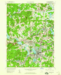
 1950 Hudson1958 Print · USGSMid-century Middlesex and Worcester counties come to life as the industrial Assabet River valley meets rural Bolton and Stow. Trace the Boston and Maine Railroad past Gleasondale Sta or find family roots at Old Quaker Cem and Bromfield Academy.3 unique versions available
 - 1950 Map of Shirley, 1958 Print
 1950 Shirley1958 Print · USGSMid-century development spreads through the Worcester and Middlesex county lines during this era of growth. Genealogists and local historians can trace family plots in St Cecelia Cemetery or locate old school sites like the White Sch and the Industrial School.
 - 1950 Map of Ayer, 1958 Print
 1950 Ayer1958 Print · USGSMiddlesex and Worcester counties are shown here at mid-century, highlighting the massive expansion of the Fort Devens military footprint. Researchers can trace the layout of Shaker Village, find the Harvard University Observatory, and locate the Groton School.
 - 1950 Map of Paxton, 1958 Print
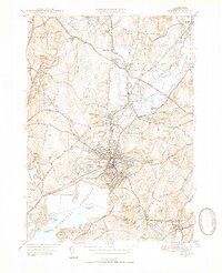
 1950 Paxton1958 Print · USGSThe hill country of central Massachusetts is revealed here at mid-century, featuring the intersection of industrial villages and municipal water systems. Genealogists and historians can locate legacy sites like Upper Wire Village, the State Sanitorium, and Quaker Cem.2 unique versions available
 - 1950 Map of Framingham, 1959 Print
 1950 Framingham1959 Print · USGSMid-century Framingham and Sudbury are shown here during a decade of rapid expansion and highway development. Genealogists can locate family landmarks like Wayside Inn, Marys Lamb Sch, and Edgell Grove Cem among the growing suburban tracts.
 - 1952 Map of Quabbin Reservoir, 1953 Print
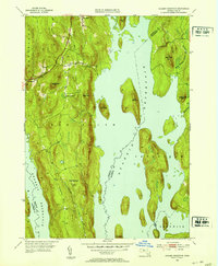 1952 Quabbin Reservoir1953 Print · USGSCentral Massachusetts in the early fifties reveals the massive transformation of the Swift River Valley following the reservoir's creation. Genealogists and historians can trace the surviving portions of North Prescott and Cooleyville or locate the site of the Baffle Dam.3 unique versions available
 - 1952 Map of Winsor Dam, 1953 Print
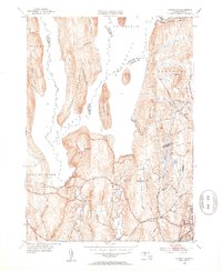 1952 Winsor Dam1953 Print · USGSHampshire and Worcester Counties are seen here in the early fifties following the transformative creation of the reservoir. Genealogists and researchers can trace the new shoreline and legacy landmarks like Winsor Dam, Quabbin Park, and West Ware.4 unique versions available
 - 1952 Map of North Brookfield, 1954 Print
 1952 North Brookfield1954 Print · USGSCentral Massachusetts in the early fifties reveals a landscape of high hills and tight-knit villages. Genealogists and historians can trace family plots at Green Hollow Cem, locate the grounds of St Josephs Abbey, or follow old routes like the Old Turnpike Road.4 unique versions available
 - 1952 Map of Wales, 1954 Print
 1952 Wales1954 Print · USGSThe rural borders of Massachusetts and Connecticut are captured here in the early fifties, showcasing a landscape of dense state forests and quiet reservoirs. Trace family sites near St Anns Cem or explore the mid-century layouts of Wales, Holland, and Mashapaug.4 unique versions available
 - 1952 Map of Southbridge, 1954 Print
 1952 Southbridge1954 Print · USGSThe Quinebaug River valley in the early fifties shows a transition from industrial mill towns to the forested borderlands of Connecticut. Local researchers can trace family landmarks like Oak Ridge Cem, the historic Old Sturbridge Village, and the Notre Dame Sem.5 unique versions available
 - 1953 Map of Fitchburg
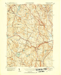
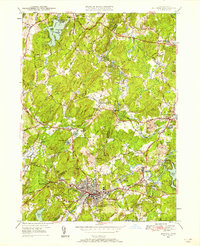
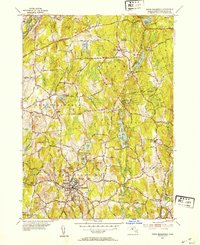
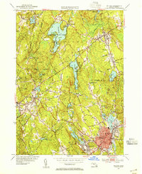
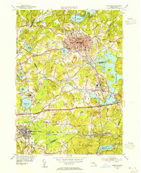
 1953 Fitchburg1953 Print · USGSMid-century Worcester County comes to life during a period of steady growth and established rail commerce. Local historians can trace family roots at Prospect Hill Cemetery or explore the development of Blackburne Village and the Fitchburg Leominster Airport.
 - 1953 Map of Holliston, 1954 Print
 1953 Holliston1954 Print · USGSMid-century Holliston and Medway are captured here just as the post-war era transformed these historic mill and rail towns. Local historians can trace the routes of the Boston & Albany RR, locate family plots in St Marys Cem, and find the old Braggville Sch.4 unique versions available
 - 1953 Map of Shrewsbury, 1954 Print
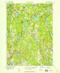
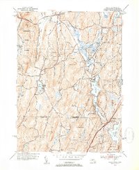
 1953 Shrewsbury1954 Print · USGSWorcester County during the mid-fifties shows a landscape of growing towns and significant public institutions between the Wachusett Reservoir and Northboro. Genealogists and researchers can locate the Grafton State Hospital, Pine Grove Cem, and the Lyman State Sch.3 unique versions available
 - 1953 Map of Blackstone, 1954 Print
 1953 Blackstone1954 Print · USGSThe industrial corridor between Mendon and Woonsocket comes alive in this mid-century survey of the Blackstone River valley. Local historians can trace the paths of the New York New Haven and Hartford railroad through family landmarks like the Chestnut Hill Meeting House and Draper Airfield.4 unique versions available
 - 1953 Map of Oxford, 1954 Print
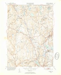
 1953 Oxford1954 Print · USGSSouthern Worcester County was a busy intersection of industry and nature in the early fifties. Trace the rail lines of the New York New Haven and Hartford and locate landmarks like the St Joseph Cem and the sprawling Lake Chaubunagungamaug.3 unique versions available
 - 1953 Map of Leicester, 1954 Print
 1953 Leicester1954 Print · USGSCentral Massachusetts in the early fifties showcases a landscape of mill towns and rail corridors. Trace family history at the Clara Barton Home or locate ancestors in Pine Grove Cem and Northside Cem.3 unique versions available
 - 1953 Map of Milford, 1955 Print
 1953 Milford1955 Print · USGSMilford and Hopkinton are shown in the early fifties, a time when rail lines still connected these growing Worcester County towns. Genealogists and local historians can locate St Marys Cath, trace the New York New Haven and Hartford RR, and explore family plots at Evergreen Cem.4 unique versions available
 - 1953 Map of Marlboro, 1955 Print
 1953 Marlboro1955 Print · USGSMid-century Worcester County was a bustling corridor of industry and education at the height of the rail era. Researchers can trace family homesteads near Maplewood Cem or explore the institutional grounds of Westborough State Hospital and St Marks Sch.4 unique versions available
 - 1953 Map of Uxbridge, 1955 Print
 1953 Uxbridge1955 Print · USGSThe Blackstone Valley villages of the mid-twentieth century are captured here alongside the rural borderlands of Rhode Island. Genealogists can trace family heritage through the Aldrich and Buffum cemeteries or locate the Tasseltop Sch.3 unique versions available
 - 1953 Map of Grafton, 1955 Print
 1953 Grafton1955 Print · USGSThe Blackstone River valley comes alive in the 1950s, showing a landscape of mill villages and established townships. Genealogists can trace family names through Riverside Cem, St Johns Ch, and the grounds of Grafton State Hospital.4 unique versions available
Showing maps 1-25 of 45
Top cities of Worcester County
- Worcester historical maps
- Leominster historical maps
- Fitchburg historical maps
- Shrewsbury historical maps
- Milford historical maps
- Gardner historical maps
See more
Frequently asked questions
- What are the different types of historical maps available for Worcester County?
- What is the oldest map of Worcester County?
- Where can I purchase historical maps of Worcester County for my home or office?
- Where can I download high-res historical maps of Worcester County?
- Are there historical topographic maps available for Worcester County?
- Is there historical aerial imagery available for Worcester County?
- Where are historical maps of Worcester County sourced from?