1980s Maps of Worcester County, Massachusetts
Explore 27 historic maps of Worcester County from the 1980s. These maps offer a rare glimpse into what life looked like during the 1980s — showing old roads, neighborhoods, homes, and landmarks that have changed or disappeared over time.
Whether you're researching your family's past, planning a metal detecting trip, or studying how Worcester County's landscape evolved across the 1980s, these high-resolution maps are a powerful tool for exploring the history of this region.
- Focus on a specific era: All maps on this page are from the 1980s, giving you a focused view of this time period.
- See what’s changed: Compare century-old streets, trails, and buildings to today's modern landscape using overlays and satellite layers.
- Research with precision: Use these maps for genealogy, historical research, land use analysis, or educational projects.
- View, download, or print: Maps are fully viewable online in high resolution, and can be downloaded or printed for your own records.
Start exploring Worcester County's history through authentic maps from the 1980s. This is your window into the past.
Worcester County, MA maps
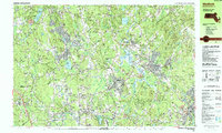
(27)- 1982 Map of Southbridge, 1983 Print
 1982 Southbridge1983 Print · USGSThe industrial Quinebaug River valley and its surrounding highlands are captured here in the early eighties as modernization reached the Massachusetts-Connecticut border. Researchers can trace family sites near St Marys Cem, navigate the ridges of Leadmine Mtn, and locate old village centers like Fiskdale and Sandersdale.2 unique versions available
 - 1982 Map of Uxbridge, 1984 Print
 1982 Uxbridge1984 Print · USGSThe Blackstone Valley at the start of the eighties shows a landscape of historic mill towns and river-driven industry. Researchers can trace family ties and civic growth through sites like the Chestnut Hill Meeting House, Northbridge High Sch, and Evergreen Cem.
 - 1982 Map of North Brookfield, 1984 Print
 1982 North Brookfield1984 Print · USGSWorcester County's rural character is on full display in the early 1980s, before modern suburban expansion altered the hills around North Brookfield. Genealogists and historians can trace family locations through numerous landmarks like St Josephs Abbey, Walnut Grove Cem, and the Eagle Hill Sch.2 unique versions available
 - 1982 Map of Webster, 1984 Print
 1982 Webster1984 Print · USGSCentral Massachusetts and the tri-state borderlands come into focus in the early eighties, centered on the industrial corridors of the French River. Genealogists can trace family sites at St Anthony Cem or locate the campus of Nichols College and the various mills of Webster.2 unique versions available
 - 1982 Map of Milford, 1984 Print
 1982 Milford1984 Print · USGSCentral Massachusetts in the early eighties reveals a landscape of industrial river towns and sprawling state forests. Genealogists and historians can trace the mill villages along the Blackstone River or locate old burial grounds like Indian Cem and Riverdale Cem.
 - 1982 Map of Warren, 1984 Print
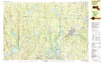
 1982 Warren1984 Print · USGSThe Quaboag River valley in the early eighties shows a landscape of industrial river towns and sprawling state parks. Local researchers can trace the rail lines of Conrail, find family plots at Pine Grove Cem, or locate landmarks like Steerage Rock.2 unique versions available
 - 1983 Map of Worcester South, 1984 Print
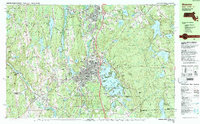
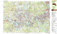
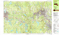
 1983 Worcester South1984 Print · USGSThe Worcester hills and southern suburbs are captured here in the early 1980s as the regional highway network matured. Researchers can trace historic family burial sites at Hope Cemetery and St Josephs Cem or locate institutional landmarks like Clark University.2 unique versions available
 - 1983 Map of Marlborough, 1984 Print
 1983 Marlborough1984 Print · USGSThe boroughs of Central Massachusetts are shown during a period of significant suburban growth in the early eighties. Genealogists and local historians can locate family plots in Mountain View Cemetery or trace the development around Marlborough Junction and the Westborough State Hospital.3 unique versions available
 - 1983 Map of Worcester North, 1984 Print
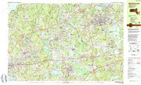
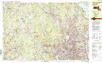 1983 Worcester North1984 Print · USGSNorth Worcester and its neighboring hill towns are shown in the early eighties as the region's academic and medical campuses expanded. Genealogists and local historians can trace the grounds of Assumption College, the Rural Cemetery, and the Rutland Heights Hospital.2 unique versions available
 - 1984 Map of Lowell
 1984 Lowell1984 Print · USGSThe Merrimack Valley industrial corridor is captured here in the mid-eighties, showing the interconnected growth of Lowell, Nashua, and Lawrence. Genealogists and historians can trace the paths of the Boston and Maine railroad or locate institutional landmarks like Merrimack College and the Fort Devens Military Reservation.
 - 1985 Map of Holyoke, 1986 Print
 1985 Holyoke1986 Print · USGSThe Pioneer Valley and surrounding uplands appear here in the mid-eighties, showing a landscape defined by the Connecticut River and modern highway expansion. Genealogists and historians can trace rail lines like the Central Vermont Railway and locate regional landmarks from Mount Tom State Reservation to the Quabbin Reservoir.2 unique versions available
 - 1985 Map of Boston, 1986 Print
 1985 Boston1986 Print · USGSThe Massachusetts urban core and its expanding suburbs are captured in the mid-eighties, showing the reach of the Mass Turnpike and Route 128. Genealogists and historians can trace the evolution of towns from Lexington to Waltham, locating landmarks like Harvard University and Minute Man National Historical Park.
 - 1986 Map of Keene
 1986 Keene1986 Print · USGSThe tri-state borderlands of the Connecticut River Valley come alive in this mid-eighties survey of southern Vermont, New Hampshire, and Massachusetts. Genealogists and historians can trace rail-era villages like Ashuelot and Millers Falls alongside landmarks like Marlboro College and Monadnock Mountain.3 unique versions available
 - 1987 Map of Framingham
 1987 Framingham1987 Print · USGSFramingham and the surrounding MetroWest towns are shown in the late eighties as a landscape of established educational campuses and busy rail corridors. Genealogists and local researchers can locate several historic burial grounds like Old Wayland Cem and Glenwood Cem, or trace the development around Lake Cochituate.2 unique versions available
 - 1987 Map of Medfield
 1987 Medfield1987 Print · USGSThe Charles River valley communities of Norfolk and Middlesex Counties reached a peak of suburban and institutional maturity during the 1980s. Local researchers can trace the footprint of the Medfield State Hospital, locate family plots in Lake Grove Cem, or follow the CONRAIL line through Gooch Corners and Millis.2 unique versions available
 - 1987 Map of Franklin
 1987 Franklin1987 Print · USGSFranklin and the Norfolk County borderlands are shown in the late eighties during a period of established institutional and suburban growth. Researchers can locate specific sites like the Wrentham State School, Dean Jr College, and the extensive Franklin State Forest.2 unique versions available
 - 1988 Map of Ayer
 1988 Ayer1988 Print · USGSThe Nashua River valley in the late eighties shows a region defined by major institutions and deep-rooted villages. Researchers can trace the layout of the Fort Devens Military Reservation, locate the historic Shaker Village, and find family sites near Shirley Center or the Groton Sch.2 unique versions available
 - 1988 Map of Winchendon
 1988 Winchendon1988 Print · USGSNorthern Worcester County and the New Hampshire borderlands are captured here in the late eighties, showing a landscape defined by mill towns and river valleys. Genealogists can locate family sites near Riverside Cemetery, Old Center Cemetery, or the residential clusters in Winchendon Center and South Royalston.2 unique versions available
 - 1988 Map of Sterling
 1988 Sterling1988 Print · USGSThe Worcester County highlands are captured here in the late 1980s, a period of managed conservation and water infrastructure. You can trace family roots at Ye Olde Cem or follow the path of the Boston and Maine Railroad past the Sterling Camp Grounds.2 unique versions available
 - 1988 Map of Fitchburg
 1988 Fitchburg1988 Print · USGSNorthern Worcester County during the late eighties shows a region shaped by industry, rail, and higher education. Genealogists and local historians can trace family plots in St Josephs Cem, locate the Northern Worcester Correctional Center, and explore neighborhoods like Waites Corner or Whalom.
 - 1988 Map of Barre
 1988 Barre1988 Print · USGSCentral Massachusetts in the late eighties shows a landscape of deep forests and quiet river towns. Genealogists can trace family landmarks like Milos Holden Cem and Coldbrook Springs alongside the sprawling Quabbin Reservoir.2 unique versions available
 - 1988 Map of Townsend
 1988 Townsend1988 Print · USGSThe Massachusetts-New Hampshire borderlands are captured here in the late twentieth century, showing a landscape of river valleys and growing suburban centers. Researchers can trace family history through sites like Fletcher Cemetery, follow the Boston and Maine RR, or locate old crossroads at Four Corners and Hovey Corner.
 - 1988 Map of Ashburnham
 1988 Ashburnham1988 Print · USGSThe Massachusetts-New Hampshire borderlands near Ashburnham appear here in the late eighties as a network of wooded hills and glacial lakes. Genealogists and local historians can trace family locations near St Dennis Cem, North Ashburnham, and Converseville.2 unique versions available
 - 1988 Map of Lowell
 1988 Lowell1988 Print · USGSThe industrial corridor of the Merrimack Valley is captured in the late eighties as it transitioned into a modern technological and residential hub. Genealogists and researchers can trace the urban layouts of Lowell and Nashua alongside landmarks like Massabesic Lake and Miller State Park.2 unique versions available
 - 1988 Map of Athol
 1988 Athol1988 Print · USGSWorcester County settlement and industry are shown here in the late twentieth century, centered on the growing corridor between Athol and Templeton. Family historians can trace ancestral plots and local landmarks like St Johns Cem, the Church in the Wildwood, and Brooks Village.2 unique versions available
Showing maps 1-25 of 27
Top cities of Worcester County
- Worcester historical maps
- Leominster historical maps
- Fitchburg historical maps
- Shrewsbury historical maps
- Milford historical maps
- Gardner historical maps
See more
Frequently asked questions
- What are the different types of historical maps available for Worcester County?
- What is the oldest map of Worcester County?
- Where can I purchase historical maps of Worcester County for my home or office?
- Where can I download high-res historical maps of Worcester County?
- Are there historical topographic maps available for Worcester County?
- Is there historical aerial imagery available for Worcester County?
- Where are historical maps of Worcester County sourced from?