Old Maps of Marquette, Michigan for Academic Research
Study the evolution of Marquette with 18 high-resolution historic maps. Whether you're teaching, researching, or modeling changes in land use, these maps provide essential visual documentation of urban, environmental, and geographic change.
- Analyze long-term change: Track patterns in development, transportation, and natural features.
- Ideal for environmental or urban studies: Support academic projects with primary historical map data.
- Use in the classroom or lab: Educators and researchers rely on these maps to bring historical context to life.
These maps are a powerful tool for teaching, research, and visualizing how Marquette has changed over the decades.
Marquette, MI maps
(18)- 1907 Map of Marquette
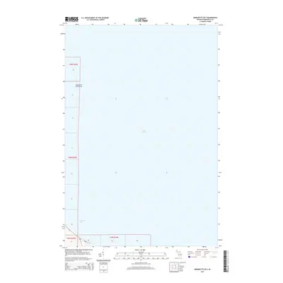
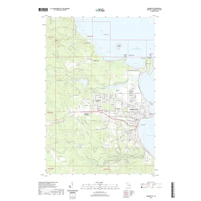
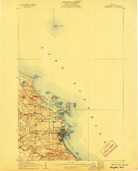 1907 Marquette1907 Print · USGSMarquette and its Lake Superior shoreline appear here during a period of heavy industrial growth in the early twentieth century. Researchers can trace the complex rail networks of the Marquette and Southeastern and locate landmarks like the State Prison and Powder Works.3 unique versions available
 - 1954 Map of Marquette, 1955 Print
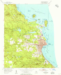 1954 Marquette1955 Print · USGSMid-century Marquette shows its development as a regional hub for education, industry, and maritime commerce along Lake Superior. Genealogists and historians can trace local institutions like Northern Michigan College, Marquette State Prison, and St Michael Sch.6 unique versions available
 - 1954 Map of Marquette, 1959 Print
 1954 Marquette1959 Print · USGSMarquette's harbor and lakeside settlement are shown in detail during the mid-fifties, when the city was a center of regional education and industry. Genealogists and historians can trace the foundations of Northern Michigan College or locate family sites near Park Cemetery and Brookton Corners.
 - 1958 Map of Marquette, 1968 Print
 1958 Marquette1968 Print · USGSThe Upper Peninsula’s central corridor is captured here in the mid-twentieth century as mining and timber industries thrived alongside new military installations. Genealogists and historians can trace the rail lines of the Soo Line Railroad through settlements like Gwinn, Turin, and Chatham.2 unique versions available
 - 1960 Map of Marquette
 1960 Marquette1960 Print · USGSUpper Peninsula mining and maritime commerce reach their peak in the late fifties across the Lake Superior shoreline. Genealogists and historians can locate remote settlements like Big Bay and Dukes, while tracing the Cyr Mine and the active rail lines of the Lake Superior and Ishpeming railroad.
 - 1961 Map of Marquette
 1961 Marquette1961 Print · USGSUpper Peninsula life in the early sixties centered on the iron docks and timber stands of the Lake Superior shore. Genealogists and historians can trace rail-to-port connections via the Lake Superior and Ishpeming Railroad and locate active sites like Republic Mine or the K.I. Sawyer Air Force Base.
 - 1968 Map of Marquette, 1977 Print
 1968 Marquette1977 Print · USGSThe Upper Peninsula iron range and Lake Superior coastline are captured here in the late sixties. Genealogists and historians can trace the rail-to-port infrastructure and the Cold War presence of K I Sawyer Air Force Base alongside towns like Ishpeming and Munising.
 - 1985 Map of Marquette
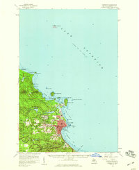
 1985 Marquette1985 Print · USGSThe iron mining country of Michigan's Upper Peninsula is shown here during the mid-1980s as industrial transport networks connected the interior to the coast. Researchers can trace historic rail lines like the Soo Line and Ls&I or locate local landmarks like Holy Cross Cem and Northern Michigan University.3 unique versions available
 - 2011 Map of Marquette OE E, 2011 Print
 2011 Marquette OE E2011 Print · USGSCovers Marquette, including Sands Township, Chocolay Township, and other nearby areas
 - 2011 Map of Marquette, 2011 Print
 2011 Marquette2011 Print · USGSCovers Marquette, including Trowbridge Park, Forestville, and other nearby areas
 - 2014 Map of Marquette OE E, 2014 Print
 2014 Marquette OE E2014 Print · USGSCovers Marquette, including Sands Township, Chocolay Township, and other nearby areas
 - 2014 Map of Marquette, 2014 Print
 2014 Marquette2014 Print · USGSCovers Marquette, including Trowbridge Park, Forestville, and other nearby areas
 - 2017 Map of Marquette, 2017 Print
 2017 Marquette2017 Print · USGSCovers Marquette, including Trowbridge Park, Forestville, and other nearby areas
 - 2017 Map of Marquette OE E, 2017 Print
 2017 Marquette OE E2017 Print · USGSCovers Marquette, including Sands Township, Chocolay Township, and other nearby areas
 - 2019 Map of Marquette OE E, 2019 Print
 2019 Marquette OE E2019 Print · USGSCovers Marquette, including Sands Township, Chocolay Township, and other nearby areas
 - 2019 Map of Marquette, 2019 Print
 2019 Marquette2019 Print · USGSCovers Marquette, including Trowbridge Park, Forestville, and other nearby areas
 - 2023 Map of Marquette OE E, 2023 Print
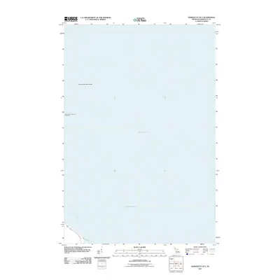
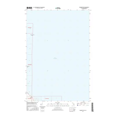
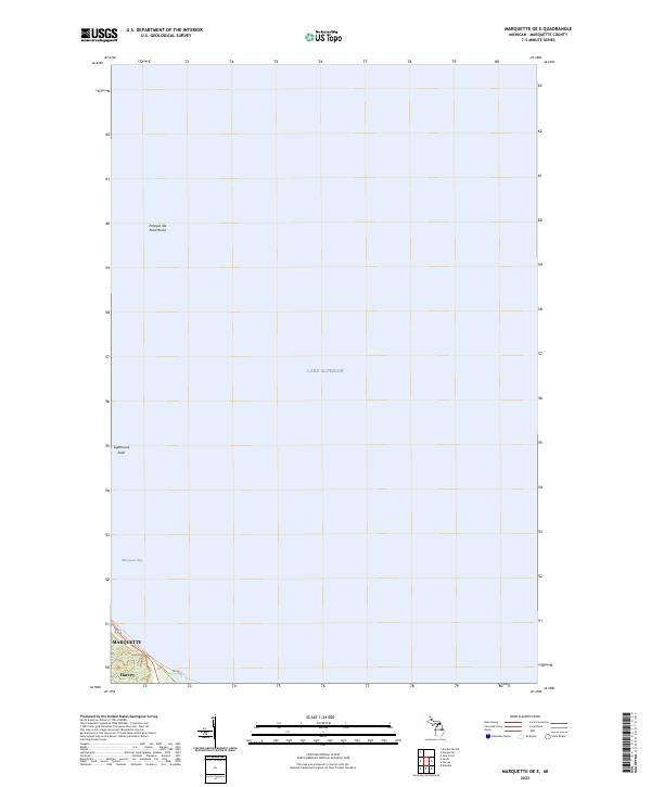 2023 Marquette OE E2023 Print · USGSCoastal Michigan and the waters of the Upper Peninsula are captured here in the early 2020s as they wrap around the historic port of Marquette. Maritime researchers can trace the shoreline from Presque Isle Point Rocks down to the settlement at Harvey.
 - 2023 Map of Marquette, 2023 Print
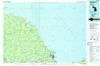
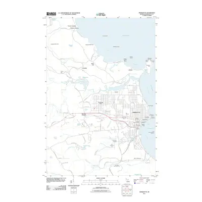
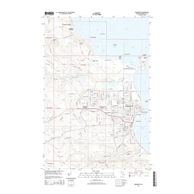
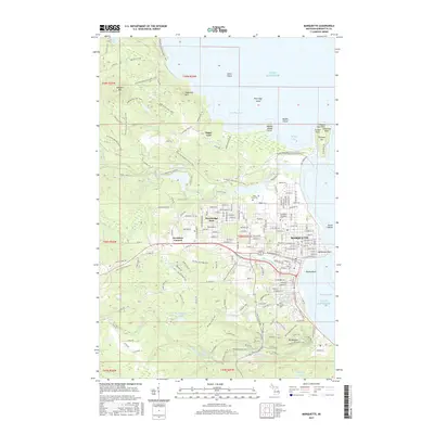
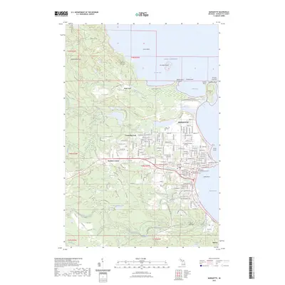 2023 Marquette2023 Print · USGSMarquette and the Superior shore are captured in this recent survey, showing the modern layout of the Upper Peninsula's largest city. Researchers can locate Northern Michigan University, the County Courthouse, and burial sites like Holy Cross Cem or Park Cem.
End of results
Showing maps 1-18 of 18
Top cities near Marquette
- Ishpeming historical maps
- Negaunee historical maps
- Sands historical maps
- Trowbridge Park historical maps
- Skandia historical maps
- Palmer historical maps
Top neighborhoods of Marquette
- Brookton Corners historical maps
- Tourville Apartments (Lincoln Avenue) historical maps
- Woodview Village Apartments historical maps
- Lincoln Apartments historical maps
- Lincoln Townhouses historical maps
- Norwood Apartments historical maps
See more
Frequently asked questions
- What are the different types of historical maps available for Marquette?
- What is the oldest map of Marquette?
- Where can I purchase historical maps of Marquette for my home or office?
- Where can I download high-res historical maps of Marquette?
- Are there historical topographic maps available for Marquette?
- Is there historical aerial imagery available for Marquette?
- Where are historical maps of Marquette sourced from?