1950s Maps of Itasca County, Minnesota
Explore 16 historic maps of Itasca County from the 1950s. These maps offer a rare glimpse into what life looked like during the 1950s — showing old roads, neighborhoods, homes, and landmarks that have changed or disappeared over time.
Whether you're researching your family's past, planning a metal detecting trip, or studying how Itasca County's landscape evolved across the 1950s, these high-resolution maps are a powerful tool for exploring the history of this region.
- Focus on a specific era: All maps on this page are from the 1950s, giving you a focused view of this time period.
- See what’s changed: Compare century-old streets, trails, and buildings to today's modern landscape using overlays and satellite layers.
- Research with precision: Use these maps for genealogy, historical research, land use analysis, or educational projects.
- View, download, or print: Maps are fully viewable online in high resolution, and can be downloaded or printed for your own records.
Start exploring Itasca County's history through authentic maps from the 1950s. This is your window into the past.
Itasca County, MN maps
(16)- 1952 Map of Keewatin, 1954 Print
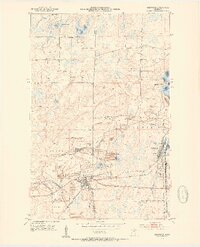 1952 Keewatin1954 Print · USGSThe Iron Range pulses with industrial activity in the early fifties, centered on the mining hubs of Keewatin and Kelly Lake. Genealogists and industrial historians can trace the massive pits of the Stevenson Mine and Bennett Mine, alongside the complex rail networks of the Great Northern and Mesabi Chief Mine RR.4 unique versions available
 - 1952 Map of Nashwauk, 1954 Print
 1952 Nashwauk1954 Print · USGSNashwauk and the Mesabi Iron Range are shown at a peak of industrial activity in the early fifties. Genealogists and industrial historians can trace the intricate network of the Great Northern railroad connecting the Larue Mine, Cloverdale Sch, and Cooley.3 unique versions available
 - 1952 Map of Silica, 1954 Print
 1952 Silica1954 Print · USGSThe Mesabi Range borderlands in the early fifties show a landscape transition from industrial rail corridors to managed timberlands. Researchers can trace the legacy of the Duluth Missabe and Iron Range tracks, locate St Theresa Ch in Silica, and explore the wetlands around Sand Lake.4 unique versions available
 - 1952 Map of Calumet, 1954 Print
 1952 Calumet1954 Print · USGSThe Mesabi Iron Range dominates this mid-century landscape, showing the massive open-pit operations and mining towns of Itasca County at their industrial peak. Researchers can trace the extensive rail networks and dig sites like the Hill Annex Mine, Majorca Mine, and the settlement of Silverwood.2 unique versions available
 - 1952 Map of Pengilly, 1954 Print
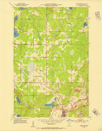
 1952 Pengilly1954 Print · USGSMid-century Itasca County is shaped here by the heavy industry of the Mesabi Range and the sprawling waters of Swan Lake. Genealogists and historians can trace the early layout of Nashwauk or locate specific operations like the Halobe Mine and Kevin Mine.4 unique versions available
 - 1952 Map of Bovey, 1954 Print
 1952 Bovey1954 Print · USGSThe Mesabi Iron Range is in full production in the 1950s, showing a landscape defined by massive open-pit mines and rail spurs. Genealogists and industrial historians can trace the foundations of Coleraine and Bovey alongside active sites like the Canisteo Mine and Lakeview Cem.4 unique versions available
 - 1953 Map of Cohasset East, 1955 Print
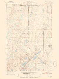
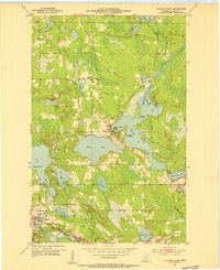 1953 Cohasset East1955 Print · USGSItasca County’s Iron Range comes into focus during the early fifties, showing the interplay of rail and water around the settlement of Cohasset. Genealogists and historians can locate Old Soldiers Cem, the Great Northern rail line, and the industrial footprint of Greenway Mine.3 unique versions available
 - 1953 Map of Siseebakwet Lake, 1955 Print
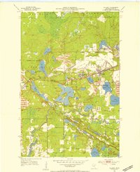
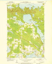
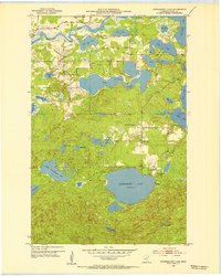 1953 Siseebakwet Lake1955 Print · USGSItasca County's lake-strewn landscape is captured here in the early fifties, featuring the sprawling waters of Siseebakwet Lake and the Mississippi River. Local historians can trace early aviation and community sites like the Otis Lodge Landing Field and the Community Hall.3 unique versions available
 - 1953 Map of Cohasset West, 1955 Print
 1953 Cohasset West1955 Print · USGSItasca County’s lake country is captured here during the mid-twentieth century, showing the intersection of tribal lands and industrial rail expansion. Researchers can trace the Great Northern line into Cohasset or explore the intricate shorelines of Deer Lake and the Mississippi River.3 unique versions available
 - 1953 Map of Grand Rapids, 1955 Print
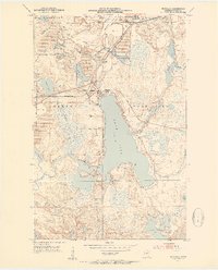
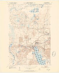
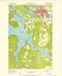 1953 Grand Rapids1955 Print · USGSGrand Rapids and the surrounding lake country are shown here in the early fifties during a period of steady growth. Researchers can find neighborhood schools like Murphy Sch, local landmarks such as the Courthouse, and the intricate shoreline of Pokegama Lake.4 unique versions available
 - 1954 Map of Bemidji, 1966 Print
 1954 Bemidji1966 Print · USGSNorthern Minnesota's lake country and timberlands are captured here at a mid-century peak of rail and road expansion. Genealogists and historians can trace family roots through numerous small settlements like Mahnomen, Clearbrook, and Walker, while locating local landmarks such as White Earth Church.4 unique versions available
 - 1954 Map of Hibbing, 1966 Print
 1954 Hibbing1966 Print · USGSNorthern Minnesota's Iron Range thrives during the mid-1960s, showing the industrial landscape between the Mesabi Range and the Mississippi River. Genealogists and historians can trace the rail lines of the Great Northern RR through mining hubs like Hibbing and Virginia.3 unique versions available
 - 1957 Map of Bemidji
 1957 Bemidji1957 Print · USGSNorthern Minnesota in the mid-fifties is defined by its massive lake systems and the sprawling timberlands of the Chippewa National Forest. Genealogists and researchers can trace old rail lines like the Great Northern RR and locate settlements such as Moberg, Naytahwaush, and Lake Itasca.
 - 1957 Map of Hibbing
 1957 Hibbing1957 Print · USGSNorthern Minnesota's Iron Range is shown at its industrial peak in the mid-fifties, dominated by the massive iron pits and rail corridors of the Mesabi Range. Researchers can trace the rail networks of the Duluth Missabe and Iron Range and locate mining hubs like Hibbing, Virginia, and Bovey.
 - 1958 Map of Bemidji
 1958 Bemidji1958 Print · USGSNorthern Minnesota in the late fifties is a vast landscape of tribal lands and timber forests tied together by rail. Genealogists and researchers can trace old rail stops and lakeside communities from Walker to Fosston, or explore the source of the Mississippi at Lake Itasca.
 - 1958 Map of Hibbing
 1958 Hibbing1958 Print · USGSThe Mesabi Iron Range reached its mid-century height during this era, defining the landscape between Grand Rapids and Virginia. Genealogists and historians can trace the mining-town networks of Hibbing and Chisholm or locate numerous iron mines and rail spurs.
End of results
Showing maps 1-16 of 16
Top cities of Itasca County
- Grand Rapids historical maps
- Cohasset historical maps
- Keewatin historical maps
- Coleraine historical maps
- Deer River historical maps
- Nashwauk historical maps
See more
Frequently asked questions
- What are the different types of historical maps available for Itasca County?
- What is the oldest map of Itasca County?
- Where can I purchase historical maps of Itasca County for my home or office?
- Where can I download high-res historical maps of Itasca County?
- Are there historical topographic maps available for Itasca County?
- Is there historical aerial imagery available for Itasca County?
- Where are historical maps of Itasca County sourced from?