1970s Maps of Itasca County, Minnesota
Explore 63 historic maps of Itasca County from the 1970s. These maps offer a rare glimpse into what life looked like during the 1970s — showing old roads, neighborhoods, homes, and landmarks that have changed or disappeared over time.
Whether you're researching your family's past, planning a metal detecting trip, or studying how Itasca County's landscape evolved across the 1970s, these high-resolution maps are a powerful tool for exploring the history of this region.
- Focus on a specific era: All maps on this page are from the 1970s, giving you a focused view of this time period.
- See what’s changed: Compare century-old streets, trails, and buildings to today's modern landscape using overlays and satellite layers.
- Research with precision: Use these maps for genealogy, historical research, land use analysis, or educational projects.
- View, download, or print: Maps are fully viewable online in high resolution, and can be downloaded or printed for your own records.
Start exploring Itasca County's history through authentic maps from the 1970s. This is your window into the past.
Itasca County, MN maps
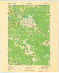
(63)- 1970 Map of Warba, 1972 Print
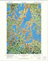
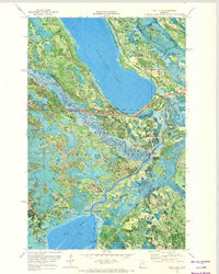
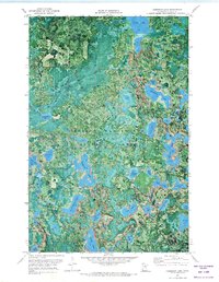
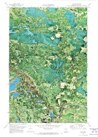
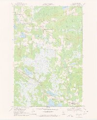 1970 Warba1972 Print · USGSItasca County's marshlands and glacial lakes are captured here in the early seventies as the railroad and pipeline corridors dominated the landscape. Genealogists can locate family landmarks like Feeley Cem, Trout Lake Ch, and the rural community of Philbin.2 unique versions available
 - 1970 Map of Split Hand Lake, 1972 Print
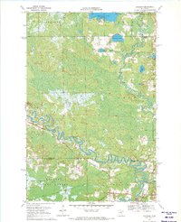
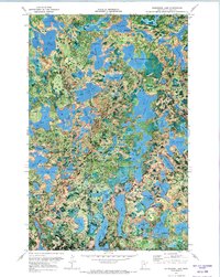
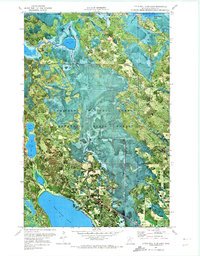
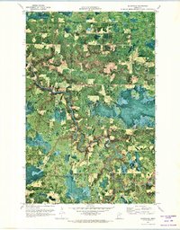
 1970 Split Hand Lake1972 Print · USGSItasca County’s lake-dotted wilderness is captured here in the early seventies, showing a landscape defined by state forests and the winding Mississippi River. Outdoorsmen and researchers can trace the old Winter Trail or locate features like the Gaging Station and Split Hand Lake.2 unique versions available
 - 1970 Map of Big Thunder Peak, 1972 Print
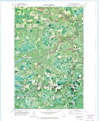
 1970 Big Thunder Peak1972 Print · USGSItasca and Aitkin counties are captured here in the early seventies, showing a landscape defined by the Sugar Hills and forest lowlands. Researchers can trace seasonal routes like the Winter Trail and locate landmarks such as Holy Water Lake or the Ski Lift at Big Thunder Peak.
 - 1970 Map of Mountain Ash Lake, 1972 Print
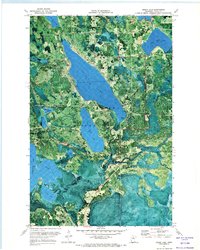
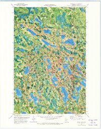
 1970 Mountain Ash Lake1972 Print · USGSNorthern Minnesota's lake country is captured in detail during the early 1970s, showcasing the transition from Itasca to Aitkin County. Trace seasonal access via the Winter Trail or locate historical points of interest like Spring Roadside Park and Hill Lake.2 unique versions available
 - 1970 Map of Swan River, 1972 Print
 1970 Swan River1972 Print · USGSSwan River and its surrounding wetlands are captured here in the early seventies at the crossroads of the Burlington Northern rail lines. Local historians can trace the community infrastructure at the Townhall and Sago Cem or locate the numerous Gravel Pits that supported the regional economy.
 - 1970 Map of Jacobson, 1972 Print
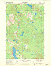
 1970 Jacobson1972 Print · USGSThe confluence of the Mississippi River and Swan River defines this northern wilderness during the early seventies. Local historians can trace the Old Railroad Grade and explore early sites near Jacobson and Shallow Lake.
 - 1970 Map of Rauch, 1973 Print
 1970 Rauch1973 Print · USGSThe Koochiching and Itasca county line comes alive in the early 1970s, showing a landscape defined by timber and the winding Little Fork River. Genealogists and local historians can locate Rauch and the SS Peter & Paul Ch amidst the deep woods.
 - 1970 Map of Bowstring Lake, 1973 Print
 1970 Bowstring Lake1973 Print · USGSItasca County’s northern lake country is captured here in the early seventies, showing a period of active forestry and public recreation. Genealogists and historians can locate Sand Lake Ch, a Cem, and old landings along Bowstring Lake and the Bowstring River.
 - 1970 Map of Deer River NE, 1973 Print
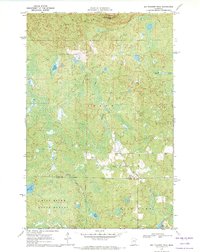
 1970 Deer River NE1973 Print · USGSItasca County’s northern timberlands are captured here in the early seventies, showing a complex landscape of state and national forests. Genealogists and researchers can trace the O-Ne-A-Ge-N Indian Reservation Boundary and old routes like the Winter Trail near Rice Lake.
 - 1970 Map of Wabana Lake, 1973 Print
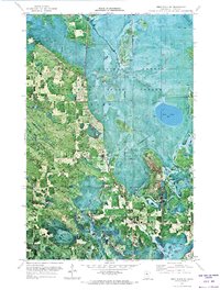
 1970 Wabana Lake1973 Print · USGSItasca County's northern woods and glacial waters are shown in detail during the early 1970s. Researchers can trace the shoreline of Trout Lake and locate specific features like the Landing Strip, Roadside Park, and Public Access points.2 unique versions available
 - 1970 Map of Clubhouse Lake, 1973 Print
 1970 Clubhouse Lake1973 Print · USGSItasca County’s northern woods and glacial lakes are captured in detail during the early 1970s. Researchers can locate remote landmarks like the Girl Scout Camp and trace the shorelines of Clubhouse Lake, Gunn Lake, and Big Dick Lake.2 unique versions available
 - 1970 Map of Jessie Lake, 1973 Print
 1970 Jessie Lake1973 Print · USGSItasca County's lake country is captured here during the 1970s, showing the intersection of timber and water at the edge of the Chippewa National Forest. Genealogists and local historians can trace the settlement at Talmoon, the Evergreen Knoll Cem, and the old Railroad Grade.
 - 1970 Map of Deer River, 1973 Print
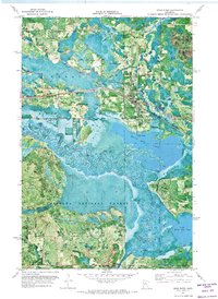 1970 Deer River1973 Print · USGSItasca County at the start of the 1970s shows the bustling rail-and-river hub of Deer River alongside the winding Mississippi River. Researchers can locate Olivet Cem, the local High Sch, and rural landmarks like White Oak Point.
 - 1970 Map of Coon Lake, 1973 Print
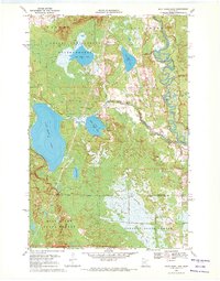
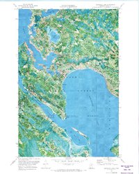
 1970 Coon Lake1973 Print · USGSItasca County’s glacial lake country is captured here during the 1970s, showcasing the extensive borders of Scenic State Park. Researchers can locate seasonal infrastructure like the Winter Trail and landmarks including the Lookout Tower and State Park Headquarters.2 unique versions available
 - 1970 Map of Ball Club, 1973 Print
 1970 Ball Club1973 Print · USGSThe meeting of Itasca and Cass Counties in the 1970s is defined by the winding Mississippi and the timberlands of the Chippewa National Forest. Local history researchers can trace the town of Ball Club, Tibbets Cem, and the path of the Burlington Northern rail line.
 - 1970 Map of Little Bowstring Lake, 1973 Print
 1970 Little Bowstring Lake1973 Print · USGSThe deep woods and lakes of Itasca County are shown here in the early seventies, spanning portions of two major forests. Researchers can trace the Old Railroad Grade and locate old landmarks like the Lookout Tower and the settlement of Suomi.2 unique versions available
 - 1970 Map of Deer Lake East, 1973 Print
 1970 Deer Lake East1973 Print · USGSItasca County’s lakeland is captured here at the start of the 1970s, showing a landscape defined by timber and water. You can trace early transit routes like the Old Railroad Grade and Winter Trail near Deer Lake and Thistledew Lake.
 - 1970 Map of Little Ball Club Lake, 1973 Print
 1970 Little Ball Club Lake1973 Print · USGSItasca County’s vast wetlands and timberlands are captured in this early 1970s orthophotomap of the Chippewa National Forest. Genealogists and researchers can trace the roads near Salem Chapel or study the shorelines of Ball Club Lake and Bowstring Lake.
 - 1970 Map of Anderson Lake, 1973 Print
 1970 Anderson Lake1973 Print · USGSItasca County’s lake-country was managed for timber and recreation in the early 1970s, as seen in this photographic survey of the George Washington State Forest. Genealogists and historians can trace seasonal routes like the Winter Trail and locate early landmarks such as the Link Lake Lookout Tower.2 unique versions available
 - 1970 Map of Silverdale, 1973 Print
 1970 Silverdale1973 Print · USGSNorthern Minnesota timberlands and river valleys are captured here at the start of the 1970s. Local researchers can locate the small settlements of Silverdale and Greaney, including the site of St Bridgets Ch along the winding Little Fork River.
 - 1970 Map of Bear River, 1973 Print
 1970 Bear River1973 Print · USGSThe North Woods along the Itasca and St. Louis county line were still defined by dense timber and small river-side hamlets in the 1970s. You can trace early township history through family landmarks like Carpenter Cem, the small settlement of Celina, and the local Bear River Sch.
 - 1970 Map of Deer Lake NE, 1973 Print
 1970 Deer Lake NE1973 Print · USGSKoochiching and Itasca Counties are shown in the early 1970s at a time when much of the landscape remained undeveloped timberland. Researchers can trace seasonal routes like the Winter Road and Holstrum Spur Trail through the Koochiching State Forest.
 - 1970 Map of Spring Lake, 1973 Print
 1970 Spring Lake1973 Print · USGSItasca County’s timber and lake country is captured here during the 1970s as the state and national forests matured. You can trace old logging routes like the Old Railroad Grade and locate local landmarks such as Riverside Chapel or Mt Tabor Camp.2 unique versions available
 - 1970 Map of Togo, 1973 Print
 1970 Togo1973 Print · USGSItasca County’s northern forests and peatlands are captured here during the late sixties, showing a landscape defined by timber and conservation. Genealogists and historians can locate the Bearville Cem, the Thistledew Lookout Tower, and the remote Togo settlement.
 - 1970 Map of Deer Lake NW, 1973 Print
 1970 Deer Lake NW1973 Print · USGSThe northern Minnesota wilderness in the early seventies is revealed through this detailed orthophotomap of the lake-studded timberlands. Researchers can trace the seasonal Winter Trail network and locate landmarks like the Lookout Tower and Myrtle Lake.
Showing maps 1-25 of 63
Top cities of Itasca County
- Grand Rapids historical maps
- Cohasset historical maps
- Keewatin historical maps
- Coleraine historical maps
- Deer River historical maps
- Nashwauk historical maps
See more
Frequently asked questions
- What are the different types of historical maps available for Itasca County?
- What is the oldest map of Itasca County?
- Where can I purchase historical maps of Itasca County for my home or office?
- Where can I download high-res historical maps of Itasca County?
- Are there historical topographic maps available for Itasca County?
- Is there historical aerial imagery available for Itasca County?
- Where are historical maps of Itasca County sourced from?