1960s Maps of Itasca County, Minnesota
Explore 9 historic maps of Itasca County from the 1960s. These maps offer a rare glimpse into what life looked like during the 1960s — showing old roads, neighborhoods, homes, and landmarks that have changed or disappeared over time.
Whether you're researching your family's past, planning a metal detecting trip, or studying how Itasca County's landscape evolved across the 1960s, these high-resolution maps are a powerful tool for exploring the history of this region.
- Focus on a specific era: All maps on this page are from the 1960s, giving you a focused view of this time period.
- See what’s changed: Compare century-old streets, trails, and buildings to today's modern landscape using overlays and satellite layers.
- Research with precision: Use these maps for genealogy, historical research, land use analysis, or educational projects.
- View, download, or print: Maps are fully viewable online in high resolution, and can be downloaded or printed for your own records.
Start exploring Itasca County's history through authentic maps from the 1960s. This is your window into the past.
Itasca County, MN maps
(9)- 1964 Map of Hibbing
 1964 Hibbing1964 Print · USGSNorthern Minnesota’s iron-rich corridor is captured here during a peak era of mid-century industrial activity. Researchers can trace the rail-to-mine connections through Mesabi Range towns like Hibbing and Virginia or locate lakefront settlements near Pokegama Lake.
 - 1964 Map of Side Lake, 1965 Print
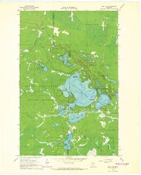 1964 Side Lake1965 Print · USGSThe Itasca and St. Louis county line runs through this lake-rich wilderness in the mid-1960s. Outdoorsmen and local historians can trace the early layout of McCarthy Beach State Park and find remote sites like Stony Brook Campground or the Lookout Tower.3 unique versions available
 - 1964 Map of Stingy Lake, 1965 Print
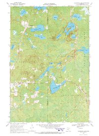
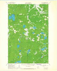 1964 Stingy Lake1965 Print · USGSNorthern Minnesota's lake-and-forest interior is preserved here in the mid-sixties, where the George Washington State Forest meets St. Louis county. Trace old resource sites and forest boundaries near Stingy Lake, Day Lake, and the Gravel Pit at Kleffman Lake.4 unique versions available
 - 1964 Map of Sherry Lake, 1965 Print
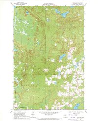
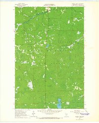 1964 Sherry Lake1965 Print · USGSItasca County’s northern timberlands are documented here in the mid-sixties, showing the remote reaches of the George Washington State Forest. Researchers can trace old logging and fire access routes like the Snake Trail and locate the lookout tower atop Stony Ridge.
 - 1964 Map of O'Leary Lake, 1965 Print
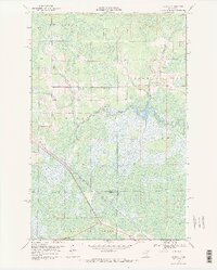
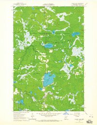 1964 O'Leary Lake1965 Print · USGSItasca County’s northern timberlands are showcased in the mid-1960s, a period defined by state-managed conservation and glacial hydrology. Trace the waterways of Buck Lake and O'Leary Lake, or locate the meandering paths of the Prairie River and Day Brook.3 unique versions available
 - 1969 Map of Wawina, 1971 Print
 1969 Wawina1971 Print · USGSIn the late 1960s, the boggy crossroads of Wawina sat at the junction of three counties and the Burlington Northern railroad. Genealogists can locate family landmarks like the Cedar Valley Cem, Apostolic Ch, and the local Town Hall.2 unique versions available
 - 1969 Map of Floodwood Lake, 1972 Print
 1969 Floodwood Lake1972 Print · USGSNorthern Minnesota lake country is captured here in the late sixties, showcasing the dense woods and waterways of the St. Louis County line. Researchers can locate the Maple Grove Cemetery, trace the Old Railroad Grade, or find the Gospel Ranch Landing Strip.2 unique versions available
 - 1969 Map of La Prairie, 1972 Print
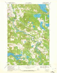 1969 La Prairie1972 Print · USGSItasca County near the end of the sixties is defined by its winding river systems and nascent rail corridors. Genealogists and historians can trace local ties at Blackberry Cem or Harris Cem and explore the industrial footprint of Gunn and La Prairie.2 unique versions available
 - 1969 Map of Goodland, 1972 Print
 1969 Goodland1972 Print · USGSItasca County's lake country is documented here in the late sixties, centered on the settlement of Goodland. Local historians can trace the development of the region's infrastructure, from the Landing Field and local Gravel Pit to the shores of Pancake Lake and Hart Lake.
End of results
Showing maps 1-9 of 9
Top cities of Itasca County
- Grand Rapids historical maps
- Cohasset historical maps
- Keewatin historical maps
- Coleraine historical maps
- Deer River historical maps
- Nashwauk historical maps
See more
Frequently asked questions
- What are the different types of historical maps available for Itasca County?
- What is the oldest map of Itasca County?
- Where can I purchase historical maps of Itasca County for my home or office?
- Where can I download high-res historical maps of Itasca County?
- Are there historical topographic maps available for Itasca County?
- Is there historical aerial imagery available for Itasca County?
- Where are historical maps of Itasca County sourced from?