Old Maps of Fall Lake Township, Minnesota for Academic Research
Study the evolution of Fall Lake Township with 138 high-resolution historic maps. Whether you're teaching, researching, or modeling changes in land use, these maps provide essential visual documentation of urban, environmental, and geographic change.
- Analyze long-term change: Track patterns in development, transportation, and natural features.
- Ideal for environmental or urban studies: Support academic projects with primary historical map data.
- Use in the classroom or lab: Educators and researchers rely on these maps to bring historical context to life.
These maps are a powerful tool for teaching, research, and visualizing how Fall Lake Township has changed over the decades.
Fall Lake Township, MN maps
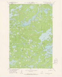
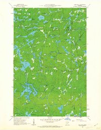
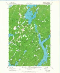
(138)- 1933 Map of Ely, 1961 Print
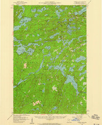
 1933 Ely1961 Print · USGSThe iron-rich Vermilion Range comes alive in the early 1930s, showing the intersection of heavy industry and the Northwoods wilderness. Genealogists and historians can trace the foundations of Ely and Winton, including the Pioneer Mines and the Halfway CCC Camp.
 - 1939 Map of Ely
 1939 Ely1939 Print · USGSEly and the surrounding Iron Range were dominated by heavy industry and woodland conservation in the years before the war. Genealogists and historians can locate specific sites like Pioneer Mines, the Halfway CCC Camp, and the White Iron Sch.3 unique versions available
 - 1954 Map of Two Harbors, 1964 Print
 1954 Two Harbors1964 Print · USGSThe Minnesota North Shore and Superior National Forest are shown here in the mid-fifties, just as the taconite industry was reshaping the coast. Genealogists and historians can trace the rail lines of the Duluth Missabe and Iron Range or locate remote outposts like Sawbill Landing and Section Thirty.2 unique versions available
 - 1957 Map of Two Harbors
 1957 Two Harbors1957 Print · USGSMinnesota's North Shore and the Arrowhead region are shown here in the mid-fifties as the taconite industry and cold war defense shaped the landscape. Researchers can trace the Duluth Missabe and Iron Range railroad, locate the Split Rock Light, and explore the iron-mining era at Taconite.
 - 1957 Map of Gabbro Lake, 1959 Print
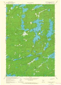
 1957 Gabbro Lake1959 Print · USGSThe northern Minnesota wilderness of the late 1950s is revealed here through its complex network of lakes and early forest management. Trace the historic waterways around Upper Pipestone Falls, Dam No 1, and the South Kawishiwi River Camp within the forest interior.3 unique versions available
 - 1957 Map of Ensign Lake, 1959 Print
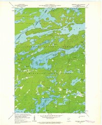
 1957 Ensign Lake1959 Print · USGSThe international borderlands of Minnesota and Ontario are captured here in the mid-fifties, showing the vast water-and-portage network of the Northwoods. Researchers can trace historic travel routes through Prairie Portage, locate the Customs Station, and explore the island-dotted waters of Agnes Lake and Sunday Lake.2 unique versions available
 - 1957 Map of Basswood Lake, 1959 Print
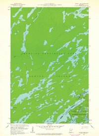
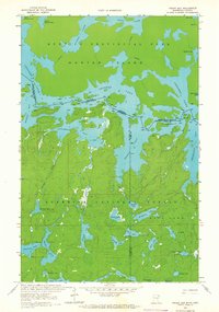
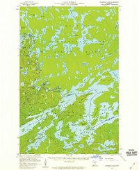 1957 Basswood Lake1959 Print · USGSThe Minnesota-Ontario borderlands are captured here in the late fifties, showcasing the intricate island chains and remote waterways of the North Woods. Genealogists and historians can trace locations like the Washington Island Cem, the Trading Post, and the Quetico Wilderness Research Center.3 unique versions available
 - 1957 Map of Quetico, 1967 Print
 1957 Quetico1967 Print · USGSThe Ontario-Minnesota borderlands are captured here in the mid-fifties, showing the vast wilderness of the Boundary Waters before modern development. Genealogists and researchers can trace rail settlements along the Canadian National Railways including Atikokan, Sapawe, and Kashabowie.2 unique versions available
 - 1958 Map of Two Harbors
 1958 Two Harbors1958 Print · USGSThe North Shore and Arrowhead region of Minnesota are captured in the 1950s as iron ore shipping and wilderness preservation shaped the land. Researchers can trace the Duluth Missabe and Iron Range RR, find maritime landmarks like Split Rock Light, and locate remote settlements from Babbitt to Grand Marais.
 - 1959 Map of Ogishkemuncie Lake, 1962 Print
 1959 Ogishkemuncie Lake1962 Print · USGSThe Minnesota wilderness at the end of the 1950s is defined here by the intricate island chains and deep waters of the Boundary Waters region. Outdoor historians and researchers can trace portage routes and depth contours for Ogishkemuncie Lake, Jasper Lake, and Kekekabic Lake.4 unique versions available
 - 1959 Map of Kekekabic Lake, 1962 Print
 1959 Kekekabic Lake1962 Print · USGSThe Boundary Waters wilderness at the end of the 1950s reveals an intricate landscape of interconnected waterways along the Canadian border. Canoeists and historians can trace the remote Kekekabic Lookout Tower and primitive trails through the Superior National Forest.3 unique versions available
 - 1959 Map of Dutton Lake, 1962 Print
 1959 Dutton Lake1962 Print · USGSThe international borderlands of Lake County appear here in the late fifties, showcasing the intricate waterway network of the Boundary Waters. Map collectors can trace the portage routes and remote lakes of Quetico Provincial Park and the Superior National Forest, including Cypress Lake and Dutton Lake.3 unique versions available
 - 1959 Map of Ester Lake, 1962 Print
 1959 Ester Lake1962 Print · USGSThe Minnesota-Ontario border wilderness is captured here in the late fifties, showing the intricate water routes of the Boundary Waters. Trace the primitive portages and remote shorelines of Saganaga Lake, Ester Lake, and the landmark High Falls near Hunter Island.4 unique versions available
 - 1960 Map of Lake Polly, 1962 Print
 1960 Lake Polly1962 Print · USGSThe northern wilderness of the Arrowhead region is captured here in the early 1960s, showing a complex network of glacial lakes and portage routes. Researchers can trace the courses of the Kawishiwi River and Louse River past landmarks like Adams Lake and Malberg Lake.4 unique versions available
 - 1960 Map of Alice Lake, 1963 Print
 1960 Alice Lake1963 Print · USGSThe interconnected waterways of Lake County are captured in the early 1960s, showing a vast wilderness of glaciated lakes and portage paths. Trace the remote drainage of the Kawishiwi River through Alice Lake, Thomas Lake, and Beaver Lake.4 unique versions available
 - 1963 Map of Fourtown Lake, 1964 Print
 1963 Fourtown Lake1964 Print · USGSThe Boundary Waters wilderness of the early sixties is preserved here, showing a landscape defined by water and primitive trails. You can trace historic canoe routes through Fourtown Lake, Tin Can Mike Lake, and along the Range River to Jackfish Bay.4 unique versions available
 - 1963 Map of Friday Bay, 1965 Print
 1963 Friday Bay1965 Print · USGSThe international borderlands of Minnesota and Ontario were a pristine wilderness in the 1960s. Researchers can trace the ancient canoe routes between Friday Bay and Saturday Bay or locate secluded waters like Ritual Lake and Bear Trap Lake.2 unique versions available
 - 1964 Map of Two Harbors
 1964 Two Harbors1964 Print · USGSThe North Shore of Lake Superior is captured here during the mid-1950s, a time of significant industrial mining growth and emerging tourism. Genealogists and historians can trace the rail lines of the Duluth Missabe and Iron Range and locate landmarks like Split Rock Light and the U S Air Force Radar Station.
 - 1965 Map of Ely, 1967 Print
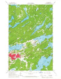 1965 Ely1967 Print · USGSEly and Winton are captured in the mid-sixties as they balanced a legacy of iron mining with their growing status as wilderness gateways. Researchers can trace the Duluth Missabe and Iron Range rail line, locate the Pioneer Mine, or find local landmarks like the Lincoln Sch and Ely Cem.3 unique versions available
 - 1965 Map of Kangas Bay, 1967 Print
 1965 Kangas Bay1967 Print · USGSThe North Woods during the mid-sixties are defined by the expansive waters of the Superior National Forest and the engineered Birch Lake Dam. Researchers can trace the reservoir shoreline and locate local landmarks like the Birch Lake Cem and Beargrease Island.3 unique versions available
 - 1968 Map of Quetico
 1968 Quetico1968 Print · USGSThe Ontario-Minnesota borderlands are captured here in the late 1960s, showing the vast wilderness of the Boundary Waters. Researchers can trace the Canadian National rail line through Atikokan or explore the interior lakes of Quetico Provincial Park and Hunter Island.
 - 1976 Map of Basswood Lake SW, 1979 Print
 1976 Basswood Lake SW1979 Print · USGSThe international border country between Minnesota and Ontario is seen here in the mid-seventies via detailed aerial photography. Researchers can trace the winding course of the Basswood River and examine the unmodified shorelines of the Minnesota wilderness.
 - 1976 Map of Basswood Lake NW, 1979 Print
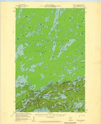
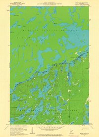
 1976 Basswood Lake NW1979 Print · USGSCovers Fall Lake Township, including Unorganized Rainy River, Lake County, and other nearby areas
 - 1976 Map of Basswood Lake SE, 1979 Print
 1976 Basswood Lake SE1979 Print · USGSBasswood Lake and the international border are captured in this mid-seventies aerial survey of the northern wilderness. Researchers can trace the jagged shorelines of Ranger Bay and Wind Bay or locate the deep waters of Hoist Bay along the Canadian line.
 - 1976 Map of Ensign Lake SE, 1979 Print
 1976 Ensign Lake SE1979 Print · USGSThe wilderness along the Minnesota-Ontario border comes into sharp focus during the mid-seventies in this detailed orthophotomap. Trace the international water boundary through Knife Lake and Carp Lake, or study the shorelines of Ensign Lake and Ima Lake.
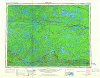
Showing maps 1-25 of 138
Top neighborhoods of Fall Lake Township
Frequently asked questions
- What are the different types of historical maps available for Fall Lake Township?
- What is the oldest map of Fall Lake Township?
- Where can I purchase historical maps of Fall Lake Township for my home or office?
- Where can I download high-res historical maps of Fall Lake Township?
- Are there historical topographic maps available for Fall Lake Township?
- Is there historical aerial imagery available for Fall Lake Township?
- Where are historical maps of Fall Lake Township sourced from?