
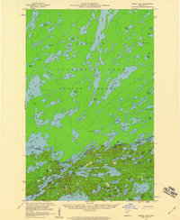
1957 Map of Ensign Lake
USGS Topo · Published 1959About this map
The Canada-United States border cuts through a sprawling network of glacial lakes and portages in the late 1950s, a period when this international wilderness remained largely undeveloped. On the Canadian side, Quetico Provincial Park dominates the landscape across Hunter Island, characterized by large water bodies such as Agnes Lake and Kahshahpiwi Lake. The map illustrates the rugged connectivity of the region, where travel relied on water routes and established crossings. To the south, within the Superior National Forest in Minnesota, Prairie Portage serves as a critical junction for travelers, marked by a Customs Station at the edge of the wilderness. This survey reveals the preservation of the borderlands' natural character, highlighting landmarks like Louisa Falls and the numerous named islands and bays that define the Northwoods navigation routes of the era.
Find a feature on this map
94 named features on this map. Tap any name to fly to it.
Don’t see what you’re looking for? This feature index may not catch every label — zoom into the map to look around manually.
Map Details
Editions of this 1957 Ensign Lake Map
2 editions found
Other maps of this area

1954 · Two Harbors
USGS Topo · 1:250,000

1957 · Two Harbors
USGS Topo · 1:250,000

1957 · Gabbro Lake
USGS Topo · 1:62,500

1957 · Basswood Lake
USGS Topo · 1:62,500

1957 · Quetico
USGS Topo · 1:250,000

1958 · Two Harbors
USGS Topo · 1:250,000

1959 · Kekekabic Lake
USGS Topo · 1:24,000

1959 · Dutton Lake
USGS Topo · 1:24,000

1960 · Alice Lake
USGS Topo · 1:24,000

1964 · Two Harbors
USGS Topo · 1:250,000