Old Maps of Renville County, Minnesota for Hiking & Exploration
Hike through history with 232 historic maps of Renville County. Explore old trails, ghost towns, and forgotten backroads — perfect for outdoor adventurers and local explorers.
- Rediscover forgotten places: Map out old mining camps, roads, and footpaths that no longer exist on modern maps.
- Layer with modern tools: Combine with LiDAR or satellite views to plan hikes through historical terrain.
- Made for exploration: Popular among hikers, overlanders, and local history lovers.
Use these maps to find adventure and explore the hidden past of Renville County.
Renville County, MN maps
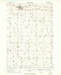
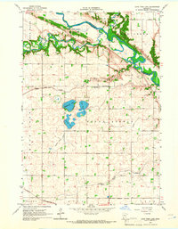
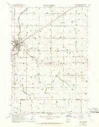
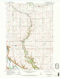
(232)- 1952 Map of Morton, 1954 Print
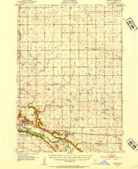 1952 Morton1954 Print · USGSRenville County farmland meets the deep Minnesota River valley in the early fifties, showing a landscape shaped by granite quarrying and river transport. Researchers can locate numerous country schools and churches like Swedlanda Ch, the Lower Sioux Indian Community, and the grounds of Fort Ridgely.2 unique versions available
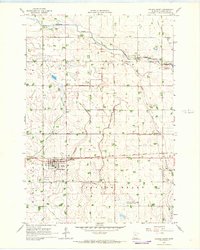
 - 1952 Map of Redwood Falls, 1954 Print
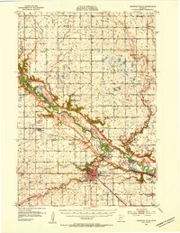 1952 Redwood Falls1954 Print · USGSRedwood Falls and the Minnesota River valley are captured in detail during the early fifties, showing the area's deep agricultural and river-town roots. Researchers can trace rural school districts, the Chicago and North Western rail line, and the Lower Sioux Indian Community.2 unique versions available
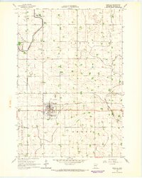
 - 1953 Map of Morgan, 1955 Print
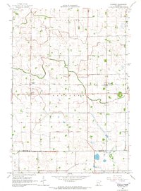
 1953 Morgan1955 Print · USGSRedwood and Brown Counties are shown at their agricultural peak in the early fifties, anchored by the rail hub at Morgan. Genealogists and historians can trace dozens of rural schoolhouses and country churches like Brookville Church or Immanuel Church.
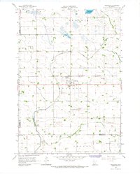
 - 1953 Map of New Ulm, 1968 Print
 1953 New Ulm1968 Print · USGSSouthern Minnesota in the mid-1950s is defined by its deep river valleys and the expanding reach of the Great Northern and Chicago and North Western railroads. Researchers can trace rural lineages through landmarks like the Milford State Monument, St. John's Ch, and the Upper Sioux Indian Res.3 unique versions available
 - 1957 Map of New Ulm
 1957 New Ulm1957 Print · USGSCentral Minnesota in the mid-fifties remains a landscape of river-valley commerce and prairie agriculture defined by its historic mission sites and rail towns. Genealogists and local historians can trace the development of New Ulm and Montevideo, or locate specific landmarks like the Milford State Monument and Minnesota Falls.
 - 1957 Map of Olivia, 1959 Print
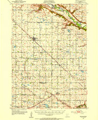
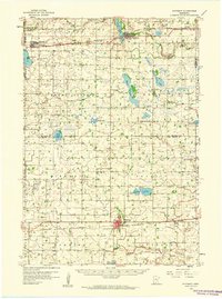
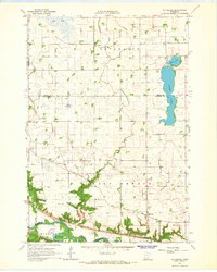
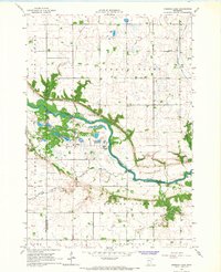
 1957 Olivia1959 Print · USGSRenville and Kandiyohi Counties are shown during the late fifties, defined by a dense grid of farm roads and competing rail lines. Genealogists can locate family landmarks like Christina Cem, St Johns Ch, and the village of Olivia.
 - 1958 Map of New Ulm
 1958 New Ulm1958 Print · USGSSouth-central Minnesota’s river valleys and prairie towns are captured here in the mid-fifties, during the height of the region's rail-and-river economy. Genealogists and historians can trace the legacy of the Upper Sioux Indian Mission or locate early rail stops along the Chicago and North Western Ry in towns like Redwood Falls and Glencoe.
 - 1958 Map of Winthrop, 1959 Print
 1958 Winthrop1959 Print · USGSMid-century Sibley and McLeod counties are captured here as the rail-centered agricultural landscape reached its peak. Genealogists can trace family roots through several rural landmarks like St Boniface Cem, St John Sch, and the town of Winthrop.
 - 1958 Map of Hutchinson, 1959 Print
 1958 Hutchinson1959 Print · USGSHutchinson and the surrounding McLeod County townships are captured here in the late fifties at a height of rail-driven agricultural activity. Genealogists can trace family footprints through numerous rural landmarks like Zion Ch, Stahl Lake Sch, and the Immanuel Sch Cem.
 - 1964 Map of Fairfax, 1965 Print
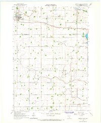
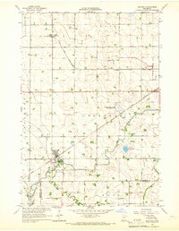
 1964 Fairfax1965 Print · USGSRenville County farmland was undergoing steady development in the mid-1960s as drainage systems transformed the prairie. Researchers can locate the Wellington Sch, trace the Chicago and North Western rail line, and find family names near St Andrews Cem.
 - 1964 Map of Sleepy Eye NW, 1965 Print
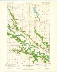 1964 Sleepy Eye NW1965 Print · USGSThe Minnesota River valley in the 1960s reveals a landscape of historic frontier defense and quiet agricultural persistence. Researchers can trace the grounds of Fort Ridgely State Park, find the Golden Gate Cem, and locate rural landmarks like St Johns Ch.
 - 1964 Map of Buffalo Lake, 1965 Print
 1964 Buffalo Lake1965 Print · USGSThe prairie of Renville and Sibley Counties is captured here in the mid-1960s as a thriving rail and agricultural corridor. Researchers can trace family sites at the United Brethren Cem, locate the village Townhall, or find the old Drive-in Theater.
 - 1964 Map of Hector, 1965 Print
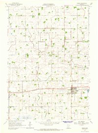
 1964 Hector1965 Print · USGSRenville County farmland was meticulously managed in the mid-1960s, centered on the rail hub of Hector. Family historians can locate specific plots near the Catholic Cem or trace the drainage networks of Judicial Ditch No 15 and Judicial Ditch No 6.
 - 1964 Map of St George, 1965 Print
 1964 St George1965 Print · USGSThe Minnesota River valley meets the prairie wetlands of Nicollet County in the mid-1960s. Researchers can trace the path of the Old Fort Road and locate family history at West Newton Cem and Clear Lake Ch Cem.
 - 1964 Map of Gibbon, 1965 Print
 1964 Gibbon1965 Print · USGSGibbon was a bustling rail-and-farm hub in the mid-1960s, defined by its grain-hauling rail lines and a vast network of prairie drainage ditches. Genealogists can trace local roots at St Willibrord Cem, Augustana Cem, and the St Peters Sch.3 unique versions available
 - 1965 Map of Danube, 1966 Print
 1965 Danube1966 Print · USGSRenville County farmland is captured here in the mid-1960s, showing the vital intersection of rail and road through Danube. Researchers can trace old family sites near the United Brethren Cem or follow the path of the Chicago Milwaukee St Paul and Pacific railroad.
 - 1965 Map of Lone Tree Lake, 1966 Print
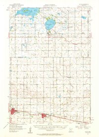
 1965 Lone Tree Lake1966 Print · USGSThe Minnesota River valley meets the prairie in the mid-1960s, showing the intersection of Dakota history and early settlement. Trace the grounds of Upper Sioux Agency State Park, Rock Valley Ch, and Hillside Cem.2 unique versions available
 - 1965 Map of Blomkest, 1966 Print
 1965 Blomkest1966 Print · USGSThe prairie landscape of southern Kandiyohi County is captured here in the mid-1960s, showing a region defined by its rail-and-ditch infrastructure. Genealogists can trace the rural layout of Roseland, locate the Blomkest Cemetery, and follow the Chicago and North Western rail line.
 - 1965 Map of Iverson Lake, 1966 Print
 1965 Iverson Lake1966 Print · USGSThe Minnesota River valley in the mid-sixties reveals a landscape of wooded bluffs and agricultural plains along the Renville and Redwood county line. Genealogists and local historians can trace landmarks like Opdal Ch, Middag Knutea, and the Joseph R Brown Wayside Park.
 - 1965 Map of Maynard, 1966 Print
 1965 Maynard1966 Print · USGSIn the mid-1960s, this portion of Chippewa County was a busy rail intersection for the local agricultural economy. Researchers can trace the tracks of the Great Northern and find local landmarks like Gluek (Wesota Sta) and Wang Ch.
 - 1965 Map of Clara City, 1966 Print
 1965 Clara City1966 Print · USGSRailroad and agricultural development define this western Minnesota landscape in the mid-sixties, where the Great Northern and Chicago and North Western lines intersect at Clara City. Genealogists and local historians can trace the early townships of Rheiderland and Ericson, locating family sites near Bunde or the Bethany Cem.
 - 1965 Map of Sacred Heart, 1966 Print
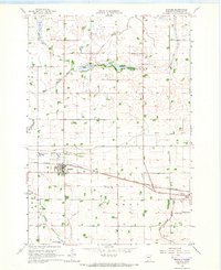
 1965 Sacred Heart1966 Print · USGSRenville County farmland in the mid-sixties reveals a landscape shaped by rail transport and pioneer settlement. Researchers can trace family history through numerous rural burial sites like Krogfus Cem or follow the Chicago Milwaukee St Paul and Pacific line through Sacred Heart.
 - 1965 Map of Renville, 1967 Print
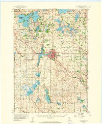
 1965 Renville1967 Print · USGSRenville was a bustling prairie rail hub in the mid-1960s, defined by its connection to the Chicago Milwaukee St Paul and Pacific line. Genealogists and historians can trace local landmarks like Ebenezer Ch, Emden Cem, and the old city Townhall.
 - 1965 Map of Prinsburg, 1967 Print
 1965 Prinsburg1967 Print · USGSThe rural agricultural landscapes of Kandiyohi County are shown here in the mid-1960s as a complex network of managed drainage and rail transit. Researchers can locate community anchors like Prinsburg, Holland Cem, and School No 815 along the Chicago and North Western line.
 - 1965 Map of Minnesota Falls, 1967 Print
 1965 Minnesota Falls1967 Print · USGSThe river valleys of Renville and Chippewa counties are shown here in the mid-1960s, centered on the settlement of Minnesota Falls. Researchers can trace the path of the Chicago Milwaukee St Paul and Pacific railroad and locate landmarks like the Vesper Song Chapel and Upper Sioux Indian Community.2 unique versions available
Showing maps 1-25 of 232
Top cities of Renville County
- Olivia historical maps
- Fairfax historical maps
- Bird Island historical maps
- Hector historical maps
- Buffalo Lake historical maps
- Sacred Heart historical maps
See more
Frequently asked questions
- What are the different types of historical maps available for Renville County?
- What is the oldest map of Renville County?
- Where can I purchase historical maps of Renville County for my home or office?
- Where can I download high-res historical maps of Renville County?
- Are there historical topographic maps available for Renville County?
- Is there historical aerial imagery available for Renville County?
- Where are historical maps of Renville County sourced from?