Old Maps of Greene County, Mississippi
Explore 47 old maps of Greene County, spanning from 1941 to today. These high-resolution historic maps reveal how streets, neighborhoods, landmarks, and natural features evolved over time — perfect for genealogy, metal detecting, research, and local history exploration.
What you can do with these maps:
- See how Greene County changed over time: Compare historical maps to modern-day views to trace roads, homesites, rail lines & more.
- View detailed metadata: Each map includes creators, publishers, year, scale, and archive source.
- Overlay maps with satellite & LiDAR: Visualize the past alongside modern tools to explore terrain & human change.
- Trusted historical sources: Maps sourced from the USGS, Library of Congress, and other archives.
- Access maps your way: View online, download high-res files, or order prints for personal or research use.
Start exploring old maps of Greene County to uncover forgotten places, hidden landmarks, and the deep history beneath your feet.
Greene County, MS maps
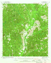
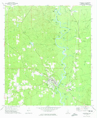
(47)- 1941 Map of Lucedale, 1961 Print
 1941 Lucedale1961 Print · USGSCovers Greene County, including Lucedale, Gibson Landing, and other nearby areas2 unique versions available
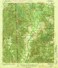
 - 1942 Map of Deer Park, 1966 Print
 1942 Deer Park1966 Print · USGSCovers Greene County, including Citronelle, Walley, and other nearby areas
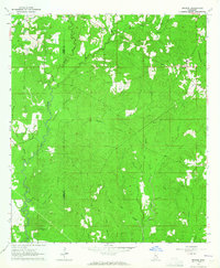
 - 1942 Map of Wilmer, 1968 Print
 1942 Wilmer1968 Print · USGSCovers Greene County, including Semmes, Earlville, and other nearby areas
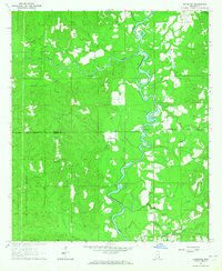
 - 1943 Map of Lucedale
 1943 Lucedale1943 Print · USGSCovers Greene County, including Lucedale, Gibson Landing, and other nearby areas2 unique versions available
 - 1943 Map of Deer Park
 1943 Deer Park1943 Print · USGSCovers Greene County, including Citronelle, Walley, and other nearby areas2 unique versions available
 - 1944 Map of Wilmer
 1944 Wilmer1944 Print · USGSCovers Greene County, including Semmes, Earlville, and other nearby areas2 unique versions available
 - 1947 Map of Beaumont, 1963 Print
 1947 Beaumont1963 Print · USGSCovers Greene County, including Beaumont, New Augusta, and other nearby areas2 unique versions available
 - 1947 Map of Benndale, 1966 Print
 1947 Benndale1966 Print · USGSCovers Greene County, including Batt Place, Avent, and other nearby areas2 unique versions available
 - 1949 Map of Beaumont
 1949 Beaumont1949 Print · USGSCovers Greene County, including Beaumont, New Augusta, and other nearby areas2 unique versions available
 - 1949 Map of Benndale
 1949 Benndale1949 Print · USGSCovers Greene County, including Batt Place, Avent, and other nearby areas2 unique versions available
 - 1953 Map of Hattiesburg, 1965 Print
 1953 Hattiesburg1965 Print · USGSCovers Greene County, including Hattiesburg, Laurel, and other nearby areas4 unique versions available
 - 1953 Map of Mobile, 1968 Print
 1953 Mobile1968 Print · USGSCovers Greene County, including New Orleans, Mobile, and other nearby areas3 unique versions available
 - 1957 Map of Mobile
 1957 Mobile1957 Print · USGSCovers Greene County, including New Orleans, Mobile, and other nearby areas3 unique versions available
 - 1958 Map of Hattiesburg
 1958 Hattiesburg1958 Print · USGSCovers Greene County, including Hattiesburg, Laurel, and other nearby areas2 unique versions available
 - 1960 Map of Mobile
 1960 Mobile1960 Print · USGSCovers Greene County, including New Orleans, Mobile, and other nearby areas
 - 1963 Map of Mobile
 1963 Mobile1963 Print · USGSCovers Greene County, including New Orleans, Mobile, and other nearby areas
 - 1963 Map of Brewer, 1965 Print
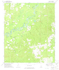
 1963 Brewer1965 Print · USGSCovers Greene County, including Sand Hill, Brewer, and other nearby areas4 unique versions available
 - 1964 Map of Knobtown, 1965 Print
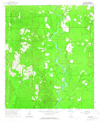
 1964 Knobtown1965 Print · USGSCovers Greene County, including Kittrell, Knobtown, and other nearby areas3 unique versions available
 - 1964 Map of Clark, 1965 Print
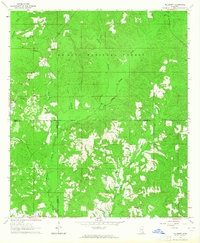
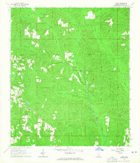
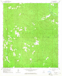
 1964 Clark1965 Print · USGSCovers Greene County, including Old Avera, Clark, and other nearby areas3 unique versions available
 - 1964 Map of Mulberry, 1965 Print
 1964 Mulberry1965 Print · USGSCovers Greene County, including Mulberry, Henderson, and other nearby areas3 unique versions available
 - 1964 Map of Avera, 1965 Print
 1964 Avera1965 Print · USGSCovers Greene County, including Avera, Bothwell, and other nearby areas3 unique versions available
 - 1964 Map of Piave, 1965 Print
 1964 Piave1965 Print · USGSCovers Greene County, including Piave, Smithtown, and other nearby areas4 unique versions available
 - 1965 Map of Mobile
 1965 Mobile1965 Print · USGSCovers Greene County, including New Orleans, Mobile, and other nearby areas
 - 1972 Map of Leakesville, 1974 Print
 1972 Leakesville1974 Print · USGSCovers Greene County, including Leakesville, Dueitt, and other nearby areas
 - 1972 Map of Vernal, 1975 Print
 1972 Vernal1975 Print · USGSCovers Greene County, including Vernal, United States, and other nearby areas
Showing maps 1-25 of 47
Top cities of Greene County
Frequently asked questions
- What are the different types of historical maps available for Greene County?
- What is the oldest map of Greene County?
- Where can I purchase historical maps of Greene County for my home or office?
- Where can I download high-res historical maps of Greene County?
- Are there historical topographic maps available for Greene County?
- Is there historical aerial imagery available for Greene County?
- Where are historical maps of Greene County sourced from?