Old Maps of Greene County, Mississippi for Metal Detecting
Plan your next treasure hunt with 147 historic maps of Greene County. Find old homesites, ghost towns, trails, and gathering spots that may be lost to time — perfect for identifying promising metal detecting locations.
- Locate forgotten sites: Uncover places like long-lost settlements, abandoned rail lines, or gathering spots.
- Plan better hunts: Use map overlays combined with LiDAR or satellite views to narrow in on historically rich areas.
- Made for detectorists: Thousands of hobbyists use these maps to discover relics, coins, and hidden history.
Use these historic maps to boost your research and find new opportunities beneath the surface of Greene County.
Greene County, MS maps
(147)- 1941 Map of Lucedale, 1961 Print
 1941 Lucedale1961 Print · USGSGeorge County's timber and rail landscape is meticulously captured here in the early 1940s as the rail lines intersect at Lucedale. Genealogists can trace family roots through numerous sites like Agricola High Sch, Woodard Cem, and the Mengel Lumber Camp.2 unique versions available
 - 1942 Map of Deer Park, 1966 Print
 1942 Deer Park1966 Print · USGSCrossing the state line in the 1940s, this area is defined by the river systems and early rail lines of the Piney Woods. Genealogists can locate family landmarks like Turners Store, Stalworth Camp, and small rural schools including McCann Sch.
 - 1942 Map of Wilmer, 1968 Print
 1942 Wilmer1968 Print · USGSMobile County and the Mississippi borderlands are captured here in the early 1940s, showing a landscape of timber ridges and river bottoms. Family historians can trace rural roots through Moffet Cem, Fellowship Ch, and the settlement at Wilmer.
 - 1943 Map of Lucedale
 1943 Lucedale1943 Print · USGSSoutheastern Mississippi at the start of the 1940s reveals a landscape of river confluences and timber-driven rail hubs. Genealogists can trace family landmarks like Ball Cem and Gibson Cem or old schools including Agricola High Sch.2 unique versions available
 - 1943 Map of Deer Park
 1943 Deer Park1943 Print · USGSSouthwestern Alabama near the Mississippi border is shown here during the early 1940s, centered on the logging and rail corridors of the Escatawpa River. Researchers can locate rural landmarks like Stalworth Camp, the Mississippi and Alabama RR, and several churches including Shiloh Ch.2 unique versions available
 - 1944 Map of Wilmer
 1944 Wilmer1944 Print · USGSMobile County and the Mississippi borderlands are captured here during the early years of the war. Genealogists and local historians can trace family roots through markers like Moffet, Semmes Cem, and the old Howell Sch along the Escatappa River.2 unique versions available
 - 1947 Map of Beaumont, 1963 Print
 1947 Beaumont1963 Print · USGSPerry and Greene Counties are shown in the late 1940s, where the winding Leaf River and timber lands meet the De Soto National Forest. Trace family history through landmarks like McSwain Sch, Lott Cem, and the railroad junctions at Beaumont.2 unique versions available
 - 1947 Map of Benndale, 1966 Print
 1947 Benndale1966 Print · USGSSoutheast Mississippi's piney woods and river bottoms are documented here just after the war. Researchers can locate family landmarks like Alexander Bridge, Indian Cem, and the community of Benndale amidst the Pascagoula River wetlands.2 unique versions available
 - 1949 Map of Beaumont
 1949 Beaumont1949 Print · USGSSoutheastern Mississippi timber and rail networks thrive mid-century at the junction of the Leaf River and Gulf Mobile and Ohio railroad. Researchers can locate the Camp Shelby Military Reservation and historic sites like Avent Station and the Lott Cem.2 unique versions available
 - 1949 Map of Benndale
 1949 Benndale1949 Print · USGSSoutheast Mississippi's piney woods and river bottoms come into focus in the late 1940s as the De Soto National Forest reaches across four counties. Researchers can trace the heritage of local settlements through Benndale, St Luke Ch, and several family cemeteries.2 unique versions available
 - 1953 Map of Hattiesburg, 1965 Print
 1953 Hattiesburg1965 Print · USGSSouth Mississippi and western Alabama are shown here during the mid-twentieth century as the timber and rail industries shaped the region. Genealogists and historians can trace rail lines like the Mississippi Central and locate rural centers such as Magee, Richton, and Mount Vernon.4 unique versions available
 - 1953 Map of Mobile, 1968 Print
 1953 Mobile1968 Print · USGSThe Gulf Coast comes alive in this mid-century survey, from the streets of Mobile to the marshes of New Orleans. Trace family roots in coastal towns like Pass Christian and Bayou La Batre or locate military landmarks including Keesler AFB.3 unique versions available
 - 1957 Map of Mobile
 1957 Mobile1957 Print · USGSThe Gulf Coast in the mid-1950s reveals a bustling corridor of rail-and-river commerce connecting Alabama to Louisiana. Genealogists and historians can trace old settlements and military hubs from Keesler Afb to the coastal reaches of Ship Island and Bogalusa.3 unique versions available
 - 1958 Map of Hattiesburg
 1958 Hattiesburg1958 Print · USGSSoutheastern Mississippi's timber and rail networks are at their peak during the late fifties, centered on the growing hubs of Hattiesburg and Laurel. Researchers can trace old family landmarks like Sims Chapel, the Busbey Game Refuge, and the vanished stops along the Mississippi Central railroad.2 unique versions available
 - 1960 Map of Mobile
 1960 Mobile1960 Print · USGSThe Gulf Coast at the dawn of the sixties shows a landscape of busy ports, military airbases, and barrier islands. Trace the rail lines of the Louisville & Nashville through BILOXI and Pascagoula or find family history in towns like Bayou La Batre and Poplarville.
 - 1963 Map of Mobile
 1963 Mobile1963 Print · USGSThe Gulf Coast at the dawn of the sixties shows a thriving maritime and military corridor from Louisiana to Alabama. Genealogists and historians can trace rail lines like the Louisville & Nashville RR and find landmarks from Brookley AFB to Fort Morgan.
 - 1963 Map of Brewer, 1965 Print
 1963 Brewer1965 Print · USGSSoutheast Mississippi's piney woods and creek bottoms are meticulously detailed in this early 1960s survey of the Perry and Greene county border. Genealogists and local historians can trace family ties through Sand Hill Cem, Nazareth Ch, and the small settlement of Brewer.4 unique versions available
 - 1964 Map of Knobtown, 1965 Print
 1964 Knobtown1965 Print · USGSSoutheast Mississippi's river bottomlands and pine forests are captured here in the mid-sixties, split by the winding Chickasawhay River. Researchers can trace rural lineages through numerous community landmarks like Slay Cemetery, Providence Church, and the settlement at Kittrell.3 unique versions available
 - 1964 Map of Clark, 1965 Print
 1964 Clark1965 Print · USGSGreene County in the mid-sixties remained a landscape of dense timber and quiet river bends along the Chickasawhay River. Genealogists can trace family connections at Old Avera and numerous rural burial sites like Adamsville Cem and Fellowship Cem.3 unique versions available
 - 1964 Map of Mulberry, 1965 Print
 1964 Mulberry1965 Print · USGSSoutheast Mississippi's pine forests and county corners are captured in detail here during the mid-1960s. Genealogists and local historians can locate rural landmarks like Mulberry, Union Grove Ch, and the Hickory Grove Cem tucked within the De Soto National Forest.3 unique versions available
 - 1964 Map of Avera, 1965 Print
 1964 Avera1965 Print · USGSGreene County's pine-forested interior is captured in the mid-1960s, showing the rural communities and forest lands of southeast Mississippi. Researchers can trace family sites at Mutual Rights Ch or locate the James Cem and Indian Hill Cem near Avera.3 unique versions available
 - 1964 Map of Piave, 1965 Print
 1964 Piave1965 Print · USGSMississippi's piney woods come into focus during the mid-sixties, capturing the rural landscape of the Wayne and Greene county border. Researchers can locate the community of Piave, find Henderson Cem, and trace the paths of Hell Hole Creek and Turkey Fork.4 unique versions available
 - 1965 Map of Mobile
 1965 Mobile1965 Print · USGSThe Gulf Coast at mid-century reveals a landscape of expanding ports and vital military installations from Louisiana to Alabama. Genealogists and historians can trace the growth of Biloxi, Pascagoula, and Mobile, alongside the sprawling De Soto National Forest.
 - 1972 Map of Leakesville, 1974 Print
 1972 Leakesville1974 Print · USGSLeakesville and the Greene County riverlands are captured in the early seventies, centered on the winding Chickasawhay River. Genealogists and local historians can trace family roots through the Magnolia Cemetery, East Salem Church, and the many family-named landmarks like Robertson Cemetery.
 - 1972 Map of Vernal, 1975 Print
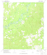 1972 Vernal1975 Print · USGSGreene County at the start of the 1970s reveals a quiet landscape of river bends and rural family settlements. Genealogists can locate several historic burial sites like McInnis Cem and White Chapel Sandy Branch Cem near the town of Vernal.
Showing maps 1-25 of 147
Top cities of Greene County
Frequently asked questions
- What are the different types of historical maps available for Greene County?
- What is the oldest map of Greene County?
- Where can I purchase historical maps of Greene County for my home or office?
- Where can I download high-res historical maps of Greene County?
- Are there historical topographic maps available for Greene County?
- Is there historical aerial imagery available for Greene County?
- Where are historical maps of Greene County sourced from?