1960s Maps of Greene County, Mississippi
Explore 9 historic maps of Greene County from the 1960s. These maps offer a rare glimpse into what life looked like during the 1960s — showing old roads, neighborhoods, homes, and landmarks that have changed or disappeared over time.
Whether you're researching your family's past, planning a metal detecting trip, or studying how Greene County's landscape evolved across the 1960s, these high-resolution maps are a powerful tool for exploring the history of this region.
- Focus on a specific era: All maps on this page are from the 1960s, giving you a focused view of this time period.
- See what’s changed: Compare century-old streets, trails, and buildings to today's modern landscape using overlays and satellite layers.
- Research with precision: Use these maps for genealogy, historical research, land use analysis, or educational projects.
- View, download, or print: Maps are fully viewable online in high resolution, and can be downloaded or printed for your own records.
Start exploring Greene County's history through authentic maps from the 1960s. This is your window into the past.
Greene County, MS maps
(9)- 1960 Map of Mobile
 1960 Mobile1960 Print · USGSThe Gulf Coast at the dawn of the sixties shows a landscape of busy ports, military airbases, and barrier islands. Trace the rail lines of the Louisville & Nashville through BILOXI and Pascagoula or find family history in towns like Bayou La Batre and Poplarville.
 - 1963 Map of Mobile
 1963 Mobile1963 Print · USGSThe Gulf Coast at the dawn of the sixties shows a thriving maritime and military corridor from Louisiana to Alabama. Genealogists and historians can trace rail lines like the Louisville & Nashville RR and find landmarks from Brookley AFB to Fort Morgan.
 - 1963 Map of Brewer, 1965 Print
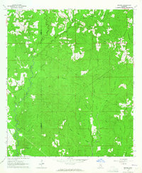 1963 Brewer1965 Print · USGSSoutheast Mississippi's piney woods and creek bottoms are meticulously detailed in this early 1960s survey of the Perry and Greene county border. Genealogists and local historians can trace family ties through Sand Hill Cem, Nazareth Ch, and the small settlement of Brewer.4 unique versions available
 - 1964 Map of Knobtown, 1965 Print
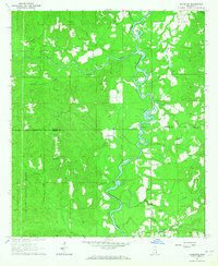 1964 Knobtown1965 Print · USGSSoutheast Mississippi's river bottomlands and pine forests are captured here in the mid-sixties, split by the winding Chickasawhay River. Researchers can trace rural lineages through numerous community landmarks like Slay Cemetery, Providence Church, and the settlement at Kittrell.3 unique versions available
 - 1964 Map of Clark, 1965 Print
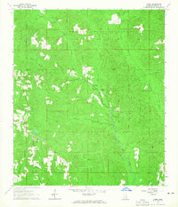
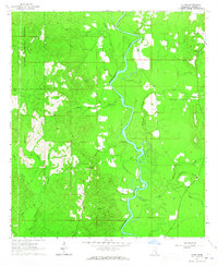 1964 Clark1965 Print · USGSGreene County in the mid-sixties remained a landscape of dense timber and quiet river bends along the Chickasawhay River. Genealogists can trace family connections at Old Avera and numerous rural burial sites like Adamsville Cem and Fellowship Cem.3 unique versions available
 - 1964 Map of Mulberry, 1965 Print
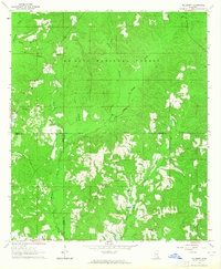 1964 Mulberry1965 Print · USGSSoutheast Mississippi's pine forests and county corners are captured in detail here during the mid-1960s. Genealogists and local historians can locate rural landmarks like Mulberry, Union Grove Ch, and the Hickory Grove Cem tucked within the De Soto National Forest.3 unique versions available
 - 1964 Map of Avera, 1965 Print
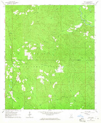
 1964 Avera1965 Print · USGSGreene County's pine-forested interior is captured in the mid-1960s, showing the rural communities and forest lands of southeast Mississippi. Researchers can trace family sites at Mutual Rights Ch or locate the James Cem and Indian Hill Cem near Avera.3 unique versions available
 - 1964 Map of Piave, 1965 Print
 1964 Piave1965 Print · USGSMississippi's piney woods come into focus during the mid-sixties, capturing the rural landscape of the Wayne and Greene county border. Researchers can locate the community of Piave, find Henderson Cem, and trace the paths of Hell Hole Creek and Turkey Fork.4 unique versions available
 - 1965 Map of Mobile
 1965 Mobile1965 Print · USGSThe Gulf Coast at mid-century reveals a landscape of expanding ports and vital military installations from Louisiana to Alabama. Genealogists and historians can trace the growth of Biloxi, Pascagoula, and Mobile, alongside the sprawling De Soto National Forest.
End of results
Showing maps 1-9 of 9
Top cities of Greene County
Frequently asked questions
- What are the different types of historical maps available for Greene County?
- What is the oldest map of Greene County?
- Where can I purchase historical maps of Greene County for my home or office?
- Where can I download high-res historical maps of Greene County?
- Are there historical topographic maps available for Greene County?
- Is there historical aerial imagery available for Greene County?
- Where are historical maps of Greene County sourced from?