1970s Maps of Greene County, Mississippi
Explore 6 historic maps of Greene County from the 1970s. These maps offer a rare glimpse into what life looked like during the 1970s — showing old roads, neighborhoods, homes, and landmarks that have changed or disappeared over time.
Whether you're researching your family's past, planning a metal detecting trip, or studying how Greene County's landscape evolved across the 1970s, these high-resolution maps are a powerful tool for exploring the history of this region.
- Focus on a specific era: All maps on this page are from the 1970s, giving you a focused view of this time period.
- See what’s changed: Compare century-old streets, trails, and buildings to today's modern landscape using overlays and satellite layers.
- Research with precision: Use these maps for genealogy, historical research, land use analysis, or educational projects.
- View, download, or print: Maps are fully viewable online in high resolution, and can be downloaded or printed for your own records.
Start exploring Greene County's history through authentic maps from the 1970s. This is your window into the past.
Greene County, MS maps
(6)- 1972 Map of Leakesville, 1974 Print
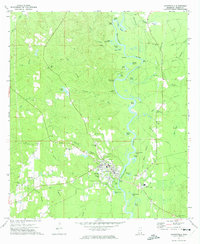 1972 Leakesville1974 Print · USGSLeakesville and the Greene County riverlands are captured in the early seventies, centered on the winding Chickasawhay River. Genealogists and local historians can trace family roots through the Magnolia Cemetery, East Salem Church, and the many family-named landmarks like Robertson Cemetery.
 - 1972 Map of Vernal, 1975 Print
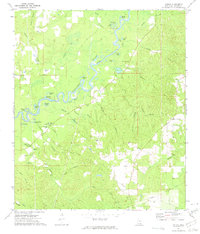 1972 Vernal1975 Print · USGSGreene County at the start of the 1970s reveals a quiet landscape of river bends and rural family settlements. Genealogists can locate several historic burial sites like McInnis Cem and White Chapel Sandy Branch Cem near the town of Vernal.
 - 1973 Map of Jonathan, 1974 Print
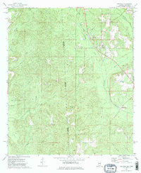
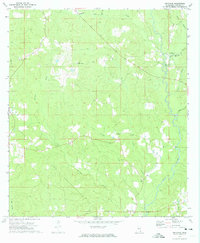 1973 Jonathan1974 Print · USGSGreene County is shown in the early seventies, a landscape of timber stands and winding creek bottoms defined by Big Creek. Researchers can trace old family sites near Hillman, locate the Green Lookout Tower, or find rural landmarks like Corinth Ch.2 unique versions available
 - 1973 Map of Leakesville SW, 1975 Print
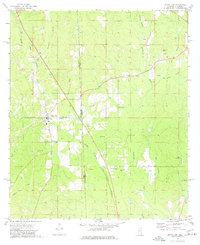
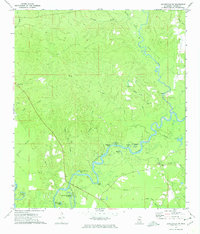 1973 Leakesville SW1975 Print · USGSGreene County in the early seventies is defined by the winding course of the Chickasawhay River and its labyrinth of oxbow lakes. Genealogists and local historians can locate remote landmarks like Green Lodge Cem, Pine Grove Ch, and the crossing at Miller Bridge.2 unique versions available
 - 1974 Map of Fruitdale, 1977 Print
 1974 Fruitdale1977 Print · USGSFruitdale and the Mississippi-Alabama borderlands appear here in the mid-1970s, showcasing a landscape of timber, rail, and deep-rooted family settlements. Genealogists can locate several burial sites including South Oak Grove Cem and Fruitdale Cem, while tracing the Illinois Central Gulf line.2 unique versions available
 - 1974 Map of State Line, 1977 Print
 1974 State Line1977 Print · USGSThe Mississippi-Alabama borderlands come into focus in the mid-1970s, showing the vital rail and timber corridor near State Line. Genealogists and local historians can locate rural landmarks like Yellow Pine, the Gilley Cem, and the Milstead Lookout Tower.2 unique versions available
End of results
Showing maps 1-6 of 6
Top cities of Greene County
Frequently asked questions
- What are the different types of historical maps available for Greene County?
- What is the oldest map of Greene County?
- Where can I purchase historical maps of Greene County for my home or office?
- Where can I download high-res historical maps of Greene County?
- Are there historical topographic maps available for Greene County?
- Is there historical aerial imagery available for Greene County?
- Where are historical maps of Greene County sourced from?