1970s Maps of Itawamba County, Mississippi
Explore 2 historic maps of Itawamba County from the 1970s. These maps offer a rare glimpse into what life looked like during the 1970s — showing old roads, neighborhoods, homes, and landmarks that have changed or disappeared over time.
Whether you're researching your family's past, planning a metal detecting trip, or studying how Itawamba County's landscape evolved across the 1970s, these high-resolution maps are a powerful tool for exploring the history of this region.
- Focus on a specific era: All maps on this page are from the 1970s, giving you a focused view of this time period.
- See what’s changed: Compare century-old streets, trails, and buildings to today's modern landscape using overlays and satellite layers.
- Research with precision: Use these maps for genealogy, historical research, land use analysis, or educational projects.
- View, download, or print: Maps are fully viewable online in high resolution, and can be downloaded or printed for your own records.
Start exploring Itawamba County's history through authentic maps from the 1970s. This is your window into the past.
Itawamba County, MS maps
(2)- 1973 Map of Mooreville, 1975 Print
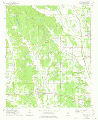 1973 Mooreville1975 Print · USGSThe rural landscapes of Lee and Itawamba Counties are captured here in the mid-1970s, showcasing a network of small farming settlements and creek-side communities. Family historians can trace long-standing landmarks like Hebron Ch, Gilvo Cem, and the old settlement at Mantachie.
 - 1973 Map of Ratliff, 1975 Print
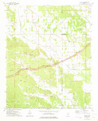 1973 Ratliff1975 Print · USGSNortheast Mississippi was a landscape of quiet crossroads and historic creek bottoms in the early seventies. Genealogists can trace family names and local landmarks like Ratliff, the Peterson Cem, and the Natchez Trace Parkway.
End of results
Showing maps 1-2 of 2
Top cities of Itawamba County
Frequently asked questions
- What are the different types of historical maps available for Itawamba County?
- What is the oldest map of Itawamba County?
- Where can I purchase historical maps of Itawamba County for my home or office?
- Where can I download high-res historical maps of Itawamba County?
- Are there historical topographic maps available for Itawamba County?
- Is there historical aerial imagery available for Itawamba County?
- Where are historical maps of Itawamba County sourced from?