Old Maps of Lincoln County, Mississippi for Metal Detecting
Plan your next treasure hunt with 128 historic maps of Lincoln County. Find old homesites, ghost towns, trails, and gathering spots that may be lost to time — perfect for identifying promising metal detecting locations.
- Locate forgotten sites: Uncover places like long-lost settlements, abandoned rail lines, or gathering spots.
- Plan better hunts: Use map overlays combined with LiDAR or satellite views to narrow in on historically rich areas.
- Made for detectorists: Thousands of hobbyists use these maps to discover relics, coins, and hidden history.
Use these historic maps to boost your research and find new opportunities beneath the surface of Lincoln County.
Lincoln County, MS maps
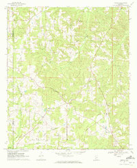
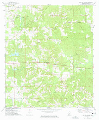
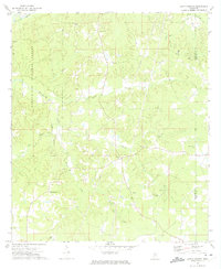
(128)- 1953 Map of Natchez, 1966 Print
 1953 Natchez1966 Print · USGSSouthwest Mississippi and the Louisiana border country come alive in this mid-century survey of the river valley and forest lands. Researchers can trace the rail lines of the Illinois Central RR and locate rural hubs like Gloster and Ferriday.3 unique versions available
 - 1956 Map of Natchez
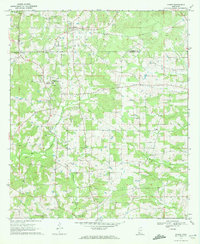
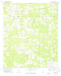
 1956 Natchez1956 Print · USGSThe Mississippi River borderlands and the Pine Hills come alive in this mid-fifties study of the Natchez region. Genealogists and historians can trace rail-era towns along the Illinois Central RR and explore the oxbows of Lake Bruin and Lake Concordia.
 - 1959 Map of Natchez
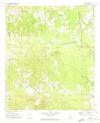
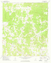
 1959 Natchez1959 Print · USGSSouthwestern Mississippi and eastern Louisiana are captured in the late fifties, showing a landscape defined by the winding Mississippi River and the timbered Homochitto National Forest. Researchers can trace the sprawling Illinois Central RR and find rural landmarks like Union Church and Camp Van Dorn (Abandoned).
 - 1970 Map of Topeka, 1972 Print
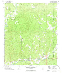
 1970 Topeka1972 Print · USGSLawrence County and the Lawrence-Lincoln border appear here in the early seventies, capturing a rural landscape of ridges and creek bottoms. Genealogists can trace family connections through landmarks like Ballards Chapel, Topeka-Tilton Sch, and the many gravel pits near Topeka.
 - 1970 Map of Jayess, 1972 Print
 1970 Jayess1972 Print · USGSSouth Mississippi rural life in the early seventies centers on the settlements of Jayess and Enon. Genealogists and historians can trace community roots through numerous landmarks like New Hope Ch, Greer Cem, and the New Bethel Sch.
 - 1970 Map of Nola, 1972 Print
 1970 Nola1972 Print · USGSLawrence County and the outskirts of Monticello are captured here in the early seventies, showing a landscape of timbered hills and winding creek bottoms. Genealogists can trace rural communities around Mt Pleasant Ch, New Zion Ch, and Rosella along the Gulf Mobile and Ohio tracks.
 - 1971 Map of Oma, 1973 Print
 1971 Oma1973 Print · USGSThe rural borderlands of Lawrence and Copiah Counties are captured here in the early 1970s along the winding Pearl River. Researchers can trace family history through sites like Bahala Chapel Cem, the rail stop at Oma, and the Gulf Mobile and Ohio line.2 unique versions available
 - 1972 Map of West Lincoln, 1974 Print
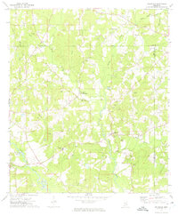
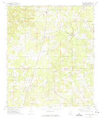 1972 West Lincoln1974 Print · USGSLincoln County in the early seventies shows a landscape of creek-side settlements and family homesteads. Genealogists can trace rural roots at Moak & Sasser Cem, Mt Zion Ch, and the community of West Lincoln.
 - 1972 Map of Fair Oak Springs, 1974 Print
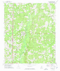
 1972 Fair Oak Springs1974 Print · USGSLincoln County's timber and river country is documented here in the early seventies, showing a landscape of rural hamlets and deep creek bottoms. Researchers can locate vanished landmarks and family sites like Heucks Retreat, Kees Cem, and Hopewell Ch.
 - 1972 Map of Smithdale, 1974 Print
 1972 Smithdale1974 Print · USGSAmite County and Franklin County are captured here in the early seventies, a landscape of family farms and rural industry along the Amite River. Researchers can locate several family burial sites like Lumpkin Cem and old country parishes such as Oak Grove Ch.
 - 1972 Map of Midway, 1974 Print
 1972 Midway1974 Print · USGSThe rural border of Copiah and Lincoln counties comes into focus in the early 1970s, showing a landscape shaped by gravel extraction and small settlements. Researchers can trace the roots of local families at Midway, Loyd Star, and Newell Cem.
 - 1972 Map of McCall Creek, 1974 Print
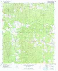
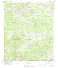
 1972 McCall Creek1974 Print · USGSFranklin and Lincoln counties are shown here in the early seventies, where the massive Homochitto National Forest meets local rail towns. Genealogists can locate family burial sites like Wright Cem and rural centers such as McCall Creek or Shucktown.
 - 1972 Map of Little Springs, 1974 Print
 1972 Little Springs1974 Print · USGSFranklin and Lincoln counties in the early 1970s are shown here as a landscape of timber and rural homesteads. Genealogists can trace family names at McCall Ch, Cotton Cem, and the settlement of Little Springs near the historic Indian Treaty Boundary.
 - 1972 Map of Auburn, 1974 Print
 1972 Auburn1974 Print · USGSAmite and Lincoln Counties come into focus in the early seventies as the local oil industry expands across the landscape. Genealogists can trace family roots through numerous country sites like Johnston Chapel, Terrell Cem, and the Smithdale Oil Field.
 - 1972 Map of Caseyville, 1974 Print
 1972 Caseyville1974 Print · USGSSettled at the intersection of Lincoln and Copiah counties in the early seventies, this area features the dense woodlands of the Homochitto National Forest. Genealogists can locate family landmarks like Ben Salem Cem, Philadelphia Ch, and the community of Caseyville.
 - 1972 Map of Ruth, 1974 Print
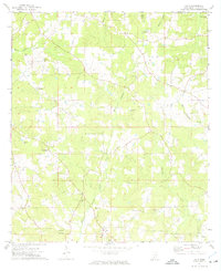 1972 Ruth1974 Print · USGSLincoln County’s rural landscape is captured here in the early seventies, centered on the communities of Ruth and East Lincoln. Researchers can trace local lineage through family-named sites like Moak Cem and Brister Cem or locate the path of the Old Railroad Grade.
 - 1972 Map of Pricedale, 1974 Print
 1972 Pricedale1974 Print · USGSPike and Lincoln Counties are captured in the early seventies, showcasing a rural landscape defined by oil production and creek-side settlements. Genealogists can locate family-named landmarks like McDavid Cem and McEwen Cem or local centers like Pricedale and Felders Campground.
 - 1972 Map of Bogue Chitto, 1974 Print
 1972 Bogue Chitto1974 Print · USGSLincoln County’s rail and oil corridors are in full view during the early 1970s, centered on the historic timber and rail hub of Bogue Chitto. Researchers can trace local genealogy through numerous rural landmarks like Stewarts Cem, Norfield, and the Mallalieu Oil Field.2 unique versions available
 - 1972 Map of Stronghope, 1974 Print
 1972 Stronghope1974 Print · USGSThe rural landscape near the Copiah and Lincoln county line comes into focus in the early 1970s. Trace local history through numerous country landmarks like Zion Hill Ch, the Old Indian Treaty Boundary, and the Illinois Central Gulf railroad.
 - 1972 Map of Brookhaven, 1974 Print
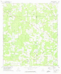
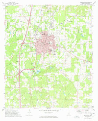 1972 Brookhaven1974 Print · USGSBrookhaven and its surrounding Lincoln County landscape appear here in the early seventies, caught between its rail-hub heritage and modern growth. Researchers can trace family sites from Rose Hill Cemetery to Whitworth College and locate rural landmarks like Lacks Chapel.2 unique versions available
 - 1972 Map of Zetus, 1974 Print
 1972 Zetus1974 Print · USGSLincoln County’s rural character and oil industry are well-defined in the early 1970s as the Brookhaven Oil Field expanded across the landscape. Researchers can trace family history through numerous landmarks like Friendship Ch, Old Macedonia Cem, and the old Treaty Boundary.
 - 1972 Map of Wesson, 1974 Print
 1972 Wesson1974 Print · USGSThe town of Wesson and the neighboring village of Beauregard are captured in the early 1970s as the regional rail economy transitioned. Local historians can trace the Indian Treaty Boundary and locate landmarks like Copiah Lincoln Jr College and Mathews Chapel.2 unique versions available
 - 1972 Map of McComb North, 1974 Print
 1972 McComb North1974 Print · USGSThe Pike County corridor in the early seventies shows the steady growth of Summit and Mc Comb along the Illinois Central Gulf rail line. Researchers can trace local roots at Johnstons Station or locate family plots in Woodlawn Cem and Rocky Point Cem.
 - 1984 Map of Brookhaven
 1984 Brookhaven1984 Print · USGSSouth-central Mississippi's rural character and rail-centered commerce are shown here in the mid-eighties, from the Homochitto woods to the Pearl River. Trace local roots through Union Church, Meadows Store, and the campus of Copiah-Lincoln Jr College.2 unique versions available
 - 1984 Map of McComb
 1984 McComb1984 Print · USGSSouth Mississippi in the mid-eighties was defined by the rail corridor connecting McComb and Magnolia to the surrounding timberlands. You can trace the rural network of Pike County through landmarks like Holmesville, Percy Quin State Park, and the winding Bogue Chitto.
Showing maps 1-25 of 128
Top cities of Lincoln County
Frequently asked questions
- What are the different types of historical maps available for Lincoln County?
- What is the oldest map of Lincoln County?
- Where can I purchase historical maps of Lincoln County for my home or office?
- Where can I download high-res historical maps of Lincoln County?
- Are there historical topographic maps available for Lincoln County?
- Is there historical aerial imagery available for Lincoln County?
- Where are historical maps of Lincoln County sourced from?