Old Maps of Washington County, Mississippi for Metal Detecting
Plan your next treasure hunt with 167 historic maps of Washington County. Find old homesites, ghost towns, trails, and gathering spots that may be lost to time — perfect for identifying promising metal detecting locations.
- Locate forgotten sites: Uncover places like long-lost settlements, abandoned rail lines, or gathering spots.
- Plan better hunts: Use map overlays combined with LiDAR or satellite views to narrow in on historically rich areas.
- Made for detectorists: Thousands of hobbyists use these maps to discover relics, coins, and hidden history.
Use these historic maps to boost your research and find new opportunities beneath the surface of Washington County.
Washington County, MS maps
(167)- 1933 Map of Lamont
 1933 Lamont1933 Print · USGSThe Mississippi River delta in the early 1930s is captured here just after the historic floods of the previous decade. Genealogists and historians can trace the foundations of Arkansas City, locate rural sites like Eutaw Store, and follow the tracks of the Mo Pac RR.
 - 1939 Map of Readland, 1942 Print
 1939 Readland1942 Print · USGSThe tri-state delta country comes alive in this late Depression-era survey of the Mississippi riverfront. Genealogists and historians can trace numerous rural congregations and landings, from the Graymound Cem to Lakeport Ldg and Daniels Chapel Shiloh Ch.3 unique versions available
 - 1939 Map of Refuge, 1949 Print
 1939 Refuge1949 Print · USGSThe Mississippi River delta in the late thirties reveals a landscape shaped by massive engineering projects and traditional river life. Trace the shifting banks and cutoff channels alongside rural settlements like Refuge, the rails of the Yazoo and Mississippi Valley Railroad, and local landmarks like Macedonia Ch.4 unique versions available
 - 1939 Map of Lamont, 1961 Print
 1939 Lamont1961 Print · USGSThe Mississippi Delta in the late thirties reveals a landscape in transition as engineering cut-offs reshaped the river's path. Researchers can locate vanished landings like Monterey Ldg, trace the Yazoo and Mississippi Valley rail line, and find rural centers like Morning Star Ch & Sch.3 unique versions available
 - 1939 Map of Tralake, 1964 Print
 1939 Tralake1964 Print · USGSWashington County in the late 1930s shows a landscape of intensive Delta farming and rail-side commerce. Researchers can trace family roots through numerous local churches like St Marys Ch and St James Ch or locate forgotten stops like Aldridge and Burdett.
 - 1939 Map of Choctaw, 1965 Print
 1939 Choctaw1965 Print · USGSBolivar County and Washington County are captured here at the end of the 1930s, showing a Delta landscape transformed by drainage canals and rail. You can trace early twentieth-century settlement patterns through landmarks like Mt Olive Ch, the Illinois Central Railroad corridor, and the community at Shaw.
 - 1939 Map of Swan Lake, 1966 Print
 1939 Swan Lake1966 Print · USGSThe Mississippi Delta's intricate water and rail networks are captured here during the late 1930s. Researchers can locate numerous plantation-era settlements and landmarks including Indian Mounds, the community of Nitta Yuma, and the grounds of Leroy Percy State Park.
 - 1940 Map of Auter, 1941 Print
 1940 Auter1941 Print · USGSThe Mississippi Delta in the early 1940s is captured here as a world of river landings and plantation agriculture along the Big Sunflower River. Genealogists and researchers can trace family landmarks at Hard Cash, Midnight, and Daybreak Plantation.
 - 1940 Map of Baird, 1942 Print
 1940 Baird1942 Print · USGSThe Mississippi Delta's intricate river and rail economy is on full display during the early 1940s. Genealogists and historians can trace family roots through specific landmarks like Price School, Heard Ferry, and the many small settlements like Baird and Inverness.
 - 1953 Map of Greenwood, 1966 Print
 1953 Greenwood1966 Print · USGSThe Mississippi Delta in the mid-fifties is captured here as a thriving network of river towns, railroads, and oxbow lakes. Researchers can trace the legacy of the Illinois Central Railroad and locate landmarks like the State Penal Farm and Greenville Air Force Base.5 unique versions available
 - 1956 Map of Greenwood
 1956 Greenwood1956 Print · USGSThe Mississippi Delta in the mid-fifties is captured here during a period of significant military and agricultural activity. Researchers can trace the rail lines of the Illinois Central RR, find the Greenville Air Force Base, or locate the State Penal Farm.
 - 1965 Map of Richey, 1966 Print
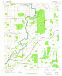 1965 Richey1966 Print · USGSSharkey County and the surrounding Delta lands are captured here in the mid-1960s as the river economy remained central to local life. Genealogists can locate family landmarks like Short Jerusalem Ch and the river crossings at Murphy Ferry or Bommers Ferry.
 - 1965 Map of Kinlock, 1966 Print
 1965 Kinlock1966 Print · USGSThe Mississippi Delta's river-driven landscape is captured here in the mid-sixties, centering on the curves of the Big Sunflower River. Genealogists and historians can trace family-named estates like Waco Plantation and local landmarks like Big Morning Star Ch.
 - 1965 Map of Midnight NW, 1966 Print
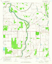 1965 Midnight NW1966 Print · USGSHumphreys and Washington Counties are shown in the mid-1960s as a landscape of alluvial waterways and delta farmland. Genealogists and historians can trace local landmarks like Pilgrim Rest Cem, Sunflower Chapel, and an ancient Indian Mound along the Big Sunflower River.
 - 1967 Map of Baird
 1967 Baird1967 Print · USGSThe Mississippi Delta's rail-and-river economy is on full display in the late 1960s, centered on the crossing of major lines at Indianola. Locate ancestral sites like Woodburn Plantation or country churches including Union Star Ch and Indian Bayou Ch.
 - 1967 Map of Auter
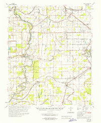 1967 Auter1967 Print · USGSHumphreys County and the surrounding Delta flatlands are captured here in the late sixties as the agricultural economy relied on both rail and river. Trace family roots at Midnight or Silver City, and find old landmarks like River Oak Sch and Pilgrim Rest Cem.
 - 1967 Map of Tribbett, 1968 Print
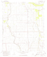 1967 Tribbett1968 Print · USGSThe Mississippi Delta's agricultural heartland is captured here in the late sixties, showing a landscape defined by its bayous and sloughs. Genealogists and local historians can trace family-named landmarks and rural congregations like Mt Zion Ch, Bourbon, and the Indian Mounds near Sixmile Bayou.2 unique versions available
 - 1967 Map of Arcola, 1968 Print
 1967 Arcola1968 Print · USGSThe Mississippi Delta's intricate landscape of winding bayous and rail lines is captured here in the late sixties. Trace the local genealogy and land use through landmarks like Arcola, the ILLINOIS CENTRAL railroad, and Morning Star Ch.2 unique versions available
 - 1967 Map of Stringtown, 1968 Print
 1967 Stringtown1968 Print · USGSThe Bolivar and Washington County line in the late sixties reveals a landscape of delta bayous and rural settlements. Genealogists can trace family landmarks like Asia Cem and Kindling Altar Ch, or locate the historic Indian Treaty Boundary near Meltonia.2 unique versions available
 - 1967 Map of Leland, 1968 Print
 1967 Leland1968 Print · USGSThe Mississippi Delta's rail and river landscape comes alive in this late 1960s survey of the Leland area. Genealogists and historians can locate family landmarks like Greenlawn Memorial Gardens, trace the paths of Deer Creek, and find small settlements such as Magenta and Stoneville.2 unique versions available
 - 1967 Map of Shaw, 1968 Print
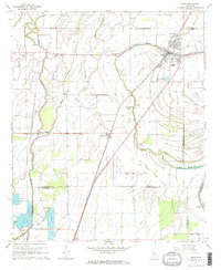 1967 Shaw1968 Print · USGSThe Mississippi Delta's agricultural heartland is captured here in the late sixties, centered on the railroad town of Shaw. Genealogists and historians can trace the Old Indian Treaty Boundary and locate rural landmarks like Strangers Rest Cem and Choctaw.2 unique versions available
 - 1967 Map of Holly Ridge, 1968 Print
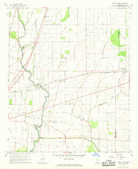 1967 Holly Ridge1968 Print · USGSThe Mississippi Delta in the late sixties reveals a landscape of winding bayous and railroad-adjacent settlements. Genealogists can locate family landmarks like Jones Cem, Old Whitestone Ch, and the rural community of Rexburg.2 unique versions available
 - 1967 Map of Swan Lake NW, 1968 Print
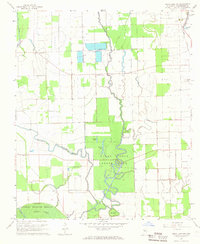 1967 Swan Lake NW1968 Print · USGSThe Mississippi Delta's complex water systems and rural life are detailed here in the late sixties. Genealogists and historians can trace the foundations of Washington County communities through Macedonia Cem, Indian Mounds, and the Muskedine settlement.
 - 1967 Map of Percy, 1970 Print
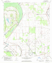 1967 Percy1970 Print · USGSThis Mississippi Delta landscape in the late sixties reveals a mix of protected wetlands and deep-rooted agricultural life across three counties. Genealogists and researchers can locate old communities like Percy and Grace, or trace family landmarks including Canaan Hill Cem and Goodwill Ch.2 unique versions available
 - 1968 Map of Hollandale, 1969 Print
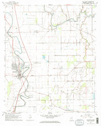 1968 Hollandale1969 Print · USGSThe Mississippi Delta landscape of the late sixties centers on the railroad town of Hollandale and its winding bayous. Researchers can trace family history through local sites like Simmons Sch and family-named cemeteries such as Magruder Cem.2 unique versions available
Showing maps 1-25 of 167
Top cities of Washington County
- Greenville historical maps
- Leland historical maps
- Hollandale historical maps
- Metcalfe historical maps
- Arcola historical maps
Frequently asked questions
- What are the different types of historical maps available for Washington County?
- What is the oldest map of Washington County?
- Where can I purchase historical maps of Washington County for my home or office?
- Where can I download high-res historical maps of Washington County?
- Are there historical topographic maps available for Washington County?
- Is there historical aerial imagery available for Washington County?
- Where are historical maps of Washington County sourced from?