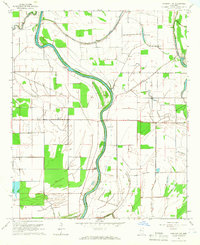
1965 Map of Midnight NW
USGS Topo · Published 1966About this map
The Big Sunflower River defines the landscape of this Mississippi Delta region, winding through the boundary of Washington and Humphreys Counties. In the mid-1960s, the area was characterized by a complex network of waterways including Bogue Phalia, Beasley Bayou, and Mills Bayou, which drained the surrounding agricultural lands. Cultural landmarks such as the Indian Mound suggest ancient habitation, while more contemporary 20th-century life is marked by the presence of Central Ch and Sunflower Chapel.
Find a feature on this map
20 named features on this map. Tap any name to fly to it.
Don’t see what you’re looking for? This feature index may not catch every label — zoom into the map to look around manually.
Map Details
Editions of this 1965 Midnight NW Map
This is the sole edition of this map. No revisions or reprints were ever made.
Other maps of this area

1939 · Tralake
USGS Topo · 1:62,500

1939 · Swan Lake
USGS Topo · 1:62,500

1940 · Auter
USGS Topo · 1:62,500

1940 · Baird
USGS Topo · 1:62,500

1953 · Greenwood
USGS Topo · 1:250,000

1956 · Greenwood
USGS Topo · 1:250,000
1965 · Richey
USGS Topo · 1:24,000
1965 · Midnight
USGS Topo · 1:24,000

1965 · Inverness
USGS Topo · 1:24,000

1965 · Kinlock
USGS Topo · 1:24,000