1970s Maps of Callaway County, Missouri
Explore 13 historic maps of Callaway County from the 1970s. These maps offer a rare glimpse into what life looked like during the 1970s — showing old roads, neighborhoods, homes, and landmarks that have changed or disappeared over time.
Whether you're researching your family's past, planning a metal detecting trip, or studying how Callaway County's landscape evolved across the 1970s, these high-resolution maps are a powerful tool for exploring the history of this region.
- Focus on a specific era: All maps on this page are from the 1970s, giving you a focused view of this time period.
- See what’s changed: Compare century-old streets, trails, and buildings to today's modern landscape using overlays and satellite layers.
- Research with precision: Use these maps for genealogy, historical research, land use analysis, or educational projects.
- View, download, or print: Maps are fully viewable online in high resolution, and can be downloaded or printed for your own records.
Start exploring Callaway County's history through authentic maps from the 1970s. This is your window into the past.
Callaway County, MO maps
(13)- 1972 Map of Auxvasse, 1974 Print
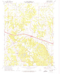
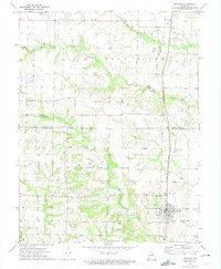 1972 Auxvasse1974 Print · USGSCallaway and Audrain counties are shown in the early seventies during a period of steady rural character. Genealogists can locate family sites near Auxvasse and Concord, or trace the Gulf Central Illinois rail line and Grand Prairie Cem.
 - 1972 Map of Mexico SE, 1974 Print
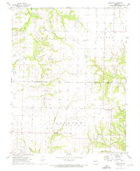 1972 Mexico SE1974 Print · USGSThe rural borderlands of Audrain and Callaway counties are captured here in the early seventies. Genealogists and local historians can trace family roots through sites like New Hope Cem, the settlement at Watts, and the industrial Claypits.2 unique versions available
 - 1973 Map of Kingdom City, 1975 Print
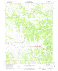
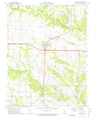 1973 Kingdom City1975 Print · USGSKingdom City and its rural Callaway County surroundings are captured in the early 1970s, showing a landscape defined by creek branches and the Illinois Central Gulf rail line. Genealogists and local historians can locate the Richland Cem, Richland Ch, and landmarks like the Drive-in Theater.2 unique versions available
 - 1973 Map of Martinsburg, 1975 Print
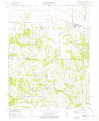 1973 Martinsburg1975 Print · USGSMartinsburg and the rural crossroads of Shamrock appear in the early 1970s at the meeting of three Missouri counties. Trace the rail-and-river landscape of the day through the Burlington Northern junction, numerous local Claypit mines, and historic sites like Liberty Ch.2 unique versions available
 - 1973 Map of Calwood, 1975 Print
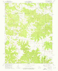
 1973 Calwood1975 Print · USGSCallaway County's rural character is preserved here in the early seventies, spanning from the Bachelor settlement to the Nine Mile Prairie. Family historians can locate several landmarks including New Hope Cem, Fairview Cem, and Whetstone Ch.2 unique versions available
 - 1973 Map of Williamsburg, 1975 Print
 1973 Williamsburg1975 Print · USGSCallaway and Montgomery Counties are captured in the early 1970s as a landscape of prairie farms and active industry. Researchers can trace family sites at Augusta Cem and Covington Cem, or locate local landmarks like the Callaway R-1 Sch.2 unique versions available
 - 1973 Map of Readsville, 1975 Print
 1973 Readsville1975 Print · USGSThe rural border of Callaway and Montgomery counties is captured here in the early seventies, centered on the Nine Mile Prairie and Readsville. Researchers can trace old family sites at Gregory Cem or Bethel Ch and locate active Claypits of the era.2 unique versions available
 - 1974 Map of Morrison, 1976 Print
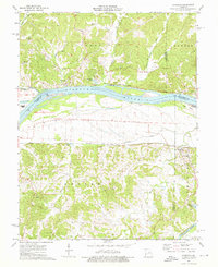 1974 Morrison1976 Print · USGSThe Missouri River and Gasconade River confluence area is captured here in the mid-seventies, showing a landscape defined by rail and river. Researchers can trace family history through numerous bluff-side burials like Schobe Cem and Good Hope Cem or locate old river stops at Portland and Bluffton.2 unique versions available
 - 1975 Map of Reform, 1977 Print
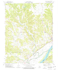
 1975 Reform1977 Print · USGSMid-century Callaway County is captured here just as modern infrastructure began to reach its rural corners. Researchers can trace family sites at Old Salem Cem, explore the early industrial Claypit workings, and locate the Atmospheric Test Tower.2 unique versions available
 - 1975 Map of Mokane West, 1977 Print
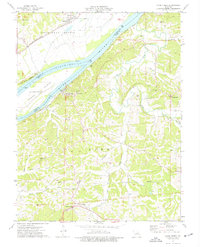
 1975 Mokane West1977 Print · USGSCallaway County's riverfront and upland townships are documented here during the mid-seventies, showing the intersection of rail, river, and rural life. Researchers can trace the Missouri Kansas Texas line near Mokane or locate family sites like Oakley Ch and Riverview Cem.
 - 1975 Map of Mokane East, 1977 Print
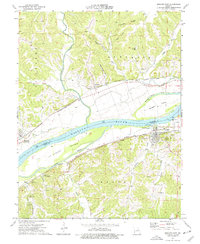 1975 Mokane East1977 Print · USGSThe Missouri River corridor in the mid-seventies shows a landscape defined by rail and river transport between Callaway and Osage counties. Genealogists can locate family landmarks like Hughes Cem and Stoner Cem or the riverside community of Chamois.2 unique versions available
 - 1975 Map of Loose Creek, 1977 Print
 1975 Loose Creek1977 Print · USGSOsage and Callaway counties meet at the Missouri River in the mid-1970s, showcasing a landscape of riverside rail towns and high-ridge settlements. Genealogists and local historians can locate early parish sites and family plots like St Louis Cem and Bonnots Mill.
 - 1975 Map of Fulton, 1977 Print
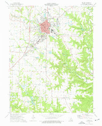 1975 Fulton1977 Print · USGSMid-Missouri's regional center of education and industry is captured in the mid-seventies, showing the growth of its colleges and clay mining operations. Researchers can locate family landmarks like Hillcrest Cem and Muir Cem, or trace the historical campus footprints of Westminster College and the School for the Deaf.2 unique versions available
End of results
Showing maps 1-13 of 13
Top cities of Callaway County
- Fulton historical maps
- Holts Summit historical maps
- Auxvasse historical maps
- New Bloomfield historical maps
- Lake Mykee Town historical maps
- Mokane historical maps
See more
Frequently asked questions
- What are the different types of historical maps available for Callaway County?
- What is the oldest map of Callaway County?
- Where can I purchase historical maps of Callaway County for my home or office?
- Where can I download high-res historical maps of Callaway County?
- Are there historical topographic maps available for Callaway County?
- Is there historical aerial imagery available for Callaway County?
- Where are historical maps of Callaway County sourced from?