Old Maps of Callaway County, Missouri for Hiking & Exploration
Hike through history with 97 historic maps of Callaway County. Explore old trails, ghost towns, and forgotten backroads — perfect for outdoor adventurers and local explorers.
- Rediscover forgotten places: Map out old mining camps, roads, and footpaths that no longer exist on modern maps.
- Layer with modern tools: Combine with LiDAR or satellite views to plan hikes through historical terrain.
- Made for exploration: Popular among hikers, overlanders, and local history lovers.
Use these maps to find adventure and explore the hidden past of Callaway County.
Callaway County, MO maps
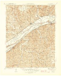
(97)- 1886 Map of Jefferson City
 1886 Jefferson City1886 Print · USGSCovers Callaway County, including Columbia, Jefferson City, and other nearby areas
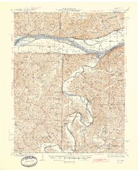
 - 1890 Map of Mexico
 1890 Mexico1890 Print · USGSCovers Callaway County, including Mexico, Vandalia, and other nearby areas5 unique versions available
 - 1890 Map of Moberly
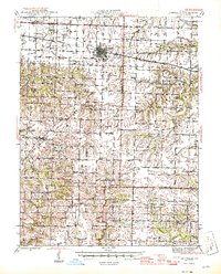
 1890 Moberly1890 Print · USGSCovers Callaway County, including Columbia, Moberly, and other nearby areas6 unique versions available
 - 1890 Map of Fulton
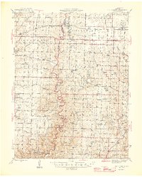
 1890 Fulton1890 Print · USGSCovers Callaway County, including Fulton, Montgomery City, and other nearby areas5 unique versions available
 - 1894 Map of Jefferson City
 1894 Jefferson City1894 Print · USGSCovers Callaway County, including Columbia, Jefferson City, and other nearby areas4 unique versions available
 - 1928 Map of Fulton, 1954 Print
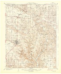
 1928 Fulton1954 Print · USGSCovers Callaway County, including Fulton, Kingdom City, and other nearby areas2 unique versions available
 - 1931 Map of Fulton
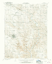
 1931 Fulton1931 Print · USGSCovers Callaway County, including Fulton, Kingdom City, and other nearby areas2 unique versions available
 - 1932 Map of Mexico
 1932 Mexico1932 Print · USGSCovers Callaway County, including Mexico, Auxvasse, and other nearby areas3 unique versions available
 - 1935 Map of Morrison
 1935 Morrison1935 Print · USGSCovers Callaway County, including Gasconade, Rhineland, and other nearby areas
 - 1939 Map of Jefferson City
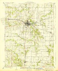
 1939 Jefferson City1939 Print · USGSCovers Callaway County, including Jefferson City, Holts Summit, and other nearby areas2 unique versions available
 - 1939 Map of Jefferson City, 1954 Print
 1939 Jefferson City1954 Print · USGSCovers Callaway County, including Jefferson City, Holts Summit, and other nearby areas2 unique versions available
 - 1940 Map of Montgomery City, 1965 Print
 1940 Montgomery City1965 Print · USGSCovers Callaway County, including Montgomery City, Readsville, and other nearby areas2 unique versions available
 - 1942 Map of Montgomery City
 1942 Montgomery City1942 Print · USGSCovers Callaway County, including Montgomery City, Readsville, and other nearby areas2 unique versions available
 - 1942 Map of Wellsville
 1942 Wellsville1942 Print · USGSCovers Callaway County, including Wellsville, Laddonia, and other nearby areas2 unique versions available
 - 1942 Map of Jefferson City
 1942 Jefferson City1942 Print · USGSCovers Callaway County, including Jefferson City, Holts Summit, and other nearby areas2 unique versions available
 - 1942 Map of Morrison, 1961 Print
 1942 Morrison1961 Print · USGSCovers Callaway County, including Gasconade, Rhineland, and other nearby areas2 unique versions available
 - 1944 Map of Millersburg, 1963 Print
 1944 Millersburg1963 Print · USGSCovers Callaway County, including Columbia, Ashland, and other nearby areas
 - 1945 Map of Mokane
 1945 Mokane1945 Print · USGSCovers Callaway County, including Chamois, Mokane, and other nearby areas3 unique versions available
 - 1945 Map of Morrison
 1945 Morrison1945 Print · USGSCovers Callaway County, including Gasconade, Rhineland, and other nearby areas2 unique versions available
 - 1945 Map of Centralia
 1945 Centralia1945 Print · USGSCovers Callaway County, including Columbia, Centralia, and other nearby areas2 unique versions available
 - 1946 Map of Millersburg
 1946 Millersburg1946 Print · USGSCovers Callaway County, including Columbia, Ashland, and other nearby areas2 unique versions available
 - 1947 Map of Jefferson City, 1949 Print
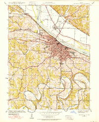
 1947 Jefferson City1949 Print · USGSCovers Callaway County, including Columbia, Jefferson City, and other nearby areas
 - 1948 Map of Quincy
 1948 Quincy1948 Print · USGSCovers Callaway County, including Quincy, Hannibal, and other nearby areas2 unique versions available
 - 1949 Map of Saint Louis
 1949 Saint Louis1949 Print · USGSCovers Callaway County, including St. Louis, O'Fallon, and other nearby areas2 unique versions available
 - 1953 Map of Moberly
 1953 Moberly1953 Print · USGSCovers Callaway County, including Columbia, Moberly, and other nearby areas
Showing maps 1-25 of 97
Top cities of Callaway County
- Fulton historical maps
- Holts Summit historical maps
- Auxvasse historical maps
- New Bloomfield historical maps
- Lake Mykee Town historical maps
- Mokane historical maps
See more
Frequently asked questions
- What are the different types of historical maps available for Callaway County?
- What is the oldest map of Callaway County?
- Where can I purchase historical maps of Callaway County for my home or office?
- Where can I download high-res historical maps of Callaway County?
- Are there historical topographic maps available for Callaway County?
- Is there historical aerial imagery available for Callaway County?
- Where are historical maps of Callaway County sourced from?