Old Maps of Callaway County, Missouri for Academic Research
Study the evolution of Callaway County with 166 high-resolution historic maps. Whether you're teaching, researching, or modeling changes in land use, these maps provide essential visual documentation of urban, environmental, and geographic change.
- Analyze long-term change: Track patterns in development, transportation, and natural features.
- Ideal for environmental or urban studies: Support academic projects with primary historical map data.
- Use in the classroom or lab: Educators and researchers rely on these maps to bring historical context to life.
These maps are a powerful tool for teaching, research, and visualizing how Callaway County has changed over the decades.
Callaway County, MO maps
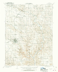
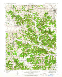
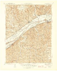
(166)- 1886 Map of Jefferson City
 1886 Jefferson City1886 Print · USGSMid-Missouri was a bustling corridor of river traffic and rail expansion during the 1880s. You can trace the early tracks of the Missouri Pacific Railroad and locate vanished river landings like Nashville or Providence along the winding Missouri River.
 - 1890 Map of Mexico
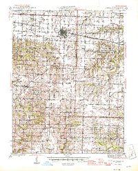
 1890 Mexico1890 Print · USGSMid-Missouri was a bustling junction of rail and river in the late 1880s, where iron rails began to reshape the old prairie. Genealogists can trace family roots in early settlements like Mexico, Laddonia, and the rural community at Shamrock P.O..5 unique versions available
 - 1890 Map of Moberly
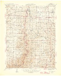
 1890 Moberly1890 Print · USGSMid-Missouri at the close of the frontier era was a landscape defined by the iron rails of the Wabash and Chicago & Alton lines. Genealogists can trace early homesteads and rail stops from Moberly to Centralia, and find rural communities like Middle Grove or Dripping Spring.6 unique versions available
 - 1890 Map of Fulton
 1890 Fulton1890 Print · USGSMid-Missouri river life and railroad expansion come into focus in this late nineteenth-century survey. Genealogists and historians can trace old township lines and early river towns like Chamois, Danville, and the bustling county seat at Fulton.5 unique versions available
 - 1894 Map of Jefferson City
 1894 Jefferson City1894 Print · USGSMid-Missouri during the late nineteenth century was a landscape of river landings and burgeoning rail towns. Genealogists and historians can trace early track layouts of the Missouri Pacific Railroad and locate interior settlements like Ashland, Millersburg, and Centretown.4 unique versions available
 - 1928 Map of Fulton, 1954 Print
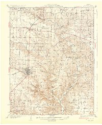
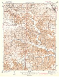
 1928 Fulton1954 Print · USGSCallaway County settlement patterns are frozen in time here during the late twenties, centered on the rail hub of Fulton. Genealogists can locate dozens of rural landmarks, from St Eunice Sch and Harmony Ch to the small community of Reform.2 unique versions available
 - 1931 Map of Fulton
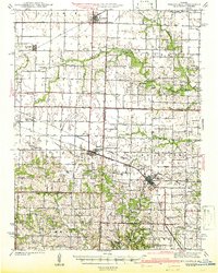
 1931 Fulton1931 Print · USGSFulton and its rural Callaway County hinterlands are documented here in the early thirties as the region transitioned to modern highways. Genealogists can locate family-named landmarks like Scott Sch, Fairview Ch, and the settlement of Bachelor.2 unique versions available
 - 1932 Map of Mexico
 1932 Mexico1932 Print · USGSThe rail hub of Mexico and the surrounding Audrain County farm country are captured here between the wars, just as modern highways began to parallel the older tracks. Genealogists can locate dozens of country schools and churches, from Hedgesdale Sch to Sunrise Ch, and the grounds of the Mo Military Academy.3 unique versions available
 - 1935 Map of Morrison
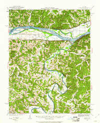
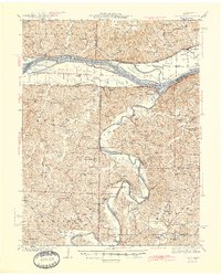
 1935 Morrison1935 Print · USGSThe confluence of the Missouri and Gasconade rivers comes to life in the mid-1930s, showing a world of river-town commerce and rural homesteads. Trace ancestral roots at Townley Cem, find old river crossings like Feiglers Ferry, or locate the Mint Hill PO.
 - 1939 Map of Jefferson City
 1939 Jefferson City1939 Print · USGSJefferson City and the winding Moreau River are captured here in the late thirties, showing the Missouri state capital as it functioned before mid-century expansion. Genealogists can locate family landmarks like Shumate Chapel Cem, the Lincoln Institute, and rural outposts like Grays.2 unique versions available
 - 1939 Map of Jefferson City, 1954 Print
 1939 Jefferson City1954 Print · USGSMissouri's capital and the surrounding river bluffs are captured here in the late thirties, showing the region's transition between rural farmland and state governance. Researchers can locate family landmarks like Providence Cem, the Algoa Reformatory, and various schools such as Sycamore Sch.2 unique versions available
 - 1940 Map of Montgomery City, 1965 Print
 1940 Montgomery City1965 Print · USGSThe Montgomery County interior at the start of the 1940s reveals a landscape of railroad towns and scattered prairie farmsteads. Genealogists can trace family roots through numerous sites like Tate Cem, St Patricks Ch, and the Loutre Valley Sch.2 unique versions available
 - 1942 Map of Montgomery City
 1942 Montgomery City1942 Print · USGSMontgomery County and the edge of Callaway County are captured here in the early 1940s, showing a landscape defined by the Loutre River and the Wabash RR. Researchers can locate dozens of rural landmarks, from family-named plots like Worland Cem to country schoolhouses like Verbena Dale Sch and Sunny Hill Sch.2 unique versions available
 - 1942 Map of Wellsville
 1942 Wellsville1942 Print · USGSMid-Missouri's rail-and-river landscape is meticulously detailed here just before the war, showcasing the busy corridors of the Alton and Wabash lines. Researchers can trace rural life through dozens of local landmarks like Chapel Grove Sch, the Laclede Christy Mine, and Shamrock.2 unique versions available
 - 1942 Map of Jefferson City
 1942 Jefferson City1942 Print · USGSJefferson City and the surrounding river bluffs are captured in the early years of the war, when rail travel and state agriculture dominated the landscape. Genealogists can locate family-named landmarks and rural schools like Hall Sch, Williams Cem, and the small settlement of New Bloomfield.2 unique versions available
 - 1942 Map of Morrison, 1961 Print
 1942 Morrison1961 Print · USGSThe river valleys of mid-Missouri are captured here in the 1940s, highlighting the vital rail and ferry networks of the era. Genealogists can locate family landmarks such as Wittenbach Cem, rural schools like Mud Creek Sch, and the historic Starkenburg community.2 unique versions available
 - 1944 Map of Millersburg, 1963 Print
 1944 Millersburg1963 Print · USGSCentral Missouri's rural heartland is documented here in the mid-1940s, showing a landscape shaped by coal mining and country school districts. Trace local history at Stephens and Millersburg, or find family sites like Hundley Cem and Monocle Chapel.
 - 1945 Map of Mokane
 1945 Mokane1945 Print · USGSThe Missouri River valley near the Osage confluence comes alive in this mid-forties survey, showing a landscape defined by river-rail commerce and rural townships. Genealogists can trace family footprints at Frankenstein, Bonnots Mill, and numerous rural sites like Metabor Cem or Acorn Sch.3 unique versions available
 - 1945 Map of Morrison
 1945 Morrison1945 Print · USGSThe river valleys of central Missouri were still deeply tied to the water in the mid-1940s, as shown by this survey of the Missouri and Gasconade confluence. Genealogists can trace family roots through numerous country schools like Best Sch and river crossings such as Brown Shanty Ferry.2 unique versions available
 - 1945 Map of Centralia
 1945 Centralia1945 Print · USGSNorth Central Missouri is shown just after the war, featuring a landscape defined by its rail junctions and numerous rural school districts. Genealogists can trace family heritage through dozens of named sites like Skull Lick Cem, Hallsville, and Angell Sch.2 unique versions available
 - 1946 Map of Millersburg
 1946 Millersburg1946 Print · USGSMid-Missouri farming and mining communities come alive in this mid-century survey of the Boone and Callaway county line. Genealogists and historians can locate dozens of rural landmarks, from the Manacle Chapel and Hundley Cem to local schools like Sunrise Sch.2 unique versions available
 - 1947 Map of Jefferson City, 1949 Print
 1947 Jefferson City1949 Print · USGSCentral Missouri and the northern Ozarks come into focus in this late 1940s survey of the river-and-rail landscape. Genealogists and historians can trace the growth of Jefferson City and Sedalia or locate family roots near Bagnell Dam and the Lake of the Ozarks.
 - 1948 Map of Quincy
 1948 Quincy1948 Print · USGSThe Mississippi and Illinois River valleys are captured at a post-war crossroads as rail and river travel met the expanding highway system. Genealogists can trace family settlements from Quincy to Hannibal and smaller towns like Vandalia and Jerseyville.2 unique versions available
 - 1949 Map of Saint Louis
 1949 Saint Louis1949 Print · USGSGreater St. Louis and its surrounding river valleys are captured here just after the war, showing the metropolitan core and the rural Ozark fringe. Researchers can trace the sprawling rail network of the Wabash RR or locate landmarks like Meramec Caverns Airport and Scott Air Force Base.2 unique versions available
 - 1953 Map of Moberly
 1953 Moberly1953 Print · USGSMid-century north-central Missouri is documented here as a bustling intersection of river commerce and heavy rail. Researchers can trace historic family-named landmarks and transport hubs from the Missouri River corridor to the rail yards of Moberly, Chillicothe, and Macon.
Showing maps 1-25 of 166
Top cities of Callaway County
- Fulton historical maps
- Holts Summit historical maps
- Auxvasse historical maps
- New Bloomfield historical maps
- Lake Mykee Town historical maps
- Mokane historical maps
See more
Frequently asked questions
- What are the different types of historical maps available for Callaway County?
- What is the oldest map of Callaway County?
- Where can I purchase historical maps of Callaway County for my home or office?
- Where can I download high-res historical maps of Callaway County?
- Are there historical topographic maps available for Callaway County?
- Is there historical aerial imagery available for Callaway County?
- Where are historical maps of Callaway County sourced from?